BD22 8SB maps, stats, and open data
BD22 8SB is located in the Worth Valley electoral ward, within the metropolitan district of Bradford and the English Parliamentary constituency of Keighley. The Sub Integrated Care Board (ICB) Location is NHS West Yorkshire ICB - 36J and the police force is West Yorkshire. This postcode has been in use since March 2018.
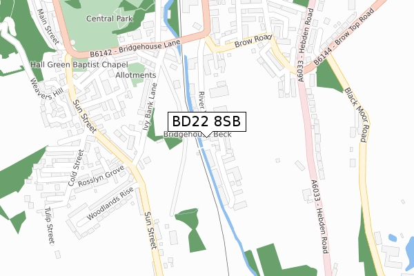
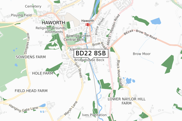
BD22 8SB maps


Licence: Open Government Licence (requires attribution)
Attribution: Contains OS data © Crown copyright and database right 2025
Source: Open Postcode Geo
Licence: Open Government Licence (requires attribution)
Attribution: Contains OS data © Crown copyright and database right 2025; Contains Royal Mail data © Royal Mail copyright and database right 2025; Source: Office for National Statistics licensed under the Open Government Licence v.3.0
BD22 8SB geodata
| Easting | 403486 |
| Northing | 436780 |
| Latitude | 53.827289 |
| Longitude | -1.948525 |
Where is BD22 8SB?
| Country | England |
| Postcode District | BD22 |
Politics
| Ward | Worth Valley |
|---|---|
| Constituency | Keighley |
House Prices
Sales of detached houses in BD22 8SB
54, RIVER VIEW, HAWORTH, KEIGHLEY, BD22 8SB 2019 16 AUG £279,950 |
46, RIVER VIEW, HAWORTH, KEIGHLEY, BD22 8SB 2018 31 AUG £324,950 |
Licence: Contains HM Land Registry data © Crown copyright and database right 2025. This data is licensed under the Open Government Licence v3.0.
Transport
Nearest bus stops to BD22 8SB
| Bridgehouse Lane (Station Road) | Haworth | 181m |
| Sun Street Woodlands Rise (Sun Street) | Haworth | 211m |
| Bridgehouse Lane | Haworth | 218m |
| Sun Street Woodlands Rise (Sun Street) | Haworth | 219m |
| Sun St Cold Street (Sun Street) | Haworth | 221m |
Nearest underground/metro/tram to BD22 8SB
| Haworth (Keighley & Worth Valley Railway) | Haworth | 441m |
| Oxenhope (Keighley & Worth Valley Railway) | Oxenhope | 1,408m |
Nearest railway stations to BD22 8SB
| Keighley Station | 5.5km |
Broadband
Broadband access in BD22 8SB (2020 data)
| Percentage of properties with Next Generation Access | 100.0% |
| Percentage of properties with Superfast Broadband | 100.0% |
| Percentage of properties with Ultrafast Broadband | 100.0% |
| Percentage of properties with Full Fibre Broadband | 100.0% |
Superfast Broadband is between 30Mbps and 300Mbps
Ultrafast Broadband is > 300Mbps
Broadband limitations in BD22 8SB (2020 data)
| Percentage of properties unable to receive 2Mbps | 0.0% |
| Percentage of properties unable to receive 5Mbps | 0.0% |
| Percentage of properties unable to receive 10Mbps | 0.0% |
| Percentage of properties unable to receive 30Mbps | 0.0% |
Deprivation
71.3% of English postcodes are less deprived than BD22 8SB:Food Standards Agency
Three nearest food hygiene ratings to BD22 8SB (metres)


➜ Get more ratings from the Food Standards Agency
Nearest post box to BD22 8SB
| Last Collection | |||
|---|---|---|---|
| Location | Mon-Fri | Sat | Distance |
| Haworth Brow P.o. Box | 17:15 | 11:15 | 449m |
| Lees Hill | 17:15 | 11:15 | 1,096m |
| Cross Roads P.o. Box | 17:15 | 11:00 | 1,521m |
Environment
| Risk of BD22 8SB flooding from rivers and sea | Medium |
BD22 8SB ITL and BD22 8SB LAU
The below table lists the International Territorial Level (ITL) codes (formerly Nomenclature of Territorial Units for Statistics (NUTS) codes) and Local Administrative Units (LAU) codes for BD22 8SB:
| ITL 1 Code | Name |
|---|---|
| TLE | Yorkshire and The Humber |
| ITL 2 Code | Name |
| TLE4 | West Yorkshire |
| ITL 3 Code | Name |
| TLE41 | Bradford |
| LAU 1 Code | Name |
| E08000032 | Bradford |
BD22 8SB census areas
The below table lists the Census Output Area (OA), Lower Layer Super Output Area (LSOA), and Middle Layer Super Output Area (MSOA) for BD22 8SB:
| Code | Name | |
|---|---|---|
| OA | E00054733 | |
| LSOA | E01010856 | Bradford 023C |
| MSOA | E02002205 | Bradford 023 |
Nearest postcodes to BD22 8SB
| BD22 8NX | Surgery Street | 135m |
| BD22 8PD | Ivy Bank Lane | 144m |
| BD22 8PB | Bridgehouse Lane | 153m |
| BD22 8BU | Ivy Bank Lane | 159m |
| BD22 8PQ | Pine Street | 162m |
| BD22 8PH | Fir Street | 177m |
| BD22 8PP | Drill Street | 183m |
| BD22 8PE | Earl Street | 188m |
| BD22 8PF | Ghyll Drive | 189m |
| BD22 8PL | Ashfield Terrace | 202m |