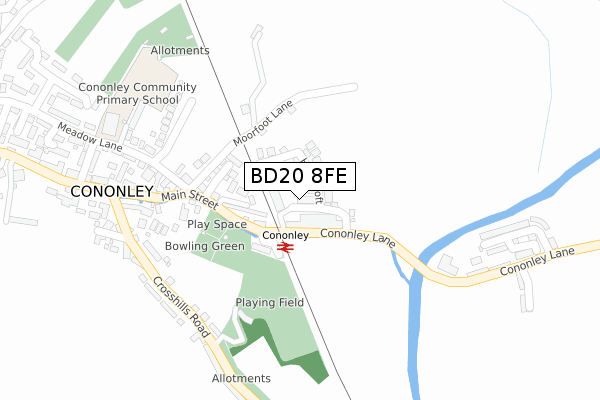
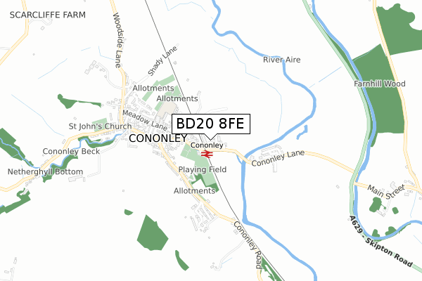
BD20 8FE is located in the Aire Valley electoral ward, within the unitary authority of North Yorkshire and the English Parliamentary constituency of Skipton and Ripon. The Sub Integrated Care Board (ICB) Location is NHS West Yorkshire ICB - 36J and the police force is North Yorkshire. This postcode has been in use since April 2019.


GetTheData
Source: OS Open Zoomstack (Ordnance Survey)
Licence: Open Government Licence (requires attribution)
Attribution: Contains OS data © Crown copyright and database right 2024
Source: Open Postcode Geo
Licence: Open Government Licence (requires attribution)
Attribution: Contains OS data © Crown copyright and database right 2024; Contains Royal Mail data © Royal Mail copyright and database right 2024; Source: Office for National Statistics licensed under the Open Government Licence v.3.0
| Easting | 399333 |
| Northing | 446892 |
| Latitude | 53.918185 |
| Longitude | -2.011645 |
GetTheData
Source: Open Postcode Geo
Licence: Open Government Licence
| Country | England |
| Postcode District | BD20 |
| ➜ BD20 open data dashboard ➜ See where BD20 is on a map ➜ Where is Cononley? | |
GetTheData
Source: Land Registry Price Paid Data
Licence: Open Government Licence
| Ward | Aire Valley |
| Constituency | Skipton And Ripon |
GetTheData
Source: ONS Postcode Database
Licence: Open Government Licence
| June 2022 | Violence and sexual offences | On or near Crosshills Road | 265m |
| June 2022 | Burglary | On or near Meadow Lane | 369m |
| June 2022 | Violence and sexual offences | On or near Aireside Avenue | 408m |
| ➜ Get more crime data in our Crime section | |||
GetTheData
Source: data.police.uk
Licence: Open Government Licence
| Railway Ph (Main Street) | Cononley | 99m |
| Railway Ph (Main Street) | Cononley | 105m |
| Post Office (Crosshills Road) | Cononley | 303m |
| Post Office (Main Street) | Cononley | 309m |
| Crag View (Crosshills Road) | Cononley | 357m |
| Cononley Station | 0.1km |
| Skipton Station | 4.6km |
| Steeton & Silsden Station | 4.8km |
GetTheData
Source: NaPTAN
Licence: Open Government Licence
| Percentage of properties with Next Generation Access | 100.0% |
| Percentage of properties with Superfast Broadband | 100.0% |
| Percentage of properties with Ultrafast Broadband | 100.0% |
| Percentage of properties with Full Fibre Broadband | 100.0% |
Superfast Broadband is between 30Mbps and 300Mbps
Ultrafast Broadband is > 300Mbps
| Percentage of properties unable to receive 2Mbps | 0.0% |
| Percentage of properties unable to receive 5Mbps | 0.0% |
| Percentage of properties unable to receive 10Mbps | 0.0% |
| Percentage of properties unable to receive 30Mbps | 0.0% |
GetTheData
Source: Ofcom
Licence: Ofcom Terms of Use (requires attribution)
GetTheData
Source: ONS Postcode Database
Licence: Open Government Licence


➜ Get more ratings from the Food Standards Agency
GetTheData
Source: Food Standards Agency
Licence: FSA terms & conditions
| Last Collection | |||
|---|---|---|---|
| Location | Mon-Fri | Sat | Distance |
| Aireview Cross Hills | 17:00 | 11:00 | 992m |
| Priestbank Road | 17:00 | 10:30 | 2,125m |
| Snaygill Industrial Estate | 18:30 | 12:00 | 3,036m |
GetTheData
Source: Dracos
Licence: Creative Commons Attribution-ShareAlike
| Facility | Distance |
|---|---|
| Cononley Sports Club Crosshills Road, Cononley, Keighley Grass Pitches | 212m |
| Bradley Cricket Club Matthew Lane, Low Bradley, Keighley Grass Pitches | 1.7km |
| Kildwick Rec (Kildwick C Of E Primary School) Priest Bank Road, Kildwick, Keighley Grass Pitches | 2.2km |
GetTheData
Source: Active Places
Licence: Open Government Licence
| School | Phase of Education | Distance |
|---|---|---|
| Cononley Community Primary School Meadow Lane, Cononley, Keighley, BD20 8NA | Primary | 346m |
| Bradleys Both Community Primary School Skipton Road, Bradley, Keighley, BD20 9EF | Primary | 1.9km |
| Kildwick Church of England Voluntary Controlled Primary School Priest Bank Road, Kildwick, Keighley, BD20 9BH | Primary | 2.1km |
GetTheData
Source: Edubase
Licence: Open Government Licence
The below table lists the International Territorial Level (ITL) codes (formerly Nomenclature of Territorial Units for Statistics (NUTS) codes) and Local Administrative Units (LAU) codes for BD20 8FE:
| ITL 1 Code | Name |
|---|---|
| TLE | Yorkshire and The Humber |
| ITL 2 Code | Name |
| TLE2 | North Yorkshire |
| ITL 3 Code | Name |
| TLE22 | North Yorkshire CC |
| LAU 1 Code | Name |
| E07000163 | Craven |
GetTheData
Source: ONS Postcode Directory
Licence: Open Government Licence
The below table lists the Census Output Area (OA), Lower Layer Super Output Area (LSOA), and Middle Layer Super Output Area (MSOA) for BD20 8FE:
| Code | Name | |
|---|---|---|
| OA | E00140254 | |
| LSOA | E01027556 | Craven 007A |
| MSOA | E02005748 | Craven 007 |
GetTheData
Source: ONS Postcode Directory
Licence: Open Government Licence
| BD20 8LS | Main Street | 95m |
| BD20 8LX | Moor Foot Lane | 130m |
| BD20 8LR | Main Street | 193m |
| BD20 8LA | Crosshills Road | 256m |
| BD20 8LL | Main Street | 262m |
| BD20 8LZ | Meadow Close | 262m |
| BD20 8NA | Meadow Lane | 272m |
| BD20 8JZ | Crosshills Road | 286m |
| BD20 8LB | Oddfellows Houses | 290m |
| BD20 8NG | Tillotsons Court | 297m |
GetTheData
Source: Open Postcode Geo; Land Registry Price Paid Data
Licence: Open Government Licence