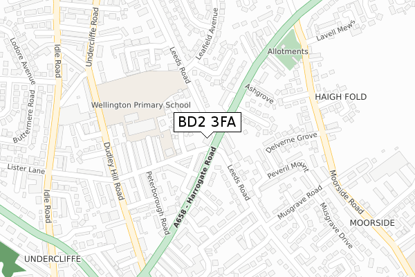
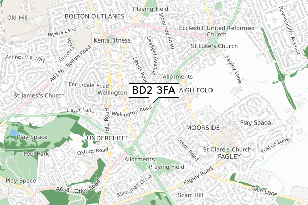
BD2 3FA is located in the Bolton and Undercliffe electoral ward, within the metropolitan district of Bradford and the English Parliamentary constituency of Bradford East. The Sub Integrated Care Board (ICB) Location is NHS West Yorkshire ICB - 36J and the police force is West Yorkshire. This postcode has been in use since October 2017.


GetTheData
Source: OS Open Zoomstack (Ordnance Survey)
Licence: Open Government Licence (requires attribution)
Attribution: Contains OS data © Crown copyright and database right 2024
Source: Open Postcode Geo
Licence: Open Government Licence (requires attribution)
Attribution: Contains OS data © Crown copyright and database right 2024; Contains Royal Mail data © Royal Mail copyright and database right 2024; Source: Office for National Statistics licensed under the Open Government Licence v.3.0
| Easting | 418049 |
| Northing | 435094 |
| Latitude | 53.811838 |
| Longitude | -1.727379 |
GetTheData
Source: Open Postcode Geo
Licence: Open Government Licence
| Country | England |
| Postcode District | BD2 |
| ➜ BD2 open data dashboard ➜ See where BD2 is on a map ➜ Where is Bradford? | |
GetTheData
Source: Land Registry Price Paid Data
Licence: Open Government Licence
| Ward | Bolton And Undercliffe |
| Constituency | Bradford East |
GetTheData
Source: ONS Postcode Database
Licence: Open Government Licence
| December 2023 | Vehicle crime | On or near Petrol Station | 496m |
| December 2023 | Other theft | On or near Petrol Station | 496m |
| December 2023 | Violence and sexual offences | On or near Petrol Station | 496m |
| ➜ Get more crime data in our Crime section | |||
GetTheData
Source: data.police.uk
Licence: Open Government Licence
| Harrogate Rd Leeds Road (Harrogate Road) | Undercliffe | 51m |
| Harrogate Road Leeds Rd (Harrogate Road) | Undercliffe | 61m |
| Dudley Hill Road Askrigg Dr (Dudley Hill Road) | Undercliffe | 250m |
| Dudley Hill Road Tower St (Dudley Hill Road) | Undercliffe | 250m |
| Moorside Rd Moorside Close (Moorside Road) | Fagley | 281m |
| Bradford Forster Square Station | 2.4km |
| Bradford Interchange Station | 2.7km |
| Frizinghall Station | 2.9km |
GetTheData
Source: NaPTAN
Licence: Open Government Licence
| Percentage of properties with Next Generation Access | 100.0% |
| Percentage of properties with Superfast Broadband | 100.0% |
| Percentage of properties with Ultrafast Broadband | 0.0% |
| Percentage of properties with Full Fibre Broadband | 0.0% |
Superfast Broadband is between 30Mbps and 300Mbps
Ultrafast Broadband is > 300Mbps
| Percentage of properties unable to receive 2Mbps | 0.0% |
| Percentage of properties unable to receive 5Mbps | 0.0% |
| Percentage of properties unable to receive 10Mbps | 0.0% |
| Percentage of properties unable to receive 30Mbps | 0.0% |
GetTheData
Source: Ofcom
Licence: Ofcom Terms of Use (requires attribution)
GetTheData
Source: ONS Postcode Database
Licence: Open Government Licence


➜ Get more ratings from the Food Standards Agency
GetTheData
Source: Food Standards Agency
Licence: FSA terms & conditions
| Last Collection | |||
|---|---|---|---|
| Location | Mon-Fri | Sat | Distance |
| Idle Road | 18:00 | 12:30 | 454m |
| 62 Pullan Avenue | 18:00 | 12:15 | 599m |
| 119 Fagley Road | 17:15 | 12:30 | 664m |
GetTheData
Source: Dracos
Licence: Creative Commons Attribution-ShareAlike
| Facility | Distance |
|---|---|
| Wellington Primary School (Eccleshill) Dudley Hill Road, Bradford Grass Pitches | 175m |
| Undercliffe Cricket Club Intake Road, Bradford Grass Pitches | 465m |
| Kents Gym Undercliffe Road, Bradford Health and Fitness Gym, Studio | 615m |
GetTheData
Source: Active Places
Licence: Open Government Licence
| School | Phase of Education | Distance |
|---|---|---|
| Wellington Primary School Dudley Hill Road, Bradford, BD2 3DE | Primary | 171m |
| Fagley Primary School Falsgrave Avenue, Fagley, Bradford, BD2 3PU | Primary | 656m |
| St Luke's CofE Primary School Fagley Lane, Eccleshill, Bradford, BD2 3NS | Primary | 695m |
GetTheData
Source: Edubase
Licence: Open Government Licence
The below table lists the International Territorial Level (ITL) codes (formerly Nomenclature of Territorial Units for Statistics (NUTS) codes) and Local Administrative Units (LAU) codes for BD2 3FA:
| ITL 1 Code | Name |
|---|---|
| TLE | Yorkshire and The Humber |
| ITL 2 Code | Name |
| TLE4 | West Yorkshire |
| ITL 3 Code | Name |
| TLE41 | Bradford |
| LAU 1 Code | Name |
| E08000032 | Bradford |
GetTheData
Source: ONS Postcode Directory
Licence: Open Government Licence
The below table lists the Census Output Area (OA), Lower Layer Super Output Area (LSOA), and Middle Layer Super Output Area (MSOA) for BD2 3FA:
| Code | Name | |
|---|---|---|
| OA | E00053536 | |
| LSOA | E01010601 | Bradford 032A |
| MSOA | E02002214 | Bradford 032 |
GetTheData
Source: ONS Postcode Directory
Licence: Open Government Licence
| BD2 3EN | Wellington Place | 50m |
| BD2 3AU | Wellington Road | 53m |
| BD2 3AF | Scholars Walk | 72m |
| BD2 3DP | Wellington Street | 110m |
| BD2 3DY | Harrogate Road | 110m |
| BD2 3AZ | Leeds Road | 120m |
| BD2 3DN | Peterborough Place | 124m |
| BD2 3ER | Silwood Drive | 125m |
| BD2 3EP | Harrogate Road | 129m |
| BD2 3EL | Leeds Road | 137m |
GetTheData
Source: Open Postcode Geo; Land Registry Price Paid Data
Licence: Open Government Licence