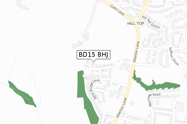
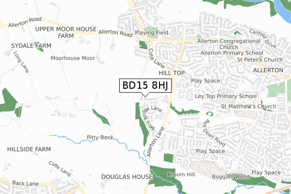
BD15 8HJ is located in the Thornton and Allerton electoral ward, within the metropolitan district of Bradford and the English Parliamentary constituency of Bradford West. The Sub Integrated Care Board (ICB) Location is NHS West Yorkshire ICB - 36J and the police force is West Yorkshire. This postcode has been in use since June 2019.


GetTheData
Source: OS Open Zoomstack (Ordnance Survey)
Licence: Open Government Licence (requires attribution)
Attribution: Contains OS data © Crown copyright and database right 2024
Source: Open Postcode Geo
Licence: Open Government Licence (requires attribution)
Attribution: Contains OS data © Crown copyright and database right 2024; Contains Royal Mail data © Royal Mail copyright and database right 2024; Source: Office for National Statistics licensed under the Open Government Licence v.3.0
| Easting | 411165 |
| Northing | 433885 |
| Latitude | 53.801163 |
| Longitude | -1.831967 |
GetTheData
Source: Open Postcode Geo
Licence: Open Government Licence
| Country | England |
| Postcode District | BD15 |
| ➜ BD15 open data dashboard ➜ See where BD15 is on a map ➜ Where is Bradford? | |
GetTheData
Source: Land Registry Price Paid Data
Licence: Open Government Licence
| Ward | Thornton And Allerton |
| Constituency | Bradford West |
GetTheData
Source: ONS Postcode Database
Licence: Open Government Licence
70, MEADOWLANDS, ALLERTON, BRADFORD, BD15 8HJ 2022 15 JUL £254,995 |
64, MEADOWLANDS, ALLERTON, BRADFORD, BD15 8HJ 2022 29 APR £244,995 |
2021 8 OCT £215,000 |
38, MEADOWLANDS, ALLERTON, BRADFORD, BD15 8HJ 2020 17 DEC £220,995 |
36, MEADOWLANDS, ALLERTON, BRADFORD, BD15 8HJ 2020 11 DEC £247,995 |
26, MEADOWLANDS, ALLERTON, BRADFORD, BD15 8HJ 2020 30 OCT £204,995 |
20, MEADOWLANDS, ALLERTON, BRADFORD, BD15 8HJ 2020 18 SEP £194,995 |
14, MEADOWLANDS, ALLERTON, BRADFORD, BD15 8HJ 2020 31 JAN £210,995 |
12, MEADOWLANDS, ALLERTON, BRADFORD, BD15 8HJ 2020 31 JAN £230,995 |
2020 30 JAN £209,995 |
GetTheData
Source: HM Land Registry Price Paid Data
Licence: Contains HM Land Registry data © Crown copyright and database right 2024. This data is licensed under the Open Government Licence v3.0.
| December 2023 | Public order | On or near Terracotta Drive | 271m |
| August 2023 | Violence and sexual offences | On or near Terracotta Drive | 271m |
| August 2023 | Violence and sexual offences | On or near Terracotta Drive | 271m |
| ➜ Get more crime data in our Crime section | |||
GetTheData
Source: data.police.uk
Licence: Open Government Licence
| Saffron Drive Weymouth Ave (Saffron Drive) | Allerton | 322m |
| Saffron Drive Weymouth Ave (Saffron Drive) | Allerton | 323m |
| Bracewell Ave Merrivale Rd (Bracewell Avenue) | Allerton | 399m |
| Bracewell Ave Merrivale Rd (Bracewell Avenue) | Allerton | 432m |
| Saffron Dr Brocklesby Drive (Saffron Drive) | Allerton | 433m |
| Frizinghall Station | 4.7km |
| Saltaire Station | 5km |
| Shipley Station | 5.2km |
GetTheData
Source: NaPTAN
Licence: Open Government Licence
GetTheData
Source: ONS Postcode Database
Licence: Open Government Licence


➜ Get more ratings from the Food Standards Agency
GetTheData
Source: Food Standards Agency
Licence: FSA terms & conditions
| Last Collection | |||
|---|---|---|---|
| Location | Mon-Fri | Sat | Distance |
| Allerton Franchise P.o. Box | 17:15 | 12:15 | 828m |
| Town End Road Clayton | 17:15 | 12:00 | 1,972m |
| 61 The Avenue Clayton | 17:45 | 12:00 | 2,006m |
GetTheData
Source: Dracos
Licence: Creative Commons Attribution-ShareAlike
| Facility | Distance |
|---|---|
| Prune Park Recreation Ground Ivy Lane, Allerton, Bradford Grass Pitches | 556m |
| Allerton Cricket Club Greenbank Road, Bradford Grass Pitches | 963m |
| Ladyhill Park Chapel Lane, Allerton, Bradford Grass Pitches | 1.1km |
GetTheData
Source: Active Places
Licence: Open Government Licence
| School | Phase of Education | Distance |
|---|---|---|
| Ley Top Primary School Avenel Road, Allerton, Bradford, BD15 7PQ | Primary | 613m |
| The Academy At St. James Chelwood Drive, Allerton, Bradford, BD15 7YD | Primary | 616m |
| Beckfoot Allerton Primary School and Nursery Garforth Street, Allerton, Bradford, BD15 7HB | Primary | 726m |
GetTheData
Source: Edubase
Licence: Open Government Licence
The below table lists the International Territorial Level (ITL) codes (formerly Nomenclature of Territorial Units for Statistics (NUTS) codes) and Local Administrative Units (LAU) codes for BD15 8HJ:
| ITL 1 Code | Name |
|---|---|
| TLE | Yorkshire and The Humber |
| ITL 2 Code | Name |
| TLE4 | West Yorkshire |
| ITL 3 Code | Name |
| TLE41 | Bradford |
| LAU 1 Code | Name |
| E08000032 | Bradford |
GetTheData
Source: ONS Postcode Directory
Licence: Open Government Licence
The below table lists the Census Output Area (OA), Lower Layer Super Output Area (LSOA), and Middle Layer Super Output Area (MSOA) for BD15 8HJ:
| Code | Name | |
|---|---|---|
| OA | E00054455 | |
| LSOA | E01010802 | Bradford 036F |
| MSOA | E02002218 | Bradford 036 |
GetTheData
Source: ONS Postcode Directory
Licence: Open Government Licence
| BD15 8HB | Allerton Lane | 64m |
| BD15 8AA | Bailey Fold | 196m |
| BD15 7JL | Woodford Close | 208m |
| BD15 7JJ | Weymouth Avenue | 264m |
| BD15 8HA | Hill Top Lane | 273m |
| BD15 7TB | Bracewell Avenue | 300m |
| BD15 7LF | Hill Top Grove | 304m |
| BD15 8LD | Cote Lane | 322m |
| BD15 7ES | Kildare Crescent | 329m |
| BD15 7SL | Merrivale Road | 347m |
GetTheData
Source: Open Postcode Geo; Land Registry Price Paid Data
Licence: Open Government Licence