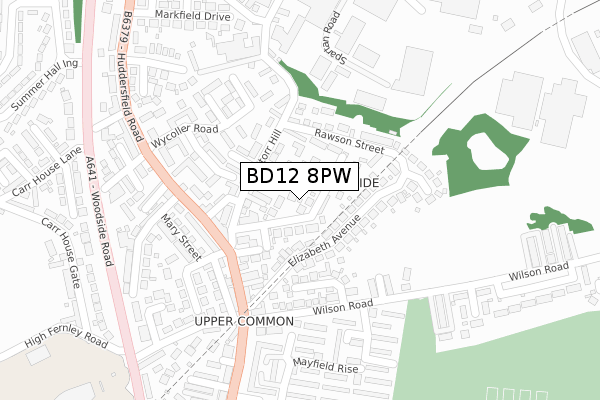
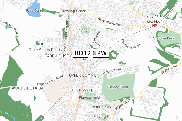
BD12 8PW is located in the Wyke electoral ward, within the metropolitan district of Bradford and the English Parliamentary constituency of Bradford South. The Sub Integrated Care Board (ICB) Location is NHS West Yorkshire ICB - 36J and the police force is West Yorkshire. This postcode has been in use since November 2019.


GetTheData
Source: OS Open Zoomstack (Ordnance Survey)
Licence: Open Government Licence (requires attribution)
Attribution: Contains OS data © Crown copyright and database right 2024
Source: Open Postcode Geo
Licence: Open Government Licence (requires attribution)
Attribution: Contains OS data © Crown copyright and database right 2024; Contains Royal Mail data © Royal Mail copyright and database right 2024; Source: Office for National Statistics licensed under the Open Government Licence v.3.0
| Easting | 415603 |
| Northing | 427886 |
| Latitude | 53.747132 |
| Longitude | -1.764887 |
GetTheData
Source: Open Postcode Geo
Licence: Open Government Licence
| Country | England |
| Postcode District | BD12 |
| ➜ BD12 open data dashboard ➜ See where BD12 is on a map ➜ Where is Bradford? | |
GetTheData
Source: Land Registry Price Paid Data
Licence: Open Government Licence
| Ward | Wyke |
| Constituency | Bradford South |
GetTheData
Source: ONS Postcode Database
Licence: Open Government Licence
| June 2022 | Violence and sexual offences | On or near Rawson Street | 53m |
| June 2022 | Other crime | On or near Rawson Street | 53m |
| June 2022 | Other crime | On or near Storr Hill | 128m |
| ➜ Get more crime data in our Crime section | |||
GetTheData
Source: data.police.uk
Licence: Open Government Licence
| Huddersfield Road Barraclough Square (Huddersfield Road) | Wyke | 294m |
| Huddersfield Rd Wycoller Road (Huddersfield Road) | Low Moor | 318m |
| Huddersfield Rd Back Road (Huddersfield Road) | Wyke | 327m |
| Huddersfield Rd Carr House Lane (Huddersfield Road) | Low Moor | 346m |
| Huddersfield Rd Markfield Drive (Huddersfield Road) | Low Moor | 365m |
| Low Moor Station | 0.8km |
| Bradford Interchange Station | 5km |
GetTheData
Source: NaPTAN
Licence: Open Government Licence
GetTheData
Source: ONS Postcode Database
Licence: Open Government Licence


➜ Get more ratings from the Food Standards Agency
GetTheData
Source: Food Standards Agency
Licence: FSA terms & conditions
| Last Collection | |||
|---|---|---|---|
| Location | Mon-Fri | Sat | Distance |
| Carr Lane | 17:00 | 12:00 | 448m |
| Low Moor Business Box | 18:30 | 11:45 | 452m |
| Oxley Gardens | 17:15 | 12:45 | 1,136m |
GetTheData
Source: Dracos
Licence: Creative Commons Attribution-ShareAlike
| Facility | Distance |
|---|---|
| Wyke Community Sports Village Wilson Road, Wyke, Bradford Grass Pitches, Artificial Grass Pitch, Cycling | 447m |
| Appleton Academy (Closed) Wilson Road, Wyke, Bradford Grass Pitches, Sports Hall | 526m |
| Appleton Academy Woodside Road, Wyke, Bradford Artificial Grass Pitch, Grass Pitches, Studio, Sports Hall, Health and Fitness Gym, Cycling | 670m |
GetTheData
Source: Active Places
Licence: Open Government Licence
| School | Phase of Education | Distance |
|---|---|---|
| Appleton Academy Woodside Road, Bradford, BD12 8AL | All-through | 670m |
| Worthinghead Primary School Wyke Lane, Wyke, Bradford, BD12 9EL | Primary | 817m |
| Hill Top CofE Primary School Common Road, Low Moor, Bradford, BD12 0TL | Primary | 948m |
GetTheData
Source: Edubase
Licence: Open Government Licence
The below table lists the International Territorial Level (ITL) codes (formerly Nomenclature of Territorial Units for Statistics (NUTS) codes) and Local Administrative Units (LAU) codes for BD12 8PW:
| ITL 1 Code | Name |
|---|---|
| TLE | Yorkshire and The Humber |
| ITL 2 Code | Name |
| TLE4 | West Yorkshire |
| ITL 3 Code | Name |
| TLE41 | Bradford |
| LAU 1 Code | Name |
| E08000032 | Bradford |
GetTheData
Source: ONS Postcode Directory
Licence: Open Government Licence
The below table lists the Census Output Area (OA), Lower Layer Super Output Area (LSOA), and Middle Layer Super Output Area (MSOA) for BD12 8PW:
| Code | Name | |
|---|---|---|
| OA | E00054805 | |
| LSOA | E01010869 | Bradford 061B |
| MSOA | E02002243 | Bradford 061 |
GetTheData
Source: ONS Postcode Directory
Licence: Open Government Licence
| BD12 8PH | Rawson Street | 58m |
| BD12 8PE | Storr Hill | 76m |
| BD12 8PR | Elizabeth Close | 97m |
| BD12 8PY | Winrose Close | 135m |
| BD12 8PQ | Storr Hill | 139m |
| BD12 8PP | Elizabeth Drive | 152m |
| BD12 8PN | Elizabeth Street | 154m |
| BD12 8NF | Elizabeth Avenue | 174m |
| BD12 8PJ | Rose Bank | 175m |
| BD12 8PL | Ivy Bank | 179m |
GetTheData
Source: Open Postcode Geo; Land Registry Price Paid Data
Licence: Open Government Licence