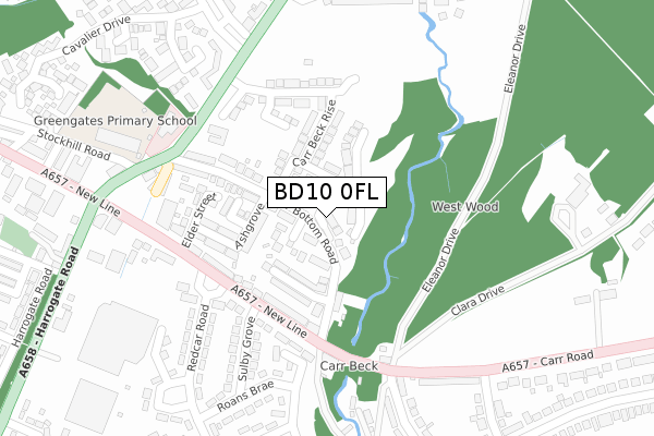
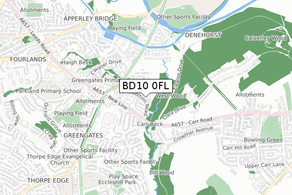
BD10 0FL is located in the Idle and Thackley electoral ward, within the metropolitan district of Bradford and the English Parliamentary constituency of Bradford East. The Sub Integrated Care Board (ICB) Location is NHS West Yorkshire ICB - 36J and the police force is West Yorkshire. This postcode has been in use since December 2017.


GetTheData
Source: OS Open Zoomstack (Ordnance Survey)
Licence: Open Government Licence (requires attribution)
Attribution: Contains OS data © Crown copyright and database right 2024
Source: Open Postcode Geo
Licence: Open Government Licence (requires attribution)
Attribution: Contains OS data © Crown copyright and database right 2024; Contains Royal Mail data © Royal Mail copyright and database right 2024; Source: Office for National Statistics licensed under the Open Government Licence v.3.0
| Easting | 419397 |
| Northing | 437250 |
| Latitude | 53.831168 |
| Longitude | -1.706773 |
GetTheData
Source: Open Postcode Geo
Licence: Open Government Licence
| Country | England |
| Postcode District | BD10 |
| ➜ BD10 open data dashboard ➜ See where BD10 is on a map ➜ Where is Bradford? | |
GetTheData
Source: Land Registry Price Paid Data
Licence: Open Government Licence
| Ward | Idle And Thackley |
| Constituency | Bradford East |
GetTheData
Source: ONS Postcode Database
Licence: Open Government Licence
5, WEST WOOD CLOSE, APPERLEY BRIDGE, BRADFORD, BD10 0FL 2020 30 JAN £414,950 |
9, WEST WOOD CLOSE, GREENGATES, BRADFORD, BD10 0FL 2019 18 MAR £484,750 |
2, WEST WOOD CLOSE, GREENGATES, BRADFORD, BD10 0FL 2019 22 FEB £369,950 |
4, WEST WOOD CLOSE, GREENGATES, BRADFORD, BD10 0FL 2018 26 OCT £399,950 |
8, WEST WOOD CLOSE, GREENGATES, BRADFORD, BD10 0FL 2018 26 OCT £399,950 |
GetTheData
Source: HM Land Registry Price Paid Data
Licence: Contains HM Land Registry data © Crown copyright and database right 2024. This data is licensed under the Open Government Licence v3.0.
| January 2024 | Other theft | On or near Petrol Station | 211m |
| January 2024 | Other theft | On or near Petrol Station | 211m |
| December 2023 | Violence and sexual offences | On or near Petrol Station | 211m |
| ➜ Get more crime data in our Crime section | |||
GetTheData
Source: data.police.uk
Licence: Open Government Licence
| New Line Carr Bottom Road (New Line) | Greengates | 177m |
| New Line Sulby Grove (New Line) | Greengates | 179m |
| New Line Redcar Road (New Line) | Greengates | 200m |
| Redcar Road New Line (Redcar Road) | Greengates | 217m |
| Redcar Road New Line (Redcar Road) | Greengates | 218m |
| Apperley Bridge Station | 1.2km |
| New Pudsey Station | 3.4km |
| Baildon Station | 3.7km |
GetTheData
Source: NaPTAN
Licence: Open Government Licence
| Percentage of properties with Next Generation Access | 100.0% |
| Percentage of properties with Superfast Broadband | 100.0% |
| Percentage of properties with Ultrafast Broadband | 100.0% |
| Percentage of properties with Full Fibre Broadband | 100.0% |
Superfast Broadband is between 30Mbps and 300Mbps
Ultrafast Broadband is > 300Mbps
| Percentage of properties unable to receive 2Mbps | 0.0% |
| Percentage of properties unable to receive 5Mbps | 0.0% |
| Percentage of properties unable to receive 10Mbps | 0.0% |
| Percentage of properties unable to receive 30Mbps | 0.0% |
GetTheData
Source: Ofcom
Licence: Ofcom Terms of Use (requires attribution)
GetTheData
Source: ONS Postcode Database
Licence: Open Government Licence


➜ Get more ratings from the Food Standards Agency
GetTheData
Source: Food Standards Agency
Licence: FSA terms & conditions
| Last Collection | |||
|---|---|---|---|
| Location | Mon-Fri | Sat | Distance |
| Apperley Bridge | 17:15 | 12:00 | 250m |
| Greengates P.o. Box | 17:15 | 12:15 | 289m |
| 28 Redcar Road | 17:45 | 12:00 | 336m |
GetTheData
Source: Dracos
Licence: Creative Commons Attribution-ShareAlike
| Facility | Distance |
|---|---|
| Greengates Primary Academy Stockhill Road, Bradford Grass Pitches | 341m |
| Jetts Greengates Harrogate Road, Bradford Health and Fitness Gym, Studio | 359m |
| Health Works Fitness Centre (Closed) Ravenscliffe Road, Calverley, Pudsey Health and Fitness Gym, Sports Hall | 498m |
GetTheData
Source: Active Places
Licence: Open Government Licence
| School | Phase of Education | Distance |
|---|---|---|
| Greengates Primary Academy 31 Stockhill Road, Greengates, Bradford, BD10 9AX | Primary | 341m |
| Co-op Academy Parkland Old Park Road, Thorpe Edge, Bradford, BD10 9BG | Primary | 813m |
| Holybrook Primary School Rillington Mead, Greengates, Bradford, BD10 0EF | Primary | 815m |
GetTheData
Source: Edubase
Licence: Open Government Licence
The below table lists the International Territorial Level (ITL) codes (formerly Nomenclature of Territorial Units for Statistics (NUTS) codes) and Local Administrative Units (LAU) codes for BD10 0FL:
| ITL 1 Code | Name |
|---|---|
| TLE | Yorkshire and The Humber |
| ITL 2 Code | Name |
| TLE4 | West Yorkshire |
| ITL 3 Code | Name |
| TLE41 | Bradford |
| LAU 1 Code | Name |
| E08000032 | Bradford |
GetTheData
Source: ONS Postcode Directory
Licence: Open Government Licence
The below table lists the Census Output Area (OA), Lower Layer Super Output Area (LSOA), and Middle Layer Super Output Area (MSOA) for BD10 0FL:
| Code | Name | |
|---|---|---|
| OA | E00053895 | |
| LSOA | E01010689 | Bradford 019F |
| MSOA | E02002201 | Bradford 019 |
GetTheData
Source: ONS Postcode Directory
Licence: Open Government Licence
| BD10 0BD | Carrbottom Road | 67m |
| BD10 0BG | Newlay Close | 68m |
| BD10 0BE | Bateson Street | 126m |
| BD10 0BW | Ash Mews | 138m |
| BD10 0BP | Ashgrove | 152m |
| BD10 0BN | New Line | 157m |
| BD10 0BB | Carrbottom Road | 185m |
| BD10 0BL | New Line | 197m |
| BD10 0BJ | New Line | 198m |
| BD10 0BS | Elder Street | 204m |
GetTheData
Source: Open Postcode Geo; Land Registry Price Paid Data
Licence: Open Government Licence