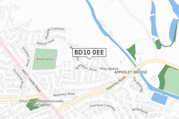
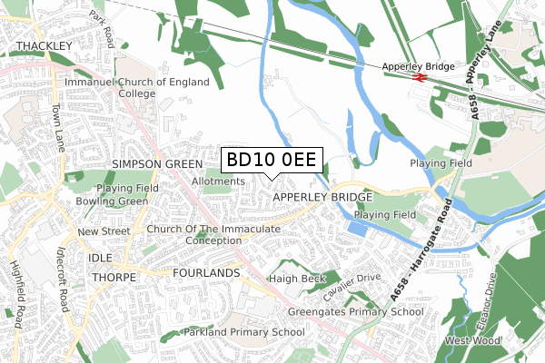
BD10 0EE is located in the Idle and Thackley electoral ward, within the metropolitan district of Bradford and the English Parliamentary constituency of Bradford East. The Sub Integrated Care Board (ICB) Location is NHS West Yorkshire ICB - 36J and the police force is West Yorkshire. This postcode has been in use since January 2018.


GetTheData
Source: OS Open Zoomstack (Ordnance Survey)
Licence: Open Government Licence (requires attribution)
Attribution: Contains OS data © Crown copyright and database right 2024
Source: Open Postcode Geo
Licence: Open Government Licence (requires attribution)
Attribution: Contains OS data © Crown copyright and database right 2024; Contains Royal Mail data © Royal Mail copyright and database right 2024; Source: Office for National Statistics licensed under the Open Government Licence v.3.0
| Easting | 418692 |
| Northing | 438000 |
| Latitude | 53.837934 |
| Longitude | -1.717439 |
GetTheData
Source: Open Postcode Geo
Licence: Open Government Licence
| Country | England |
| Postcode District | BD10 |
| ➜ BD10 open data dashboard ➜ See where BD10 is on a map ➜ Where is Bradford? | |
GetTheData
Source: Land Registry Price Paid Data
Licence: Open Government Licence
| Ward | Idle And Thackley |
| Constituency | Bradford East |
GetTheData
Source: ONS Postcode Database
Licence: Open Government Licence
2021 9 JUL £299,995 |
5, MILMAN WALK, BRADFORD, BD10 0EE 2018 26 NOV £349,995 |
1, MILMAN WALK, BRADFORD, BD10 0EE 2018 29 JUN £279,995 |
3, MILMAN WALK, BRADFORD, BD10 0EE 2018 31 MAY £329,995 |
11, MILMAN WALK, BRADFORD, BD10 0EE 2018 24 MAY £370,000 |
2018 30 APR £259,995 |
9, MILMAN WALK, BRADFORD, BD10 0EE 2018 27 APR £335,000 |
6, MILMAN WALK, BRADFORD, BD10 0EE 2018 31 JAN £280,000 |
2, MILMAN WALK, BRADFORD, BD10 0EE 2018 26 JAN £330,000 |
4, MILMAN WALK, BRADFORD, BD10 0EE 2017 21 DEC £280,000 |
GetTheData
Source: HM Land Registry Price Paid Data
Licence: Contains HM Land Registry data © Crown copyright and database right 2024. This data is licensed under the Open Government Licence v3.0.
| November 2023 | Violence and sexual offences | On or near Strangford Court | 321m |
| April 2023 | Other crime | On or near Strangford Court | 321m |
| July 2022 | Burglary | On or near Strangford Court | 321m |
| ➜ Get more crime data in our Crime section | |||
GetTheData
Source: data.police.uk
Licence: Open Government Licence
| Leeds Rd Marlborough Road (Leeds Road) | Idle | 333m |
| Leeds Rd Marlborough Road (Leeds Road) | Idle | 345m |
| Apperley Road Leeds Rd (Apperley Road) | Idle | 388m |
| Apperley Road Leeds Rd (Apperley Road) | Idle | 393m |
| Leeds Rd Fourlands Drive (Leeds Road) | Idle | 404m |
| Apperley Bridge Station | 0.9km |
| Baildon Station | 2.7km |
| Shipley Station | 3.7km |
GetTheData
Source: NaPTAN
Licence: Open Government Licence
| Percentage of properties with Next Generation Access | 83.3% |
| Percentage of properties with Superfast Broadband | 83.3% |
| Percentage of properties with Ultrafast Broadband | 83.3% |
| Percentage of properties with Full Fibre Broadband | 0.0% |
Superfast Broadband is between 30Mbps and 300Mbps
Ultrafast Broadband is > 300Mbps
| Percentage of properties unable to receive 2Mbps | 0.0% |
| Percentage of properties unable to receive 5Mbps | 0.0% |
| Percentage of properties unable to receive 10Mbps | 0.0% |
| Percentage of properties unable to receive 30Mbps | 16.7% |
GetTheData
Source: Ofcom
Licence: Ofcom Terms of Use (requires attribution)
GetTheData
Source: ONS Postcode Database
Licence: Open Government Licence


➜ Get more ratings from the Food Standards Agency
GetTheData
Source: Food Standards Agency
Licence: FSA terms & conditions
| Last Collection | |||
|---|---|---|---|
| Location | Mon-Fri | Sat | Distance |
| Albion Road | 18:00 | 12:30 | 533m |
| Tenterfields | 17:15 | 12:00 | 672m |
| Thorn Garth | 18:00 | 12:15 | 687m |
GetTheData
Source: Dracos
Licence: Creative Commons Attribution-ShareAlike
| Facility | Distance |
|---|---|
| Elm Tree Farm Apperley Road, Bradford Grass Pitches | 540m |
| Apperley Bridge Playing Fields Apperley Road, Apperley Bridge, Bradford Grass Pitches | 614m |
| Idle Recreation Ground (Closed) Railway Road, Idle, Bradford Grass Pitches | 641m |
GetTheData
Source: Active Places
Licence: Open Government Licence
| School | Phase of Education | Distance |
|---|---|---|
| Co-op Academy Parkland Old Park Road, Thorpe Edge, Bradford, BD10 9BG | Primary | 680m |
| Immanuel College Leeds Road, Idle, Bradford, BD10 9AQ | Secondary | 725m |
| Greengates Primary Academy 31 Stockhill Road, Greengates, Bradford, BD10 9AX | Primary | 741m |
GetTheData
Source: Edubase
Licence: Open Government Licence
The below table lists the International Territorial Level (ITL) codes (formerly Nomenclature of Territorial Units for Statistics (NUTS) codes) and Local Administrative Units (LAU) codes for BD10 0EE:
| ITL 1 Code | Name |
|---|---|
| TLE | Yorkshire and The Humber |
| ITL 2 Code | Name |
| TLE4 | West Yorkshire |
| ITL 3 Code | Name |
| TLE41 | Bradford |
| LAU 1 Code | Name |
| E08000032 | Bradford |
GetTheData
Source: ONS Postcode Directory
Licence: Open Government Licence
The below table lists the Census Output Area (OA), Lower Layer Super Output Area (LSOA), and Middle Layer Super Output Area (MSOA) for BD10 0EE:
| Code | Name | |
|---|---|---|
| OA | E00053924 | |
| LSOA | E01010683 | Bradford 017A |
| MSOA | E02002199 | Bradford 017 |
GetTheData
Source: ONS Postcode Directory
Licence: Open Government Licence
| BD10 0AX | Apperley Road | 169m |
| BD10 0PY | Dobson Locks | 204m |
| BD10 9TP | Apperley Road | 224m |
| BD10 0PW | Tannery Court | 236m |
| BD10 0AU | Apperley Road | 241m |
| BD10 9TT | Hemingway Road | 247m |
| BD10 0PX | Apperley Road | 247m |
| BD10 9ST | Leamington Drive | 249m |
| BD10 9TH | The Covet | 300m |
| BD10 9TG | Overland Crescent | 300m |
GetTheData
Source: Open Postcode Geo; Land Registry Price Paid Data
Licence: Open Government Licence