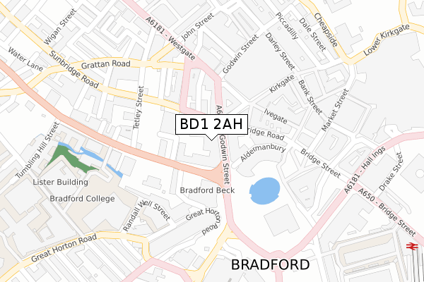
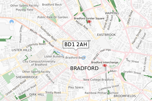
BD1 2AH is located in the City electoral ward, within the metropolitan district of Bradford and the English Parliamentary constituency of Bradford West. The Sub Integrated Care Board (ICB) Location is NHS West Yorkshire ICB - 36J and the police force is West Yorkshire. This postcode has been in use since December 2018.


GetTheData
Source: OS Open Zoomstack (Ordnance Survey)
Licence: Open Government Licence (requires attribution)
Attribution: Contains OS data © Crown copyright and database right 2024
Source: Open Postcode Geo
Licence: Open Government Licence (requires attribution)
Attribution: Contains OS data © Crown copyright and database right 2024; Contains Royal Mail data © Royal Mail copyright and database right 2024; Source: Office for National Statistics licensed under the Open Government Licence v.3.0
| Easting | 416129 |
| Northing | 433038 |
| Latitude | 53.793422 |
| Longitude | -1.756644 |
GetTheData
Source: Open Postcode Geo
Licence: Open Government Licence
| Country | England |
| Postcode District | BD1 |
| ➜ BD1 open data dashboard ➜ See where BD1 is on a map ➜ Where is Bradford? | |
GetTheData
Source: Land Registry Price Paid Data
Licence: Open Government Licence
| Ward | City |
| Constituency | Bradford West |
GetTheData
Source: ONS Postcode Database
Licence: Open Government Licence
| January 2024 | Anti-social behaviour | On or near Mann'S Court | 316m |
| January 2024 | Burglary | On or near Mann'S Court | 316m |
| January 2024 | Criminal damage and arson | On or near Mann'S Court | 316m |
| ➜ Get more crime data in our Crime section | |||
GetTheData
Source: data.police.uk
Licence: Open Government Licence
| Godwin Street | Bradford City Centre | 25m |
| Sunbridge Road | Bradford City Centre | 65m |
| Sunbridge Rd (Sunbridge Road) | Bradford City Centre | 86m |
| Thornton Road | Bradford City Centre | 93m |
| Sunbridge Road | Bradford City Centre | 96m |
| Bradford Forster Square Station | 0.5km |
| Bradford Interchange Station | 0.5km |
| Frizinghall Station | 3.1km |
GetTheData
Source: NaPTAN
Licence: Open Government Licence
GetTheData
Source: ONS Postcode Database
Licence: Open Government Licence


➜ Get more ratings from the Food Standards Agency
GetTheData
Source: Food Standards Agency
Licence: FSA terms & conditions
| Last Collection | |||
|---|---|---|---|
| Location | Mon-Fri | Sat | Distance |
| Sunbridge Road P.o. Box | 18:30 | 12:00 | 73m |
| Quebec Street | 18:30 | 12:45 | 92m |
| Town Hall Square | 18:30 | 11:45 | 201m |
GetTheData
Source: Dracos
Licence: Creative Commons Attribution-ShareAlike
| Facility | Distance |
|---|---|
| Evolve Fitness For Women (Closed) Westgate, Bradford Health and Fitness Gym, Studio | 110m |
| Culture Fusion (Ymca Bradford) Thornton Road, Bradford Health and Fitness Gym, Sports Hall, Studio | 235m |
| Fitness Lab (Closed) Sunbridge Road, Bradford Health and Fitness Gym | 312m |
GetTheData
Source: Active Places
Licence: Open Government Licence
| School | Phase of Education | Distance |
|---|---|---|
| University of Bradford Richmond Road, Bradford, BD7 1DP | Not applicable | 408m |
| Bradford College Great Horton Road, Bradford, BD7 1AY | 16 plus | 424m |
| New College Bradford Nelson Street, Bradford, BD5 0DX | 16 plus | 569m |
GetTheData
Source: Edubase
Licence: Open Government Licence
The below table lists the International Territorial Level (ITL) codes (formerly Nomenclature of Territorial Units for Statistics (NUTS) codes) and Local Administrative Units (LAU) codes for BD1 2AH:
| ITL 1 Code | Name |
|---|---|
| TLE | Yorkshire and The Humber |
| ITL 2 Code | Name |
| TLE4 | West Yorkshire |
| ITL 3 Code | Name |
| TLE41 | Bradford |
| LAU 1 Code | Name |
| E08000032 | Bradford |
GetTheData
Source: ONS Postcode Directory
Licence: Open Government Licence
The below table lists the Census Output Area (OA), Lower Layer Super Output Area (LSOA), and Middle Layer Super Output Area (MSOA) for BD1 2AH:
| Code | Name | |
|---|---|---|
| OA | E00176106 | |
| LSOA | E01033691 | Bradford 039H |
| MSOA | E02002221 | Bradford 039 |
GetTheData
Source: ONS Postcode Directory
Licence: Open Government Licence
| BD1 2SU | Godwin Street | 49m |
| BD1 1TH | Kirkgate | 75m |
| BD1 2DH | Thornton Road | 82m |
| BD1 2SD | Godwin Street | 82m |
| BD1 2AQ | Sunbridge Road | 85m |
| BD1 2SH | Godwin Street | 90m |
| BD1 2AY | Sunbridge Road | 107m |
| BD1 1SX | Upper Millergate | 114m |
| BD1 2AA | Sunbridge Road | 132m |
| BD1 2ER | Quebec Street | 133m |
GetTheData
Source: Open Postcode Geo; Land Registry Price Paid Data
Licence: Open Government Licence