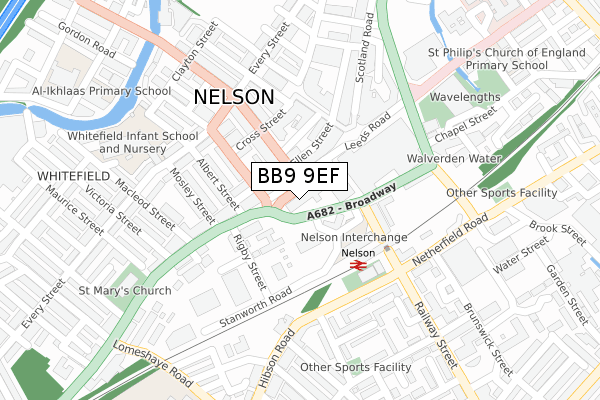
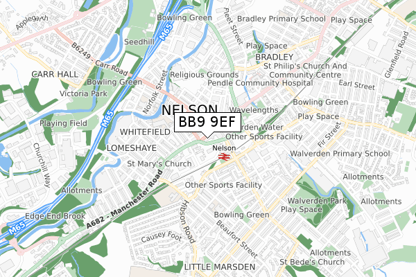
BB9 9EF is located in the Bradley electoral ward, within the local authority district of Pendle and the English Parliamentary constituency of Pendle. The Sub Integrated Care Board (ICB) Location is NHS Lancashire and South Cumbria ICB - 01A and the police force is Lancashire. This postcode has been in use since April 2020.


GetTheData
Source: OS Open Zoomstack (Ordnance Survey)
Licence: Open Government Licence (requires attribution)
Attribution: Contains OS data © Crown copyright and database right 2024
Source: Open Postcode Geo
Licence: Open Government Licence (requires attribution)
Attribution: Contains OS data © Crown copyright and database right 2024; Contains Royal Mail data © Royal Mail copyright and database right 2024; Source: Office for National Statistics licensed under the Open Government Licence v.3.0
| Easting | 385894 |
| Northing | 437736 |
| Latitude | 53.835698 |
| Longitude | -2.215831 |
GetTheData
Source: Open Postcode Geo
Licence: Open Government Licence
| Country | England |
| Postcode District | BB9 |
| ➜ BB9 open data dashboard ➜ See where BB9 is on a map ➜ Where is Nelson? | |
GetTheData
Source: Land Registry Price Paid Data
Licence: Open Government Licence
| Ward | Bradley |
| Constituency | Pendle |
GetTheData
Source: ONS Postcode Database
Licence: Open Government Licence
| January 2024 | Anti-social behaviour | On or near Parking Area | 115m |
| January 2024 | Drugs | On or near Parking Area | 115m |
| January 2024 | Other theft | On or near Forest Street | 416m |
| ➜ Get more crime data in our Crime section | |||
GetTheData
Source: data.police.uk
Licence: Open Government Licence
| Manchester Road | Nelson | 10m |
| Mosley Street | Nelson | 153m |
| Duerden Street (Netherfield Road) | Nelson | 181m |
| Market Square | Nelson | 183m |
| Duerden Street (Netherfield Road) | Nelson | 193m |
| Nelson Station | 0.2km |
| Brierfield Station | 1.9km |
| Colne Station | 3.1km |
GetTheData
Source: NaPTAN
Licence: Open Government Licence
GetTheData
Source: ONS Postcode Database
Licence: Open Government Licence


➜ Get more ratings from the Food Standards Agency
GetTheData
Source: Food Standards Agency
Licence: FSA terms & conditions
| Last Collection | |||
|---|---|---|---|
| Location | Mon-Fri | Sat | Distance |
| Hill Place | 17:30 | 12:00 | 812m |
| St Johns | 17:30 | 11:00 | 1,660m |
| 46 Carr Road | 16:00 | 11:00 | 1,751m |
GetTheData
Source: Dracos
Licence: Creative Commons Attribution-ShareAlike
| Facility | Distance |
|---|---|
| Pendle Wavelengths Leeds Road, Nelson Swimming Pool, Health and Fitness Gym, Studio | 310m |
| St John Southworth Roman Catholic Primary School Lomeshaye Road, Nelson Grass Pitches | 403m |
| Nelson Cricket Club Surrey Road, Nelson Grass Pitches | 749m |
GetTheData
Source: Active Places
Licence: Open Government Licence
| School | Phase of Education | Distance |
|---|---|---|
| Whitefield Infant School and Nursery Every Street, Nelson, BB9 7HF | Primary | 256m |
| McMillan Nursery School Railway Street, Nelson, BB9 9AG | Nursery | 360m |
| Edenfield Girls' High School Brunswick Street, Nelson, Lancashire, BB9 0PQ | Not applicable | 368m |
GetTheData
Source: Edubase
Licence: Open Government Licence
The below table lists the International Territorial Level (ITL) codes (formerly Nomenclature of Territorial Units for Statistics (NUTS) codes) and Local Administrative Units (LAU) codes for BB9 9EF:
| ITL 1 Code | Name |
|---|---|
| TLD | North West (England) |
| ITL 2 Code | Name |
| TLD4 | Lancashire |
| ITL 3 Code | Name |
| TLD46 | East Lancashire |
| LAU 1 Code | Name |
| E07000122 | Pendle |
GetTheData
Source: ONS Postcode Directory
Licence: Open Government Licence
The below table lists the Census Output Area (OA), Lower Layer Super Output Area (LSOA), and Middle Layer Super Output Area (MSOA) for BB9 9EF:
| Code | Name | |
|---|---|---|
| OA | E00128053 | |
| LSOA | E01025230 | Pendle 011D |
| MSOA | E02005250 | Pendle 011 |
GetTheData
Source: ONS Postcode Directory
Licence: Open Government Licence
| BB9 9SD | Manchester Road | 26m |
| BB9 7JD | Manchester Road | 44m |
| BB9 9AN | Place De Criel | 71m |
| BB9 7EJ | Manchester Road | 72m |
| BB9 7EG | Manchester Road | 83m |
| BB9 7EL | Stanley Street | 116m |
| BB9 9SB | Hibson Road | 122m |
| BB9 7EN | Cross Street | 124m |
| BB9 7AA | Rigby Street | 133m |
| BB9 9SG | Railway Street | 140m |
GetTheData
Source: Open Postcode Geo; Land Registry Price Paid Data
Licence: Open Government Licence