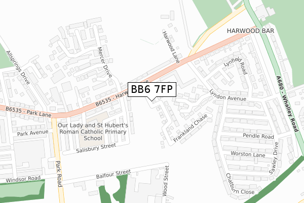
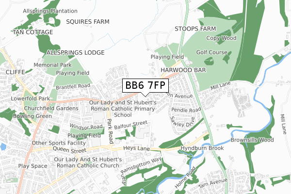
BB6 7FP is located in the Netherton electoral ward, within the local authority district of Hyndburn and the English Parliamentary constituency of Hyndburn. The Sub Integrated Care Board (ICB) Location is NHS Lancashire and South Cumbria ICB - 01A and the police force is Lancashire. This postcode has been in use since March 2019.


GetTheData
Source: OS Open Zoomstack (Ordnance Survey)
Licence: Open Government Licence (requires attribution)
Attribution: Contains OS data © Crown copyright and database right 2024
Source: Open Postcode Geo
Licence: Open Government Licence (requires attribution)
Attribution: Contains OS data © Crown copyright and database right 2024; Contains Royal Mail data © Royal Mail copyright and database right 2024; Source: Office for National Statistics licensed under the Open Government Licence v.3.0
| Easting | 374283 |
| Northing | 432582 |
| Latitude | 53.788928 |
| Longitude | -2.391827 |
GetTheData
Source: Open Postcode Geo
Licence: Open Government Licence
| Country | England |
| Postcode District | BB6 |
| ➜ BB6 open data dashboard ➜ See where BB6 is on a map ➜ Where is Great Harwood? | |
GetTheData
Source: Land Registry Price Paid Data
Licence: Open Government Licence
| Ward | Netherton |
| Constituency | Hyndburn |
GetTheData
Source: ONS Postcode Database
Licence: Open Government Licence
9, HAYDOCK FIELDS CLOSE, GREAT HARWOOD, BLACKBURN, BB6 7FP 2021 18 JUN £258,000 |
17, HAYDOCK FIELDS CLOSE, GREAT HARWOOD, BLACKBURN, BB6 7FP 2020 28 AUG £256,995 |
2019 18 OCT £244,995 |
2, HAYDOCK FIELDS CLOSE, GREAT HARWOOD, BLACKBURN, BB6 7FP 2019 4 OCT £244,995 |
GetTheData
Source: HM Land Registry Price Paid Data
Licence: Contains HM Land Registry data © Crown copyright and database right 2024. This data is licensed under the Open Government Licence v3.0.
| June 2022 | Violence and sexual offences | On or near Sports/Recreation Area | 49m |
| June 2022 | Anti-social behaviour | On or near Station Road | 459m |
| June 2022 | Public order | On or near Station Road | 459m |
| ➜ Get more crime data in our Crime section | |||
GetTheData
Source: data.police.uk
Licence: Open Government Licence
| Lyndon House (Harwood Lane) | Great Harwood | 250m |
| Lyndon House (Harwood Lane) | Great Harwood | 260m |
| Wood Street (Heys Lane) | Great Harwood | 298m |
| Wood Street (Heys Lane) | Great Harwood | 309m |
| Coronation Street (Harwood Lane) | Great Harwood | 343m |
| Rishton Station | 3.4km |
| Huncoat Station | 3.5km |
| Whalley Station | 4.1km |
GetTheData
Source: NaPTAN
Licence: Open Government Licence
| Percentage of properties with Next Generation Access | 100.0% |
| Percentage of properties with Superfast Broadband | 100.0% |
| Percentage of properties with Ultrafast Broadband | 26.7% |
| Percentage of properties with Full Fibre Broadband | 26.7% |
Superfast Broadband is between 30Mbps and 300Mbps
Ultrafast Broadband is > 300Mbps
| Percentage of properties unable to receive 2Mbps | 0.0% |
| Percentage of properties unable to receive 5Mbps | 0.0% |
| Percentage of properties unable to receive 10Mbps | 0.0% |
| Percentage of properties unable to receive 30Mbps | 0.0% |
GetTheData
Source: Ofcom
Licence: Ofcom Terms of Use (requires attribution)
GetTheData
Source: ONS Postcode Database
Licence: Open Government Licence


➜ Get more ratings from the Food Standards Agency
GetTheData
Source: Food Standards Agency
Licence: FSA terms & conditions
| Last Collection | |||
|---|---|---|---|
| Location | Mon-Fri | Sat | Distance |
| Harwood Bar | 16:30 | 11:15 | 344m |
| Park Lane | 16:30 | 11:15 | 775m |
| Meadow Street | 16:45 | 11:45 | 1,016m |
GetTheData
Source: Dracos
Licence: Creative Commons Attribution-ShareAlike
| Facility | Distance |
|---|---|
| Lyndon House Playing Fields (Great Harwood Rovers Fc) (Closed) Balfour Street, Great Harwood, Blackburn Grass Pitches | 53m |
| The Sportsmans (Great Harwood Town Fc) (Closed) Wood Street, Great Harwood Grass Pitches | 172m |
| Our Lady And St Hubert Roman Catholic Primary School Halfield Road , Great Harwood, Blackburn Grass Pitches | 279m |
GetTheData
Source: Active Places
Licence: Open Government Licence
| School | Phase of Education | Distance |
|---|---|---|
| St Hubert's Roman Catholic Primary School, Great Harwood Hallfield Road, Great Harwood, Blackburn, BB6 7SN | Primary | 279m |
| Great Harwood St Bartholomew's Parish Church of England Voluntary Aided Primary School Ash Street, Great Harwood, Blackburn, BB6 7QA | Primary | 1km |
| Great Harwood St John's Church of England Primary School St John's Street, Great Harwood, Blackburn, BB6 7ES | Primary | 1.2km |
GetTheData
Source: Edubase
Licence: Open Government Licence
The below table lists the International Territorial Level (ITL) codes (formerly Nomenclature of Territorial Units for Statistics (NUTS) codes) and Local Administrative Units (LAU) codes for BB6 7FP:
| ITL 1 Code | Name |
|---|---|
| TLD | North West (England) |
| ITL 2 Code | Name |
| TLD4 | Lancashire |
| ITL 3 Code | Name |
| TLD46 | East Lancashire |
| LAU 1 Code | Name |
| E07000120 | Hyndburn |
GetTheData
Source: ONS Postcode Directory
Licence: Open Government Licence
The below table lists the Census Output Area (OA), Lower Layer Super Output Area (LSOA), and Middle Layer Super Output Area (MSOA) for BB6 7FP:
| Code | Name | |
|---|---|---|
| OA | E00127192 | |
| LSOA | E01025061 | Hyndburn 001B |
| MSOA | E02005212 | Hyndburn 001 |
GetTheData
Source: ONS Postcode Directory
Licence: Open Government Licence
| BB6 7TJ | Sawley Drive | 129m |
| BB6 7TU | Lyndon Court | 162m |
| BB6 7ST | Shaftesbury Avenue | 174m |
| BB6 7SX | Calder Place | 228m |
| BB6 7TN | Pendle Road | 228m |
| BB6 7SU | Ribble Avenue | 233m |
| BB6 7TH | Worston Lane | 240m |
| BB6 7TW | Downham Avenue | 241m |
| BB6 7TL | Chatburn Close | 242m |
| BB6 7TP | Lyndon Avenue | 248m |
GetTheData
Source: Open Postcode Geo; Land Registry Price Paid Data
Licence: Open Government Licence