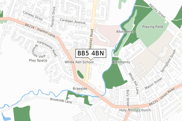
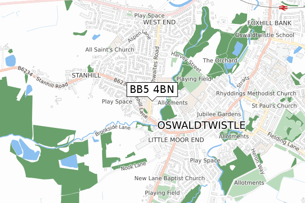
BB5 4BN is located in the St Andrew's electoral ward, within the local authority district of Hyndburn and the English Parliamentary constituency of Hyndburn. The Sub Integrated Care Board (ICB) Location is NHS Lancashire and South Cumbria ICB - 01A and the police force is Lancashire. This postcode has been in use since December 2019.


GetTheData
Source: OS Open Zoomstack (Ordnance Survey)
Licence: Open Government Licence (requires attribution)
Attribution: Contains OS data © Crown copyright and database right 2024
Source: Open Postcode Geo
Licence: Open Government Licence (requires attribution)
Attribution: Contains OS data © Crown copyright and database right 2024; Contains Royal Mail data © Royal Mail copyright and database right 2024; Source: Office for National Statistics licensed under the Open Government Licence v.3.0
| Easting | 373342 |
| Northing | 427547 |
| Latitude | 53.743628 |
| Longitude | -2.405672 |
GetTheData
Source: Open Postcode Geo
Licence: Open Government Licence
| Country | England |
| Postcode District | BB5 |
| ➜ BB5 open data dashboard ➜ See where BB5 is on a map ➜ Where is Oswaldtwistle? | |
GetTheData
Source: Land Registry Price Paid Data
Licence: Open Government Licence
| Ward | St Andrew's |
| Constituency | Hyndburn |
GetTheData
Source: ONS Postcode Database
Licence: Open Government Licence
2, BROOKFIELD GROVE, OSWALDTWISTLE, ACCRINGTON, BB5 4BN 2021 30 SEP £240,000 |
11, BROOKFIELD GROVE, OSWALDTWISTLE, ACCRINGTON, BB5 4BN 2021 3 SEP £195,000 |
10, BROOKFIELD GROVE, OSWALDTWISTLE, ACCRINGTON, BB5 4BN 2020 18 DEC £194,995 |
7, BROOKFIELD GROVE, OSWALDTWISTLE, ACCRINGTON, BB5 4BN 2020 9 APR £214,995 |
1, BROOKFIELD GROVE, OSWALDTWISTLE, ACCRINGTON, BB5 4BN 2020 2 MAR £204,995 |
9, BROOKFIELD GROVE, OSWALDTWISTLE, ACCRINGTON, BB5 4BN 2020 20 FEB £204,995 |
4, BROOKFIELD GROVE, OSWALDTWISTLE, ACCRINGTON, BB5 4BN 2019 13 DEC £204,995 |
GetTheData
Source: HM Land Registry Price Paid Data
Licence: Contains HM Land Registry data © Crown copyright and database right 2024. This data is licensed under the Open Government Licence v3.0.
| November 2023 | Violence and sexual offences | On or near Parking Area | 346m |
| September 2023 | Public order | On or near Parking Area | 346m |
| July 2023 | Criminal damage and arson | On or near Parking Area | 346m |
| ➜ Get more crime data in our Crime section | |||
GetTheData
Source: data.police.uk
Licence: Open Government Licence
| Central Avenue (Thwaites Road) | Oswaldtwistle | 142m |
| Harlech Drive (Stanhill Lane) | Oswaldtwistle | 146m |
| Thwaites Road (Stanhill Lane) | Oswaldtwistle | 161m |
| Central Avenue (Thwaites Road) | Oswaldtwistle | 163m |
| Harlech Drive (Stanhill Lane) | Oswaldtwistle | 176m |
| Church & Oswaldtwistle Station | 1.2km |
| Rishton Station | 2.4km |
| Accrington Station | 2.6km |
GetTheData
Source: NaPTAN
Licence: Open Government Licence
| Percentage of properties with Next Generation Access | 100.0% |
| Percentage of properties with Superfast Broadband | 100.0% |
| Percentage of properties with Ultrafast Broadband | 0.0% |
| Percentage of properties with Full Fibre Broadband | 0.0% |
Superfast Broadband is between 30Mbps and 300Mbps
Ultrafast Broadband is > 300Mbps
| Percentage of properties unable to receive 2Mbps | 0.0% |
| Percentage of properties unable to receive 5Mbps | 0.0% |
| Percentage of properties unable to receive 10Mbps | 0.0% |
| Percentage of properties unable to receive 30Mbps | 0.0% |
GetTheData
Source: Ofcom
Licence: Ofcom Terms of Use (requires attribution)
GetTheData
Source: ONS Postcode Database
Licence: Open Government Licence


➜ Get more ratings from the Food Standards Agency
GetTheData
Source: Food Standards Agency
Licence: FSA terms & conditions
| Last Collection | |||
|---|---|---|---|
| Location | Mon-Fri | Sat | Distance |
| Thwaites Road | 16:00 | 11:00 | 362m |
| Oswaldtwistle P.o. | 16:30 | 12:00 | 591m |
| West End Post Office | 17:00 | 11:45 | 761m |
GetTheData
Source: Dracos
Licence: Creative Commons Attribution-ShareAlike
| Facility | Distance |
|---|---|
| St Andrews C Of E Primary School Springfield Street, Oswaldtwistle, Accrington Grass Pitches | 367m |
| Whiteash Playing Fields (White Ash) Harvey Street, Oswaldtwistle , Accrington Grass Pitches | 437m |
| West End Primary School Aspen Lane, Oswaldtwistle, Accrington Grass Pitches, Sports Hall, Artificial Grass Pitch | 555m |
GetTheData
Source: Active Places
Licence: Open Government Licence
| School | Phase of Education | Distance |
|---|---|---|
| Oswaldtwistle White Ash School Thwaites Road, Oswaldtwistle, Accrington, BB5 4QG | Not applicable | 102m |
| Oswaldtwistle Moor End Primary School White Ash Lane, Oswaldtwistle, Accrington, BB5 3JG | Primary | 232m |
| Oswaldtwistle St Andrew's Church of England Primary School Springfield Street, Oswaldtwistle, Accrington, BB5 3LG | Primary | 448m |
GetTheData
Source: Edubase
Licence: Open Government Licence
The below table lists the International Territorial Level (ITL) codes (formerly Nomenclature of Territorial Units for Statistics (NUTS) codes) and Local Administrative Units (LAU) codes for BB5 4BN:
| ITL 1 Code | Name |
|---|---|
| TLD | North West (England) |
| ITL 2 Code | Name |
| TLD4 | Lancashire |
| ITL 3 Code | Name |
| TLD46 | East Lancashire |
| LAU 1 Code | Name |
| E07000120 | Hyndburn |
GetTheData
Source: ONS Postcode Directory
Licence: Open Government Licence
The below table lists the Census Output Area (OA), Lower Layer Super Output Area (LSOA), and Middle Layer Super Output Area (MSOA) for BB5 4BN:
| Code | Name | |
|---|---|---|
| OA | E00127270 | |
| LSOA | E01025077 | Hyndburn 007D |
| MSOA | E02005218 | Hyndburn 007 |
GetTheData
Source: ONS Postcode Directory
Licence: Open Government Licence
| BB5 4QR | Thwaites Road | 63m |
| BB5 4QF | Stanhill Lane | 156m |
| BB5 4QD | Stanhill Lane | 161m |
| BB5 4QE | Stanhill Street | 178m |
| BB5 4QJ | Central Avenue | 178m |
| BB5 4QG | Thwaites Road | 179m |
| BB5 3NP | Ward Avenue | 225m |
| BB5 3JG | White Ash Lane | 238m |
| BB5 4RN | Hargreaves Road | 242m |
| BB5 3JF | Oswald Street | 244m |
GetTheData
Source: Open Postcode Geo; Land Registry Price Paid Data
Licence: Open Government Licence