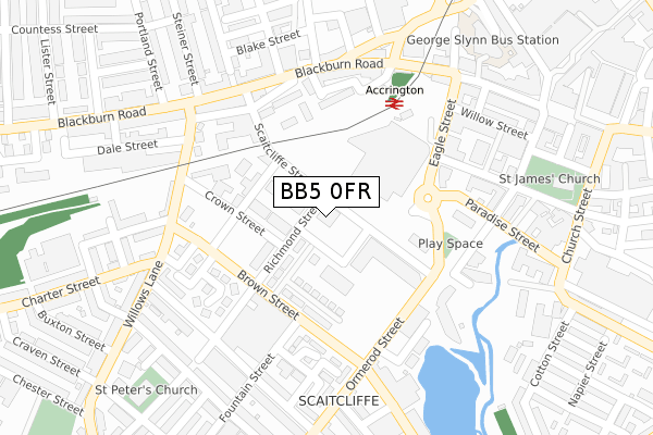
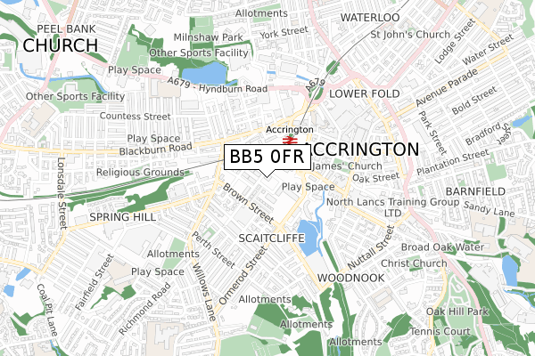
BB5 0FR is located in the Central electoral ward, within the local authority district of Hyndburn and the English Parliamentary constituency of Hyndburn. The Sub Integrated Care Board (ICB) Location is NHS Lancashire and South Cumbria ICB - 01A and the police force is Lancashire. This postcode has been in use since December 2018.


GetTheData
Source: OS Open Zoomstack (Ordnance Survey)
Licence: Open Government Licence (requires attribution)
Attribution: Contains OS data © Crown copyright and database right 2024
Source: Open Postcode Geo
Licence: Open Government Licence (requires attribution)
Attribution: Contains OS data © Crown copyright and database right 2024; Contains Royal Mail data © Royal Mail copyright and database right 2024; Source: Office for National Statistics licensed under the Open Government Licence v.3.0
| Easting | 375646 |
| Northing | 428413 |
| Latitude | 53.751525 |
| Longitude | -2.370808 |
GetTheData
Source: Open Postcode Geo
Licence: Open Government Licence
| Country | England |
| Postcode District | BB5 |
| ➜ BB5 open data dashboard ➜ See where BB5 is on a map ➜ Where is Accrington? | |
GetTheData
Source: Land Registry Price Paid Data
Licence: Open Government Licence
| Ward | Central |
| Constituency | Hyndburn |
GetTheData
Source: ONS Postcode Database
Licence: Open Government Licence
| January 2024 | Anti-social behaviour | On or near Parking Area | 198m |
| January 2024 | Anti-social behaviour | On or near Parking Area | 198m |
| January 2024 | Violence and sexual offences | On or near Parking Area | 198m |
| ➜ Get more crime data in our Crime section | |||
GetTheData
Source: data.police.uk
Licence: Open Government Licence
| Globe Centre (Scaitcliffe Street) | Scaitcliffe | 24m |
| Brown Street | Scaitcliffe | 194m |
| Ranger Street (Brown Street) | Spring Hill | 197m |
| Eagle Street Nhs (Paradise Street) | Accrington | 202m |
| Brown Street | Scaitcliffe | 205m |
| Accrington Station | 0.2km |
| Church & Oswaldtwistle Station | 1.3km |
| Huncoat Station | 2.7km |
GetTheData
Source: NaPTAN
Licence: Open Government Licence
GetTheData
Source: ONS Postcode Database
Licence: Open Government Licence


➜ Get more ratings from the Food Standards Agency
GetTheData
Source: Food Standards Agency
Licence: FSA terms & conditions
| Last Collection | |||
|---|---|---|---|
| Location | Mon-Fri | Sat | Distance |
| 52 Lancaster Avenue | 16:15 | 11:15 | 1,915m |
| Oswaldtwistle P.o. | 16:30 | 12:00 | 1,957m |
| West End Post Office | 17:00 | 11:45 | 2,338m |
GetTheData
Source: Dracos
Licence: Creative Commons Attribution-ShareAlike
| Facility | Distance |
|---|---|
| Energie Fitness Club (Accrington) (Closed) The Globe Centre, St. James Square, Accrington Health and Fitness Gym, Studio | 138m |
| Central Fitness Centre Blackburn Road, Accrington Health and Fitness Gym | 289m |
| Jetts Accrington The Viaduct, Hyndburn Road, Accrington Health and Fitness Gym | 331m |
GetTheData
Source: Active Places
Licence: Open Government Licence
| School | Phase of Education | Distance |
|---|---|---|
| Accrington Hyndburn Park Primary School Park Road, Accrington, BB5 1ST | Primary | 655m |
| Accrington Spring Hill Community Primary School Exchange Street, Accrington, BB5 0JD | Primary | 675m |
| Accrington St Mary Magdalen's Church of England Primary School Devonshire Street, Accrington, BB5 1DW | Primary | 718m |
GetTheData
Source: Edubase
Licence: Open Government Licence
The below table lists the International Territorial Level (ITL) codes (formerly Nomenclature of Territorial Units for Statistics (NUTS) codes) and Local Administrative Units (LAU) codes for BB5 0FR:
| ITL 1 Code | Name |
|---|---|
| TLD | North West (England) |
| ITL 2 Code | Name |
| TLD4 | Lancashire |
| ITL 3 Code | Name |
| TLD46 | East Lancashire |
| LAU 1 Code | Name |
| E07000120 | Hyndburn |
GetTheData
Source: ONS Postcode Directory
Licence: Open Government Licence
The below table lists the Census Output Area (OA), Lower Layer Super Output Area (LSOA), and Middle Layer Super Output Area (MSOA) for BB5 0FR:
| Code | Name | |
|---|---|---|
| OA | E00127102 | |
| LSOA | E01025041 | Hyndburn 006A |
| MSOA | E02005217 | Hyndburn 006 |
GetTheData
Source: ONS Postcode Directory
Licence: Open Government Licence
| BB5 0SU | Fountain Place | 92m |
| BB5 0RF | Scaitcliffe Street | 175m |
| BB5 1QQ | Paxton Street | 185m |
| BB5 1QJ | Brunswick Terrace | 188m |
| BB5 0AF | Blackburn Road | 238m |
| BB5 1NA | St James Court West | 244m |
| BB5 0QX | Hannah Street | 248m |
| BB5 0QU | Holden Street | 248m |
| BB5 0AE | Blackburn Road | 249m |
| BB5 0AA | Blackburn Road | 251m |
GetTheData
Source: Open Postcode Geo; Land Registry Price Paid Data
Licence: Open Government Licence