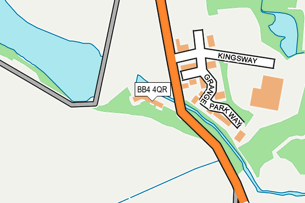
BB4 4QR is located in the Helmshore electoral ward, within the local authority district of Rossendale and the English Parliamentary constituency of Rossendale and Darwen. The Sub Integrated Care Board (ICB) Location is NHS Lancashire and South Cumbria ICB - 01A and the police force is Lancashire. This postcode has been in use since May 2017.


GetTheData
Source: OS OpenMap – Local (Ordnance Survey)
Source: OS VectorMap District (Ordnance Survey)
Licence: Open Government Licence (requires attribution)
| Easting | 377502 |
| Northing | 422120 |
| Latitude | 53.695048 |
| Longitude | -2.342202 |
GetTheData
Source: Open Postcode Geo
Licence: Open Government Licence
| Country | England |
| Postcode District | BB4 |
| ➜ BB4 open data dashboard ➜ See where BB4 is on a map ➜ Where is Haslingden? | |
GetTheData
Source: Land Registry Price Paid Data
Licence: Open Government Licence
| Ward | Helmshore |
| Constituency | Rossendale And Darwen |
GetTheData
Source: ONS Postcode Database
Licence: Open Government Licence
| June 2023 | Anti-social behaviour | On or near Grange Park Way | 131m |
| November 2022 | Vehicle crime | On or near Grange Park Way | 131m |
| June 2022 | Public order | On or near Gas Street | 464m |
| ➜ Get more crime data in our Crime section | |||
GetTheData
Source: data.police.uk
Licence: Open Government Licence
| Holden Vale Hotel (Holcombe Road) | Holden Vale | 44m |
| Holden Vale Hotel (Holcombe Road) | Holden Vale | 58m |
| Holcombe Road | Helmshore | 273m |
| Holcombe Road | Helmshore | 286m |
| Holden Arms (Holcombe Road) | Holden Vale | 362m |
| Entwistle Station | 6.5km |
GetTheData
Source: NaPTAN
Licence: Open Government Licence
➜ Broadband speed and availability dashboard for BB4 4QR
| Percentage of properties with Next Generation Access | 100.0% |
| Percentage of properties with Superfast Broadband | 100.0% |
| Percentage of properties with Ultrafast Broadband | 0.0% |
| Percentage of properties with Full Fibre Broadband | 0.0% |
Superfast Broadband is between 30Mbps and 300Mbps
Ultrafast Broadband is > 300Mbps
| Median download speed | 80.0Mbps |
| Average download speed | 76.5Mbps |
| Maximum download speed | 80.00Mbps |
| Median upload speed | 20.0Mbps |
| Average upload speed | 18.8Mbps |
| Maximum upload speed | 20.00Mbps |
| Percentage of properties unable to receive 2Mbps | 0.0% |
| Percentage of properties unable to receive 5Mbps | 0.0% |
| Percentage of properties unable to receive 10Mbps | 0.0% |
| Percentage of properties unable to receive 30Mbps | 0.0% |
➜ Broadband speed and availability dashboard for BB4 4QR
GetTheData
Source: Ofcom
Licence: Ofcom Terms of Use (requires attribution)
GetTheData
Source: ONS Postcode Database
Licence: Open Government Licence


➜ Get more ratings from the Food Standards Agency
GetTheData
Source: Food Standards Agency
Licence: FSA terms & conditions
| Last Collection | |||
|---|---|---|---|
| Location | Mon-Fri | Sat | Distance |
| Haslingden Post Office | 17:15 | 12:00 | 1,515m |
| Sidmouth Avenue | 17:30 | 12:15 | 1,770m |
| Railway Station | 16:45 | 12:30 | 3,475m |
GetTheData
Source: Dracos
Licence: Creative Commons Attribution-ShareAlike
| Facility | Distance |
|---|---|
| Hv Fitness Suite (Closed) Holcombe Road, Rossendale Health and Fitness Gym | 51m |
| Adrenaline Centre Helmshore Road, Haslingden, Rossendale Sports Hall, Health and Fitness Gym, Grass Pitches, Studio, Squash Courts, Artificial Grass Pitch, Outdoor Tennis Courts | 859m |
| Perform Centre Ltd (Closed) Waterside Road, Haslingden, Rossendale Health and Fitness Gym | 996m |
GetTheData
Source: Active Places
Licence: Open Government Licence
| School | Phase of Education | Distance |
|---|---|---|
| Helmshore Primary School Gregory Fold, Helmshore, Rossendale, BB4 4JW | Primary | 987m |
| St Veronica's Roman Catholic Primary School, Helmshore Raven Avenue, Helmshore, BB4 4EZ | Primary | 1.3km |
| Haslingden Primary School Ryefield Avenue, Haslingden, Rossendale, BB4 4BJ | Primary | 1.4km |
GetTheData
Source: Edubase
Licence: Open Government Licence
The below table lists the International Territorial Level (ITL) codes (formerly Nomenclature of Territorial Units for Statistics (NUTS) codes) and Local Administrative Units (LAU) codes for BB4 4QR:
| ITL 1 Code | Name |
|---|---|
| TLD | North West (England) |
| ITL 2 Code | Name |
| TLD4 | Lancashire |
| ITL 3 Code | Name |
| TLD46 | East Lancashire |
| LAU 1 Code | Name |
| E07000125 | Rossendale |
GetTheData
Source: ONS Postcode Directory
Licence: Open Government Licence
The below table lists the Census Output Area (OA), Lower Layer Super Output Area (LSOA), and Middle Layer Super Output Area (MSOA) for BB4 4QR:
| Code | Name | |
|---|---|---|
| OA | E00128803 | |
| LSOA | E01025378 | Rossendale 007B |
| MSOA | E02005284 | Rossendale 007 |
GetTheData
Source: ONS Postcode Directory
Licence: Open Government Licence
| BB4 4QF | Musbury Mews | 95m |
| BB4 4QE | Grange Park Way | 113m |
| BB4 4QL | Grange Park Way | 132m |
| BB4 4QH | Grange Park Way | 134m |
| BB4 4QG | Grange Park Way | 184m |
| BB4 4NY | Holcombe Road | 299m |
| BB4 4PA | Holcombe Road | 378m |
| BB4 4PH | Musbury View | 464m |
| BB4 4RQ | Holden Wood Drive | 478m |
| BB4 4PB | Grane Road | 493m |
GetTheData
Source: Open Postcode Geo; Land Registry Price Paid Data
Licence: Open Government Licence