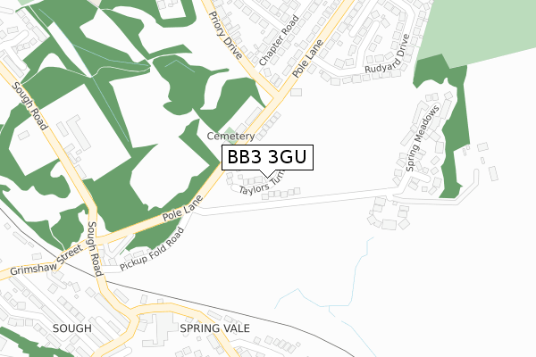
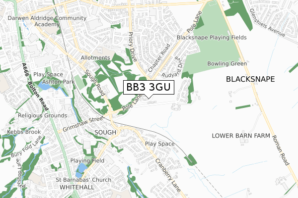
BB3 3GU is located in the Darwen South electoral ward, within the unitary authority of Blackburn with Darwen and the English Parliamentary constituency of Rossendale and Darwen. The Sub Integrated Care Board (ICB) Location is NHS Lancashire and South Cumbria ICB - 00Q and the police force is Lancashire. This postcode has been in use since February 2020.


GetTheData
Source: OS Open Zoomstack (Ordnance Survey)
Licence: Open Government Licence (requires attribution)
Attribution: Contains OS data © Crown copyright and database right 2024
Source: Open Postcode Geo
Licence: Open Government Licence (requires attribution)
Attribution: Contains OS data © Crown copyright and database right 2024; Contains Royal Mail data © Royal Mail copyright and database right 2024; Source: Office for National Statistics licensed under the Open Government Licence v.3.0
| Easting | 370367 |
| Northing | 421355 |
| Latitude | 53.687815 |
| Longitude | -2.450182 |
GetTheData
Source: Open Postcode Geo
Licence: Open Government Licence
| Country | England |
| Postcode District | BB3 |
| ➜ BB3 open data dashboard ➜ See where BB3 is on a map ➜ Where is Darwen? | |
GetTheData
Source: Land Registry Price Paid Data
Licence: Open Government Licence
| Ward | Darwen South |
| Constituency | Rossendale And Darwen |
GetTheData
Source: ONS Postcode Database
Licence: Open Government Licence
2023 5 MAY £285,000 |
2021 29 JAN £239,995 |
7, TAYLORS TURN, DARWEN, BB3 3GU 2020 16 DEC £274,995 |
5, TAYLORS TURN, DARWEN, BB3 3GU 2020 11 DEC £239,995 |
3, TAYLORS TURN, DARWEN, BB3 3GU 2020 11 DEC £259,995 |
8, TAYLORS TURN, DARWEN, BB3 3GU 2020 11 SEP £276,995 |
2020 28 FEB £282,995 |
2, TAYLORS TURN, DARWEN, BB3 3GU 2020 21 FEB £269,995 |
6, TAYLORS TURN, DARWEN, BB3 3GU 2019 20 DEC £264,995 |
10, TAYLORS TURN, DARWEN, BB3 3GU 2019 12 JUL £325,000 |
GetTheData
Source: HM Land Registry Price Paid Data
Licence: Contains HM Land Registry data © Crown copyright and database right 2024. This data is licensed under the Open Government Licence v3.0.
| December 2023 | Vehicle crime | On or near Minster Crescent | 493m |
| June 2022 | Anti-social behaviour | On or near Spring Meadows | 278m |
| June 2022 | Anti-social behaviour | On or near Spring Meadows | 278m |
| ➜ Get more crime data in our Crime section | |||
GetTheData
Source: data.police.uk
Licence: Open Government Licence
| Pole Lane Cottages (Pole Lane) | Spring Vale | 85m |
| Pole Lane Cottages (Pole Lane) | Spring Vale | 86m |
| Craven Heifer (Pole Lane) | Spring Vale | 184m |
| Craven Heifer (Pole Lane) | Spring Vale | 194m |
| Chapter Road (Priory Drive) | Darwen | 259m |
| Darwen Station | 1.5km |
| Entwistle Station | 4.3km |
GetTheData
Source: NaPTAN
Licence: Open Government Licence
GetTheData
Source: ONS Postcode Database
Licence: Open Government Licence


➜ Get more ratings from the Food Standards Agency
GetTheData
Source: Food Standards Agency
Licence: FSA terms & conditions
| Last Collection | |||
|---|---|---|---|
| Location | Mon-Fri | Sat | Distance |
| 68 Birch Hall Avenue | 16:30 | 11:00 | 1,317m |
| Royal Arms | 12:00 | 09:00 | 3,870m |
| Entwistle Station | 16:45 | 11:35 | 4,277m |
GetTheData
Source: Dracos
Licence: Creative Commons Attribution-ShareAlike
| Facility | Distance |
|---|---|
| St Barnabas Primary School Knowlesly Road, Darwen Grass Pitches | 870m |
| Blacksnape Playing Fields Blacksnape Road, Darwen Grass Pitches | 871m |
| Sudell Primary School Ellison Fold Terrace, Darwen Grass Pitches | 1km |
GetTheData
Source: Active Places
Licence: Open Government Licence
| School | Phase of Education | Distance |
|---|---|---|
| Darwen St Peter's Church of England Primary School Turncroft Road, BB3 2BW, DARWEN, BB3 2BW | Primary | 593m |
| Turncroft Nursery School Highfield Road, Darwen, BB3 2DN | Nursery | 832m |
| Darwen, St Barnabas CofE Primary Academy Knowlesly Road, Darwen, BB3 2JA | Primary | 868m |
GetTheData
Source: Edubase
Licence: Open Government Licence
The below table lists the International Territorial Level (ITL) codes (formerly Nomenclature of Territorial Units for Statistics (NUTS) codes) and Local Administrative Units (LAU) codes for BB3 3GU:
| ITL 1 Code | Name |
|---|---|
| TLD | North West (England) |
| ITL 2 Code | Name |
| TLD4 | Lancashire |
| ITL 3 Code | Name |
| TLD41 | Blackburn with Darwen |
| LAU 1 Code | Name |
| E06000008 | Blackburn with Darwen |
GetTheData
Source: ONS Postcode Directory
Licence: Open Government Licence
The below table lists the Census Output Area (OA), Lower Layer Super Output Area (LSOA), and Middle Layer Super Output Area (MSOA) for BB3 3GU:
| Code | Name | |
|---|---|---|
| OA | E00063593 | |
| LSOA | E01012614 | Blackburn with Darwen 017A |
| MSOA | E02002631 | Blackburn with Darwen 017 |
GetTheData
Source: ONS Postcode Directory
Licence: Open Government Licence
| BB3 3LQ | Moorlands Court | 238m |
| BB3 2HN | Cranberry Chase | 275m |
| BB3 3JS | Spring Meadows | 291m |
| BB3 2HQ | Lower Barn Street | 306m |
| BB3 2HF | Cranberry Lane | 317m |
| BB3 3LE | Rudyard Drive | 327m |
| BB3 3LF | Bosley Close | 329m |
| BB3 2HA | Sough Road | 348m |
| BB3 2EU | Causeway Street | 350m |
| BB3 3LD | Pole Lane | 354m |
GetTheData
Source: Open Postcode Geo; Land Registry Price Paid Data
Licence: Open Government Licence