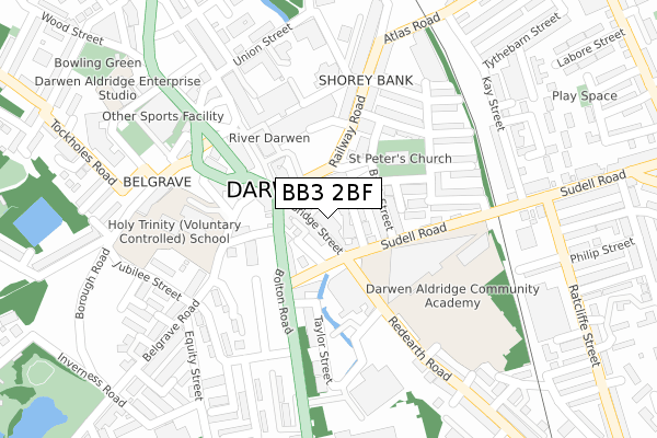
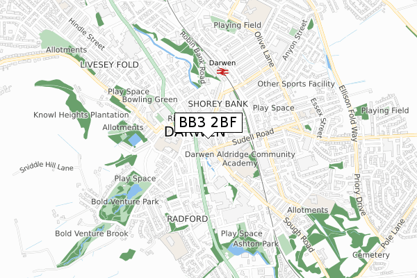
BB3 2BF is located in the Darwen East electoral ward, within the unitary authority of Blackburn with Darwen and the English Parliamentary constituency of Rossendale and Darwen. The Sub Integrated Care Board (ICB) Location is NHS Lancashire and South Cumbria ICB - 00Q and the police force is Lancashire. This postcode has been in use since February 2020.


GetTheData
Source: OS Open Zoomstack (Ordnance Survey)
Licence: Open Government Licence (requires attribution)
Attribution: Contains OS data © Crown copyright and database right 2024
Source: Open Postcode Geo
Licence: Open Government Licence (requires attribution)
Attribution: Contains OS data © Crown copyright and database right 2024; Contains Royal Mail data © Royal Mail copyright and database right 2024; Source: Office for National Statistics licensed under the Open Government Licence v.3.0
| Easting | 369324 |
| Northing | 422127 |
| Latitude | 53.694693 |
| Longitude | -2.466051 |
GetTheData
Source: Open Postcode Geo
Licence: Open Government Licence
| Country | England |
| Postcode District | BB3 |
| ➜ BB3 open data dashboard ➜ See where BB3 is on a map ➜ Where is Darwen? | |
GetTheData
Source: Land Registry Price Paid Data
Licence: Open Government Licence
| Ward | Darwen East |
| Constituency | Rossendale And Darwen |
GetTheData
Source: ONS Postcode Database
Licence: Open Government Licence
| January 2024 | Shoplifting | On or near Buff Street | 343m |
| January 2024 | Shoplifting | On or near Buff Street | 343m |
| January 2024 | Shoplifting | On or near Buff Street | 343m |
| ➜ Get more crime data in our Crime section | |||
GetTheData
Source: data.police.uk
Licence: Open Government Licence
| Victoria Street (Sudell Road) | Darwen | 64m |
| Bank Street (Sudell Road) | Darwen | 82m |
| Town Centre (Croft Street) | Darwen | 84m |
| Town Centre (Croft Street) | Darwen | 101m |
| Railway Road | Darwen | 101m |
| Darwen Station | 0.4km |
| Mill Hill (Lancs) Station | 5.1km |
| Cherry Tree Station | 5.5km |
GetTheData
Source: NaPTAN
Licence: Open Government Licence
GetTheData
Source: ONS Postcode Database
Licence: Open Government Licence


➜ Get more ratings from the Food Standards Agency
GetTheData
Source: Food Standards Agency
Licence: FSA terms & conditions
| Last Collection | |||
|---|---|---|---|
| Location | Mon-Fri | Sat | Distance |
| 68 Birch Hall Avenue | 16:30 | 11:00 | 25m |
| Royal Arms | 12:00 | 09:00 | 2,885m |
| Moorgate | 16:15 | 11:15 | 4,379m |
GetTheData
Source: Dracos
Licence: Creative Commons Attribution-ShareAlike
| Facility | Distance |
|---|---|
| Darwen Aldridge Community Academy Sudell Road, Darwen Sports Hall, Studio, Artificial Grass Pitch, Health and Fitness Gym | 144m |
| Holy Trinity Ce Primary School Bank Top, Darwen Artificial Grass Pitch | 209m |
| Darwen Leisure Centre The Green, Darwen Swimming Pool, Health and Fitness Gym, Sports Hall, Studio | 301m |
GetTheData
Source: Active Places
Licence: Open Government Licence
| School | Phase of Education | Distance |
|---|---|---|
| Darwen Aldridge Community Academy Sudell Road, Darwen, BB3 3HD | Secondary | 209m |
| Holy Trinity VC School Bank Top, Darwen, BB3 2RW | Primary | 220m |
| Darwen Aldridge Enterprise Studio Police Street, Darwen, BB3 1AF | Secondary | 366m |
GetTheData
Source: Edubase
Licence: Open Government Licence
The below table lists the International Territorial Level (ITL) codes (formerly Nomenclature of Territorial Units for Statistics (NUTS) codes) and Local Administrative Units (LAU) codes for BB3 2BF:
| ITL 1 Code | Name |
|---|---|
| TLD | North West (England) |
| ITL 2 Code | Name |
| TLD4 | Lancashire |
| ITL 3 Code | Name |
| TLD41 | Blackburn with Darwen |
| LAU 1 Code | Name |
| E06000008 | Blackburn with Darwen |
GetTheData
Source: ONS Postcode Directory
Licence: Open Government Licence
The below table lists the Census Output Area (OA), Lower Layer Super Output Area (LSOA), and Middle Layer Super Output Area (MSOA) for BB3 2BF:
| Code | Name | |
|---|---|---|
| OA | E00171883 | |
| LSOA | E01012654 | Blackburn with Darwen 016D |
| MSOA | E02002630 | Blackburn with Darwen 016 |
GetTheData
Source: ONS Postcode Directory
Licence: Open Government Licence
| BB3 2AA | Bridge Street | 10m |
| BB3 1DJ | Foundry Street | 50m |
| BB3 3HB | Victoria Street | 52m |
| BB3 2RE | Church Street | 61m |
| BB3 3HE | Bank Street | 76m |
| BB3 3HD | Sudell Road | 87m |
| BB3 1BN | Market Street | 100m |
| BB3 1DF | Bolton Road | 124m |
| BB3 1BU | Belgrave Square | 131m |
| BB3 3HR | Church Terrace | 132m |
GetTheData
Source: Open Postcode Geo; Land Registry Price Paid Data
Licence: Open Government Licence