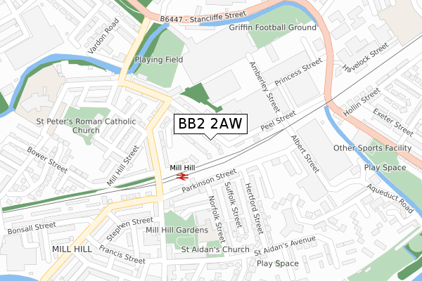
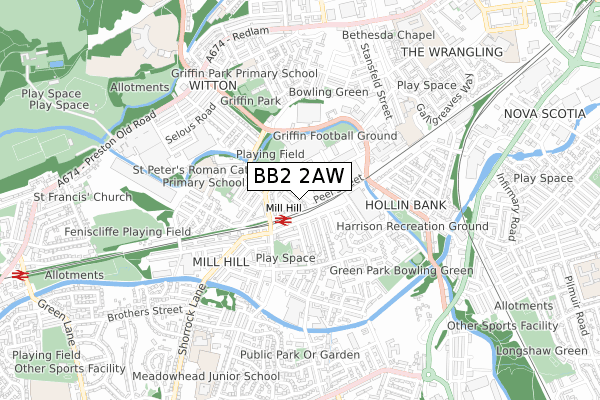
BB2 2AW is located in the Mill Hill & Moorgate electoral ward, within the unitary authority of Blackburn with Darwen and the English Parliamentary constituency of Blackburn. The Sub Integrated Care Board (ICB) Location is NHS Lancashire and South Cumbria ICB - 00Q and the police force is Lancashire. This postcode has been in use since April 2020.


GetTheData
Source: OS Open Zoomstack (Ordnance Survey)
Licence: Open Government Licence (requires attribution)
Attribution: Contains OS data © Crown copyright and database right 2024
Source: Open Postcode Geo
Licence: Open Government Licence (requires attribution)
Attribution: Contains OS data © Crown copyright and database right 2024; Contains Royal Mail data © Royal Mail copyright and database right 2024; Source: Office for National Statistics licensed under the Open Government Licence v.3.0
| Easting | 367023 |
| Northing | 426771 |
| Latitude | 53.736291 |
| Longitude | -2.501394 |
GetTheData
Source: Open Postcode Geo
Licence: Open Government Licence
| Country | England |
| Postcode District | BB2 |
| ➜ BB2 open data dashboard ➜ See where BB2 is on a map ➜ Where is Blackburn? | |
GetTheData
Source: Land Registry Price Paid Data
Licence: Open Government Licence
| Ward | Mill Hill & Moorgate |
| Constituency | Blackburn |
GetTheData
Source: ONS Postcode Database
Licence: Open Government Licence
| January 2024 | Anti-social behaviour | On or near Cave Street | 373m |
| January 2024 | Anti-social behaviour | On or near Stirling Street | 444m |
| January 2024 | Anti-social behaviour | On or near Stirling Street | 444m |
| ➜ Get more crime data in our Crime section | |||
GetTheData
Source: data.police.uk
Licence: Open Government Licence
| Brook Street (Queen Victoria Street) | Mill Hill | 106m |
| Day Centre (Mill Hill Street) | Mill Hill | 106m |
| Hertford Street (Parkinson Street) | Mill Hill | 140m |
| Parkinson St Mill Hill (Parkinson St) | Mill Hill | 143m |
| Railway Station (New Chapel Street) | Mill Hill | 160m |
| Mill Hill (Lancs) Station | 0.1km |
| Cherry Tree Station | 1.2km |
| Blackburn Station | 1.9km |
GetTheData
Source: NaPTAN
Licence: Open Government Licence
GetTheData
Source: ONS Postcode Database
Licence: Open Government Licence


➜ Get more ratings from the Food Standards Agency
GetTheData
Source: Food Standards Agency
Licence: FSA terms & conditions
| Last Collection | |||
|---|---|---|---|
| Location | Mon-Fri | Sat | Distance |
| 10 Bank Top | 16:45 | 13:15 | 201m |
| Mill Hill Post Office | 17:15 | 12:15 | 216m |
| Moorgate | 16:15 | 11:15 | 829m |
GetTheData
Source: Dracos
Licence: Creative Commons Attribution-ShareAlike
| Facility | Distance |
|---|---|
| Mill Hill St Peters Football Club Queen Victoria Street, Blackburn Grass Pitches | 187m |
| Griffin Ground Waterfall Street, Blackburn Grass Pitches | 349m |
| Griffin Park Community Primary School Cavendish Place, Blackburn Grass Pitches | 539m |
GetTheData
Source: Active Places
Licence: Open Government Licence
| School | Phase of Education | Distance |
|---|---|---|
| St Aidan's Primary School - A Church of England Academy Norfolk Street, Mill Hill, Blackburn, BB2 4EW | Primary | 206m |
| St Peter's Roman Catholic Primary School, Blackburn Hawkins Street, Blackburn, BB2 2RY | Primary | 386m |
| Griffin Park Primary School Cavendish Place, Blackburn, BB2 2PN | Primary | 506m |
GetTheData
Source: Edubase
Licence: Open Government Licence
The below table lists the International Territorial Level (ITL) codes (formerly Nomenclature of Territorial Units for Statistics (NUTS) codes) and Local Administrative Units (LAU) codes for BB2 2AW:
| ITL 1 Code | Name |
|---|---|
| TLD | North West (England) |
| ITL 2 Code | Name |
| TLD4 | Lancashire |
| ITL 3 Code | Name |
| TLD41 | Blackburn with Darwen |
| LAU 1 Code | Name |
| E06000008 | Blackburn with Darwen |
GetTheData
Source: ONS Postcode Directory
Licence: Open Government Licence
The below table lists the Census Output Area (OA), Lower Layer Super Output Area (LSOA), and Middle Layer Super Output Area (MSOA) for BB2 2AW:
| Code | Name | |
|---|---|---|
| OA | E00063633 | |
| LSOA | E01012625 | Blackburn with Darwen 009F |
| MSOA | E02002623 | Blackburn with Darwen 009 |
GetTheData
Source: ONS Postcode Directory
Licence: Open Government Licence
| BB2 2QG | Queen Victoria Street | 80m |
| BB2 2RA | Brook Street | 109m |
| BB2 2RD | New Chapel Street | 132m |
| BB2 4ET | Parkinson Street | 142m |
| BB2 4BY | Parkinson Street | 155m |
| BB2 2QZ | Queen Victoria Street | 161m |
| BB2 4EQ | Norfolk Terrace | 171m |
| BB2 2RB | Millhill Street | 173m |
| BB2 4EP | Zebudah Street | 178m |
| BB2 2RE | Railway View | 181m |
GetTheData
Source: Open Postcode Geo; Land Registry Price Paid Data
Licence: Open Government Licence