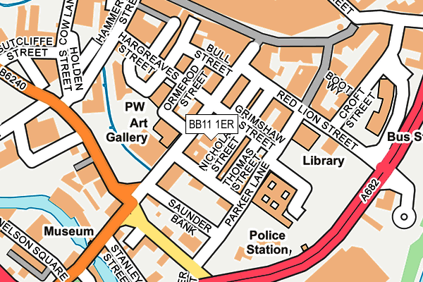
BB11 1ER is located in the Daneshouse with Stoneyholme electoral ward, within the local authority district of Burnley and the English Parliamentary constituency of Burnley. The Sub Integrated Care Board (ICB) Location is NHS Lancashire and South Cumbria ICB - 01A and the police force is Lancashire. This postcode has been in use since April 2017.


GetTheData
Source: OS OpenMap – Local (Ordnance Survey)
Source: OS VectorMap District (Ordnance Survey)
Licence: Open Government Licence (requires attribution)
| Easting | 384051 |
| Northing | 432400 |
| Latitude | 53.787685 |
| Longitude | -2.243556 |
GetTheData
Source: Open Postcode Geo
Licence: Open Government Licence
| Country | England |
| Postcode District | BB11 |
➜ See where BB11 is on a map ➜ Where is Burnley? | |
GetTheData
Source: Land Registry Price Paid Data
Licence: Open Government Licence
| Ward | Daneshouse With Stoneyholme |
| Constituency | Burnley |
GetTheData
Source: ONS Postcode Database
Licence: Open Government Licence
| Mechanics Institute (Manchester Road) | Burnley | 28m |
| Mechanics Institute (Manchester Road) | Burnley | 46m |
| Hargreaves Street | Burnley | 120m |
| Croft Street Schools (Croft Street) | Burnley | 192m |
| Red Lion Street School Stop (Red Lion Street) | Burnley | 204m |
| Burnley Manchester Road Station | 0.5km |
| Burnley Central Station | 0.7km |
| Burnley Barracks Station | 1km |
GetTheData
Source: NaPTAN
Licence: Open Government Licence
| Median download speed | 23.4Mbps |
| Average download speed | 36.8Mbps |
| Maximum download speed | 80.00Mbps |
| Median upload speed | 1.2Mbps |
| Average upload speed | 6.7Mbps |
| Maximum upload speed | 20.00Mbps |
GetTheData
Source: Ofcom
Licence: Ofcom Terms of Use (requires attribution)
GetTheData
Source: ONS Postcode Database
Licence: Open Government Licence


➜ Get more ratings from the Food Standards Agency
GetTheData
Source: Food Standards Agency
Licence: FSA terms & conditions
| Last Collection | |||
|---|---|---|---|
| Location | Mon-Fri | Sat | Distance |
| Burnley Post Office | 18:30 | 11:00 | 158m |
| Burnley Post Office | 18:30 | 11:00 | 161m |
| Burnley Delivery Office | 19:00 | 13:00 | 190m |
GetTheData
Source: Dracos
Licence: Creative Commons Attribution-ShareAlike
The below table lists the International Territorial Level (ITL) codes (formerly Nomenclature of Territorial Units for Statistics (NUTS) codes) and Local Administrative Units (LAU) codes for BB11 1ER:
| ITL 1 Code | Name |
|---|---|
| TLD | North West (England) |
| ITL 2 Code | Name |
| TLD4 | Lancashire |
| ITL 3 Code | Name |
| TLD46 | East Lancashire |
| LAU 1 Code | Name |
| E07000117 | Burnley |
GetTheData
Source: ONS Postcode Directory
Licence: Open Government Licence
The below table lists the Census Output Area (OA), Lower Layer Super Output Area (LSOA), and Middle Layer Super Output Area (MSOA) for BB11 1ER:
| Code | Name | |
|---|---|---|
| OA | E00126261 | |
| LSOA | E01024877 | Burnley 003D |
| MSOA | E02005178 | Burnley 003 |
GetTheData
Source: ONS Postcode Directory
Licence: Open Government Licence
| BB11 1HJ | Manchester Road | 19m |
| BB11 2AS | Grimshaw Street | 32m |
| BB11 1HG | Manchester Road | 54m |
| BB11 2BQ | Elizabeth Street | 69m |
| BB11 2BU | Parker Lane | 71m |
| BB11 1HH | Manchester Road | 84m |
| BB11 1DU | Hargreaves Street | 148m |
| BB11 1NH | St James's Street | 158m |
| BB11 2AE | Red Lion Street | 165m |
| BB11 2BY | Parker Lane | 166m |
GetTheData
Source: Open Postcode Geo; Land Registry Price Paid Data
Licence: Open Government Licence