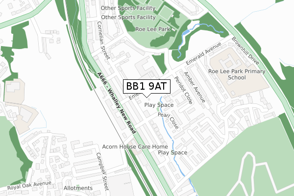
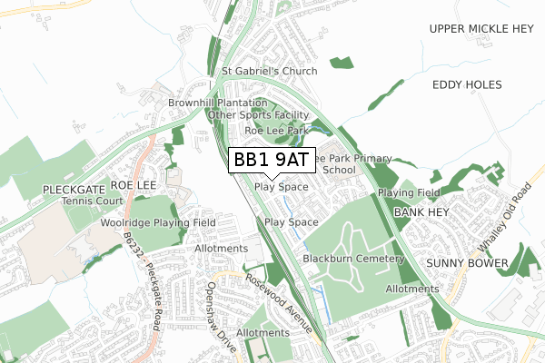
BB1 9AT is located in the Wilpshire & Ramsgreave electoral ward, within the local authority district of Ribble Valley and the English Parliamentary constituency of Ribble Valley. The Sub Integrated Care Board (ICB) Location is NHS Lancashire and South Cumbria ICB - 01A and the police force is Lancashire. This postcode has been in use since February 2020.


GetTheData
Source: OS Open Zoomstack (Ordnance Survey)
Licence: Open Government Licence (requires attribution)
Attribution: Contains OS data © Crown copyright and database right 2024
Source: Open Postcode Geo
Licence: Open Government Licence (requires attribution)
Attribution: Contains OS data © Crown copyright and database right 2024; Contains Royal Mail data © Royal Mail copyright and database right 2024; Source: Office for National Statistics licensed under the Open Government Licence v.3.0
| Easting | 368634 |
| Northing | 432003 |
| Latitude | 53.783413 |
| Longitude | -2.477507 |
GetTheData
Source: Open Postcode Geo
Licence: Open Government Licence
| Country | England |
| Postcode District | BB1 |
| ➜ BB1 open data dashboard ➜ See where BB1 is on a map ➜ Where is Blackburn? | |
GetTheData
Source: Land Registry Price Paid Data
Licence: Open Government Licence
| Ward | Wilpshire & Ramsgreave |
| Constituency | Ribble Valley |
GetTheData
Source: ONS Postcode Database
Licence: Open Government Licence
| June 2022 | Vehicle crime | On or near Mayfair Crescent | 77m |
| June 2022 | Anti-social behaviour | On or near Station Close | 129m |
| June 2022 | Violence and sexual offences | On or near Knowsley Road | 332m |
| ➜ Get more crime data in our Crime section | |||
GetTheData
Source: data.police.uk
Licence: Open Government Licence
| Mayfair Crescent (Knowsley Road) | Wilpshire | 84m |
| Mayfair Crescent (Knowsley Road) | Wilpshire | 86m |
| Old Railway Station (Whalley New Road) | Wilpshire | 164m |
| Old Railway Station (Whalley New Road) | Wilpshire | 170m |
| Turning Circle (Whalley New Road) | Wilpshire | 209m |
| Ramsgreave & Wilpshire Station | 0.4km |
| Langho Station | 3km |
| Blackburn Station | 4.1km |
GetTheData
Source: NaPTAN
Licence: Open Government Licence
GetTheData
Source: ONS Postcode Database
Licence: Open Government Licence


➜ Get more ratings from the Food Standards Agency
GetTheData
Source: Food Standards Agency
Licence: FSA terms & conditions
| Last Collection | |||
|---|---|---|---|
| Location | Mon-Fri | Sat | Distance |
| Shear Brow | 16:45 | 12:00 | 2,778m |
| Phillips Road | 18:00 | 12:30 | 3,121m |
| Whitebirk Ind Estate | 17:15 | 12:30 | 3,306m |
GetTheData
Source: Dracos
Licence: Creative Commons Attribution-ShareAlike
| Facility | Distance |
|---|---|
| Wilpshire Golf Club Whalley Road, Wilpshire, Blackburn Golf | 672m |
| Wilpshire Wanderers Football Club Ribchester Road, Clayton-le-dale, Blackburn Grass Pitches, Sports Hall, Outdoor Tennis Courts | 951m |
| Salesbury Cricket Club Lovely Hall Lane, Salesbury, Blackburn Grass Pitches | 1km |
GetTheData
Source: Active Places
Licence: Open Government Licence
| School | Phase of Education | Distance |
|---|---|---|
| Salesbury Church of England Primary School Lovely Hall Lane, Salesbury, Blackburn, BB1 9EQ | Primary | 1.2km |
| Roe Lee Park Primary School Emerald Avenue, Blackburn, BB1 9RP | Primary | 1.4km |
| St Gabriel's Church of England Primary School Wilworth Crescent, Blackburn, BB1 8QN | Primary | 1.5km |
GetTheData
Source: Edubase
Licence: Open Government Licence
The below table lists the International Territorial Level (ITL) codes (formerly Nomenclature of Territorial Units for Statistics (NUTS) codes) and Local Administrative Units (LAU) codes for BB1 9AT:
| ITL 1 Code | Name |
|---|---|
| TLD | North West (England) |
| ITL 2 Code | Name |
| TLD4 | Lancashire |
| ITL 3 Code | Name |
| TLD45 | Mid Lancashire |
| LAU 1 Code | Name |
| E07000124 | Ribble Valley |
GetTheData
Source: ONS Postcode Directory
Licence: Open Government Licence
The below table lists the Census Output Area (OA), Lower Layer Super Output Area (LSOA), and Middle Layer Super Output Area (MSOA) for BB1 9AT:
| Code | Name | |
|---|---|---|
| OA | E00128676 | |
| LSOA | E01025353 | Ribble Valley 008G |
| MSOA | E02005277 | Ribble Valley 008 |
GetTheData
Source: ONS Postcode Directory
Licence: Open Government Licence
| BB1 9PX | Knowsley Road | 54m |
| BB1 9PY | Mayfair Crescent | 76m |
| BB1 9PZ | Clifton Grove | 84m |
| BB1 9PT | Station Close | 130m |
| BB1 9PS | Wilpshire Banks | 188m |
| BB1 9PP | Brooklyn Road | 206m |
| BB1 9PB | Showley Brook Close | 211m |
| BB1 9JT | Whalley Road | 221m |
| BB1 9PJ | Whalley Road | 247m |
| BB1 9PR | Woodcrest | 267m |
GetTheData
Source: Open Postcode Geo; Land Registry Price Paid Data
Licence: Open Government Licence