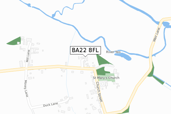
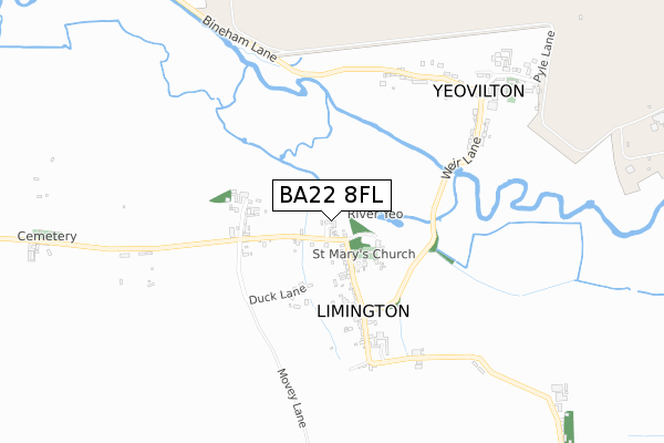
BA22 8FL is located in the Castle Cary electoral ward, within the unitary authority of Somerset and the English Parliamentary constituency of Yeovil. The Sub Integrated Care Board (ICB) Location is NHS Somerset ICB - 11X and the police force is Avon and Somerset. This postcode has been in use since December 2019.


GetTheData
Source: OS Open Zoomstack (Ordnance Survey)
Licence: Open Government Licence (requires attribution)
Attribution: Contains OS data © Crown copyright and database right 2024
Source: Open Postcode Geo
Licence: Open Government Licence (requires attribution)
Attribution: Contains OS data © Crown copyright and database right 2024; Contains Royal Mail data © Royal Mail copyright and database right 2024; Source: Office for National Statistics licensed under the Open Government Licence v.3.0
| Easting | 354014 |
| Northing | 122469 |
| Latitude | 50.999757 |
| Longitude | -2.656713 |
GetTheData
Source: Open Postcode Geo
Licence: Open Government Licence
| Country | England |
| Postcode District | BA22 |
| ➜ BA22 open data dashboard ➜ See where BA22 is on a map ➜ Where is Limington? | |
GetTheData
Source: Land Registry Price Paid Data
Licence: Open Government Licence
| Ward | Castle Cary |
| Constituency | Yeovil |
GetTheData
Source: ONS Postcode Database
Licence: Open Government Licence
| June 2021 | Criminal damage and arson | On or near Duck Lane | 340m |
| February 2021 | Other crime | On or near Duck Lane | 340m |
| ➜ Get more crime data in our Crime section | |||
GetTheData
Source: data.police.uk
Licence: Open Government Licence
| The Old Post Office (Church Street) | Limington | 257m |
| The Old Post Office (Church Street) | Limington | 260m |
| Broadmeadows (Weir Lane) | Limington | 702m |
| Broadmeadows (Weir Lane) | Limington | 719m |
| Rnas (Pyle Lane) | Limington | 913m |
GetTheData
Source: NaPTAN
Licence: Open Government Licence
GetTheData
Source: ONS Postcode Database
Licence: Open Government Licence


➜ Get more ratings from the Food Standards Agency
GetTheData
Source: Food Standards Agency
Licence: FSA terms & conditions
| Last Collection | |||
|---|---|---|---|
| Location | Mon-Fri | Sat | Distance |
| Air Museum | 12:00 | 12:00 | 2,194m |
| Mudford Post Office | 17:30 | 11:00 | 4,651m |
GetTheData
Source: Dracos
Licence: Creative Commons Attribution-ShareAlike
| Facility | Distance |
|---|---|
| Royal Naval Air Station Yeovilton Royal Naval Air Station, Yeovilton, Yeovil Sports Hall, Swimming Pool, Health and Fitness Gym, Squash Courts, Outdoor Tennis Courts | 1.5km |
| Rnas Yeovilton Sports Field Vixen Close , Yeovilton, Yeovil Athletics, Artificial Grass Pitch, Grass Pitches, Outdoor Tennis Courts, Squash Courts | 2km |
| Ilchester Sports Field Ilchester, Yeovil Grass Pitches | 2.1km |
GetTheData
Source: Active Places
Licence: Open Government Licence
| School | Phase of Education | Distance |
|---|---|---|
| Chilton Bridge School Chilton Bridge School, Chilton Cantelo, Yeovil, BA22 8BE | Not applicable | 1.6km |
| Ilchester Community School Somerton Road, Ilchester, Yeovil, BA22 8JL | Primary | 2.3km |
| Chilthorne Domer Church School Main Street, Chilthorne Domer, Yeovil, BA22 8RD | Primary | 3.8km |
GetTheData
Source: Edubase
Licence: Open Government Licence
The below table lists the International Territorial Level (ITL) codes (formerly Nomenclature of Territorial Units for Statistics (NUTS) codes) and Local Administrative Units (LAU) codes for BA22 8FL:
| ITL 1 Code | Name |
|---|---|
| TLK | South West (England) |
| ITL 2 Code | Name |
| TLK2 | Dorset and Somerset |
| ITL 3 Code | Name |
| TLK23 | Somerset CC |
| LAU 1 Code | Name |
| E07000189 | South Somerset |
GetTheData
Source: ONS Postcode Directory
Licence: Open Government Licence
The below table lists the Census Output Area (OA), Lower Layer Super Output Area (LSOA), and Middle Layer Super Output Area (MSOA) for BA22 8FL:
| Code | Name | |
|---|---|---|
| OA | E00148746 | |
| LSOA | E01029199 | South Somerset 006D |
| MSOA | E02006080 | South Somerset 006 |
GetTheData
Source: ONS Postcode Directory
Licence: Open Government Licence
| BA22 8EQ | 229m | |
| BA22 8EH | 272m | |
| BA22 8EL | Duck Lane | 279m |
| BA22 8EG | 464m | |
| BA22 8EU | Weir Lane | 625m |
| BA22 8EZ | Bineham Lane | 640m |
| BA22 8EP | Glanfield Terrace | 741m |
| BA22 8EF | Fairview Terrace | 765m |
| BA22 8EX | 843m | |
| BA22 8EE | 1424m |
GetTheData
Source: Open Postcode Geo; Land Registry Price Paid Data
Licence: Open Government Licence