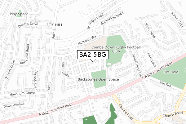
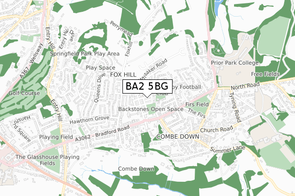
BA2 5BG is located in the Combe Down electoral ward, within the unitary authority of Bath and North East Somerset and the English Parliamentary constituency of Bath. The Sub Integrated Care Board (ICB) Location is NHS Bath and North East Somerset, Swindon and Wiltshire ICB - 92 and the police force is Avon and Somerset. This postcode has been in use since August 2017.


GetTheData
Source: OS Open Zoomstack (Ordnance Survey)
Licence: Open Government Licence (requires attribution)
Attribution: Contains OS data © Crown copyright and database right 2024
Source: Open Postcode Geo
Licence: Open Government Licence (requires attribution)
Attribution: Contains OS data © Crown copyright and database right 2024; Contains Royal Mail data © Royal Mail copyright and database right 2024; Source: Office for National Statistics licensed under the Open Government Licence v.3.0
| Easting | 375501 |
| Northing | 162581 |
| Latitude | 51.361759 |
| Longitude | -2.353259 |
GetTheData
Source: Open Postcode Geo
Licence: Open Government Licence
| Country | England |
| Postcode District | BA2 |
| ➜ BA2 open data dashboard ➜ See where BA2 is on a map ➜ Where is Bath? | |
GetTheData
Source: Land Registry Price Paid Data
Licence: Open Government Licence
| Ward | Combe Down |
| Constituency | Bath |
GetTheData
Source: ONS Postcode Database
Licence: Open Government Licence
34, WINDELL STREET, BATH, BA2 5BG 2023 15 NOV £550,000 |
30, WINDELL STREET, BATH, BA2 5BG 2020 29 JUL £699,995 |
28, WINDELL STREET, BATH, BA2 5BG 2020 31 JAN £630,000 |
26, WINDELL STREET, BATH, BA2 5BG 2020 31 JAN £464,995 |
32, WINDELL STREET, BATH, BA2 5BG 2019 19 SEP £419,995 |
22, WINDELL STREET, BATH, BA2 5BG 2019 15 AUG £547,995 |
24, WINDELL STREET, BATH, BA2 5BG 2019 31 MAY £545,000 |
11, WINDELL STREET, BATH, BA2 5BG 2019 3 MAY £515,000 |
16, WINDELL STREET, BATH, BA2 5BG 2019 15 APR £529,995 |
21, WINDELL STREET, BATH, BA2 5BG 2019 5 APR £508,000 |
GetTheData
Source: HM Land Registry Price Paid Data
Licence: Contains HM Land Registry data © Crown copyright and database right 2024. This data is licensed under the Open Government Licence v3.0.
| January 2024 | Anti-social behaviour | On or near Bradford Park | 265m |
| December 2023 | Violence and sexual offences | On or near Bradford Park | 265m |
| December 2023 | Violence and sexual offences | On or near Bradford Park | 265m |
| ➜ Get more crime data in our Crime section | |||
GetTheData
Source: data.police.uk
Licence: Open Government Licence
| Foxhill Hutments (Bradford Road) | Fox Hill | 204m |
| Combe Road (North Road) | Combe Down | 211m |
| Bradford Park (Fox Hill) | Fox Hill | 236m |
| Stonehouse Lane (North Road) | Combe Down | 254m |
| Queen's Drive (Fox Hill) | Fox Hill | 281m |
| Bath Spa Station | 1.8km |
| Oldfield Park Station | 2.7km |
| Freshford Station | 4.2km |
GetTheData
Source: NaPTAN
Licence: Open Government Licence
➜ Broadband speed and availability dashboard for BA2 5BG
| Percentage of properties with Next Generation Access | 100.0% |
| Percentage of properties with Superfast Broadband | 100.0% |
| Percentage of properties with Ultrafast Broadband | 100.0% |
| Percentage of properties with Full Fibre Broadband | 100.0% |
Superfast Broadband is between 30Mbps and 300Mbps
Ultrafast Broadband is > 300Mbps
| Median download speed | 360.0Mbps |
| Average download speed | 342.7Mbps |
| Maximum download speed | 360.00Mbps |
| Median upload speed | 360.0Mbps |
| Average upload speed | 341.1Mbps |
| Maximum upload speed | 360.00Mbps |
| Percentage of properties unable to receive 2Mbps | 0.0% |
| Percentage of properties unable to receive 5Mbps | 0.0% |
| Percentage of properties unable to receive 10Mbps | 0.0% |
| Percentage of properties unable to receive 30Mbps | 0.0% |
➜ Broadband speed and availability dashboard for BA2 5BG
GetTheData
Source: Ofcom
Licence: Ofcom Terms of Use (requires attribution)
GetTheData
Source: ONS Postcode Database
Licence: Open Government Licence


➜ Get more ratings from the Food Standards Agency
GetTheData
Source: Food Standards Agency
Licence: FSA terms & conditions
| Last Collection | |||
|---|---|---|---|
| Location | Mon-Fri | Sat | Distance |
| Junction Road | 17:30 | 11:30 | 587m |
| Charlton Buildings | 17:30 | 12:00 | 921m |
| Abbey Cemetery | 17:30 | 12:45 | 1,006m |
GetTheData
Source: Dracos
Licence: Creative Commons Attribution-ShareAlike
| Facility | Distance |
|---|---|
| Mulberry Park Et Primary Academy Mulberry Way, Combe Down, Bath Artificial Grass Pitch | 73m |
| Combe Down Rfc North Road, North Road, Combe Down, Bath Grass Pitches | 78m |
| Prior Park College Ralph Allen Drive, Bath Sports Hall, Swimming Pool, Health and Fitness Gym, Artificial Grass Pitch, Grass Pitches, Studio | 772m |
GetTheData
Source: Active Places
Licence: Open Government Licence
| School | Phase of Education | Distance |
|---|---|---|
| Mulberry Park Educate Together Primary Academy Mulberry Way, Combe Down, Bath, BA2 5BU | Primary | 73m |
| Combe Down CofE Primary School Church Road, Combe Down, Bath, BA2 5JQ | Primary | 591m |
| Prior Park College Ralph Allen Drive, Bath, BA2 5AH | Not applicable | 772m |
GetTheData
Source: Edubase
Licence: Open Government Licence
The below table lists the International Territorial Level (ITL) codes (formerly Nomenclature of Territorial Units for Statistics (NUTS) codes) and Local Administrative Units (LAU) codes for BA2 5BG:
| ITL 1 Code | Name |
|---|---|
| TLK | South West (England) |
| ITL 2 Code | Name |
| TLK1 | Gloucestershire, Wiltshire and Bath/Bristol area |
| ITL 3 Code | Name |
| TLK12 | Bath and North East Somerset, North Somerset and South Gloucestershire |
| LAU 1 Code | Name |
| E06000022 | Bath and North East Somerset |
GetTheData
Source: ONS Postcode Directory
Licence: Open Government Licence
The below table lists the Census Output Area (OA), Lower Layer Super Output Area (LSOA), and Middle Layer Super Output Area (MSOA) for BA2 5BG:
| Code | Name | |
|---|---|---|
| OA | E00072670 | |
| LSOA | E01014389 | Bath and North East Somerset 018C |
| MSOA | E02003002 | Bath and North East Somerset 018 |
GetTheData
Source: ONS Postcode Directory
Licence: Open Government Licence
| BA2 5DR | Bramble Way | 117m |
| BA2 5DP | Stonehouse Close | 159m |
| BA2 5BT | Bradford Road | 173m |
| BA2 5DA | Bradford Road | 196m |
| BA2 5DE | North Road | 209m |
| BA2 5DW | Stonehouse Lane | 209m |
| BA2 5QN | Fox Hill | 223m |
| BA2 5DQ | North Road | 231m |
| BA2 5DD | Greendown Place | 251m |
| BA2 5BZ | Bradford Road | 257m |
GetTheData
Source: Open Postcode Geo; Land Registry Price Paid Data
Licence: Open Government Licence