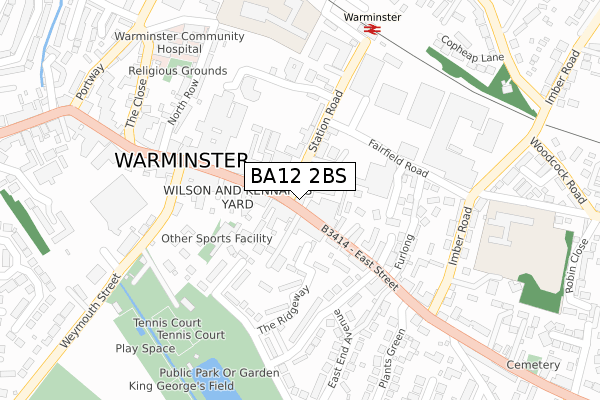
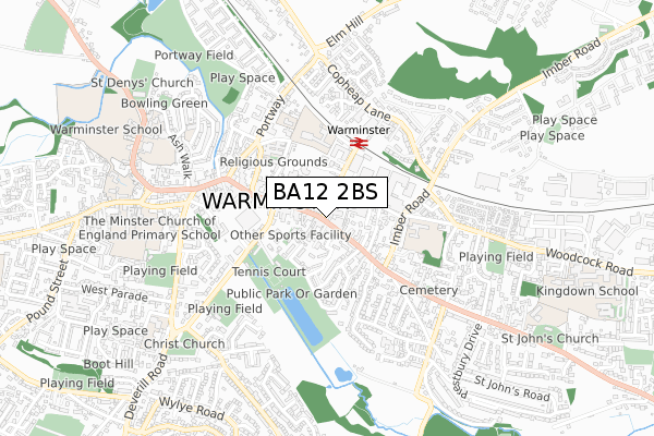
BA12 2BS is located in the Warminster East electoral ward, within the unitary authority of Wiltshire and the English Parliamentary constituency of South West Wiltshire. The Sub Integrated Care Board (ICB) Location is NHS Bath and North East Somerset, Swindon and Wiltshire ICB - 92 and the police force is Wiltshire. This postcode has been in use since April 2018.


GetTheData
Source: OS Open Zoomstack (Ordnance Survey)
Licence: Open Government Licence (requires attribution)
Attribution: Contains OS data © Crown copyright and database right 2024
Source: Open Postcode Geo
Licence: Open Government Licence (requires attribution)
Attribution: Contains OS data © Crown copyright and database right 2024; Contains Royal Mail data © Royal Mail copyright and database right 2024; Source: Office for National Statistics licensed under the Open Government Licence v.3.0
| Easting | 387635 |
| Northing | 145027 |
| Latitude | 51.204312 |
| Longitude | -2.178365 |
GetTheData
Source: Open Postcode Geo
Licence: Open Government Licence
| Country | England |
| Postcode District | BA12 |
| ➜ BA12 open data dashboard ➜ See where BA12 is on a map ➜ Where is Warminster? | |
GetTheData
Source: Land Registry Price Paid Data
Licence: Open Government Licence
| Ward | Warminster East |
| Constituency | South West Wiltshire |
GetTheData
Source: ONS Postcode Database
Licence: Open Government Licence
| January 2024 | Criminal damage and arson | On or near Buttons Yard | 152m |
| January 2024 | Anti-social behaviour | On or near Petrol Station | 193m |
| December 2023 | Anti-social behaviour | On or near Petrol Station | 193m |
| ➜ Get more crime data in our Crime section | |||
GetTheData
Source: data.police.uk
Licence: Open Government Licence
| Station Road | Warminster | 16m |
| Station Road | Warminster | 24m |
| Market Place | Warminster | 56m |
| Market Place | Warminster | 70m |
| Central Car Park (The Avenue) | Warminster | 175m |
| Warminster Station | 0.3km |
| Dilton Marsh Station | 5.4km |
GetTheData
Source: NaPTAN
Licence: Open Government Licence
GetTheData
Source: ONS Postcode Database
Licence: Open Government Licence


➜ Get more ratings from the Food Standards Agency
GetTheData
Source: Food Standards Agency
Licence: FSA terms & conditions
| Last Collection | |||
|---|---|---|---|
| Location | Mon-Fri | Sat | Distance |
| Warminster Business Box | 18:00 | 12:30 | 35m |
| Warminster Delivery Office | 18:00 | 12:30 | 42m |
| Safeway | 17:15 | 12:00 | 324m |
GetTheData
Source: Dracos
Licence: Creative Commons Attribution-ShareAlike
| Facility | Distance |
|---|---|
| Harridges Health & Fitness Studio Market Place, Warminster Health and Fitness Gym, Studio | 137m |
| Snap Fitness (Warminster) Castlemore Retail Park, Warminster Health and Fitness Gym, Studio | 197m |
| Busy Bodies Health And Fitness Club (Closed) Three Horseshoes Walk, Warminster Health and Fitness Gym, Studio | 206m |
GetTheData
Source: Active Places
Licence: Open Government Licence
| School | Phase of Education | Distance |
|---|---|---|
| The Avenue Primary School and Children's Centre 7 The Avenue, Warminster, BA12 9AA | Primary | 228m |
| New Close Primary School 30 Imber Road, Warminster, BA12 9JJ | Primary | 413m |
| The Minster CofE Primary School Emwell Street, Warminster, BA12 8JA | Primary | 719m |
GetTheData
Source: Edubase
Licence: Open Government Licence
The below table lists the International Territorial Level (ITL) codes (formerly Nomenclature of Territorial Units for Statistics (NUTS) codes) and Local Administrative Units (LAU) codes for BA12 2BS:
| ITL 1 Code | Name |
|---|---|
| TLK | South West (England) |
| ITL 2 Code | Name |
| TLK1 | Gloucestershire, Wiltshire and Bath/Bristol area |
| ITL 3 Code | Name |
| TLK15 | Wiltshire |
| LAU 1 Code | Name |
| E06000054 | Wiltshire |
GetTheData
Source: ONS Postcode Directory
Licence: Open Government Licence
The below table lists the Census Output Area (OA), Lower Layer Super Output Area (LSOA), and Middle Layer Super Output Area (MSOA) for BA12 2BS:
| Code | Name | |
|---|---|---|
| OA | E00163756 | |
| LSOA | E01032103 | Wiltshire 044A |
| MSOA | E02006694 | Wiltshire 044 |
GetTheData
Source: ONS Postcode Directory
Licence: Open Government Licence
| BA12 9LS | Station Road | 43m |
| BA12 9BN | East Street | 53m |
| BA12 9AW | Market Place | 65m |
| BA12 9BY | East Street | 69m |
| BA12 9BS | Beavens Court | 79m |
| BA12 9AZ | Market Place | 84m |
| BA12 9NY | Yard Court | 113m |
| BA12 9BR | Station Road | 116m |
| BA12 9FB | Anchor Court | 117m |
| BA12 9BW | East Street | 117m |
GetTheData
Source: Open Postcode Geo; Land Registry Price Paid Data
Licence: Open Government Licence