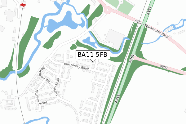
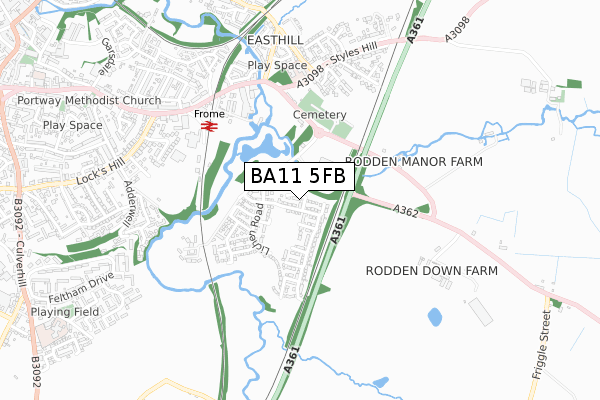
BA11 5FB is located in the Frome East electoral ward, within the unitary authority of Somerset and the English Parliamentary constituency of Somerton and Frome. The Sub Integrated Care Board (ICB) Location is NHS Somerset ICB - 11X and the police force is Avon and Somerset. This postcode has been in use since December 2017.


GetTheData
Source: OS Open Zoomstack (Ordnance Survey)
Licence: Open Government Licence (requires attribution)
Attribution: Contains OS data © Crown copyright and database right 2024
Source: Open Postcode Geo
Licence: Open Government Licence (requires attribution)
Attribution: Contains OS data © Crown copyright and database right 2024; Contains Royal Mail data © Royal Mail copyright and database right 2024; Source: Office for National Statistics licensed under the Open Government Licence v.3.0
| Easting | 378827 |
| Northing | 147298 |
| Latitude | 51.224472 |
| Longitude | -2.304576 |
GetTheData
Source: Open Postcode Geo
Licence: Open Government Licence
| Country | England |
| Postcode District | BA11 |
| ➜ BA11 open data dashboard ➜ See where BA11 is on a map ➜ Where is Frome? | |
GetTheData
Source: Land Registry Price Paid Data
Licence: Open Government Licence
| Ward | Frome East |
| Constituency | Somerton And Frome |
GetTheData
Source: ONS Postcode Database
Licence: Open Government Licence
27, BUTTERCUP CLOSE, FROME, BA11 5FB 2021 14 DEC £326,000 |
23, BUTTERCUP CLOSE, FROME, BA11 5FB 2018 5 JUN £277,000 |
27, BUTTERCUP CLOSE, FROME, BA11 5FB 2018 30 APR £283,995 |
25, BUTTERCUP CLOSE, FROME, BA11 5FB 2018 13 APR £304,995 |
10, BUTTERCUP CLOSE, FROME, BA11 5FB 2018 29 MAR £307,995 |
2, BUTTERCUP CLOSE, FROME, BA11 5FB 2018 26 MAR £274,995 |
8, BUTTERCUP CLOSE, FROME, BA11 5FB 2018 22 MAR £310,000 |
21, BUTTERCUP CLOSE, FROME, BA11 5FB 2018 15 MAR £329,995 |
9, BUTTERCUP CLOSE, FROME, BA11 5FB 2017 19 DEC £309,995 |
1, BUTTERCUP CLOSE, FROME, BA11 5FB 2017 15 DEC £309,995 |
GetTheData
Source: HM Land Registry Price Paid Data
Licence: Contains HM Land Registry data © Crown copyright and database right 2024. This data is licensed under the Open Government Licence v3.0.
| Asda Superstore (Warminster Road) | Rodden | 297m |
| Asda Superstore (Warminster Road) | Rodden | 308m |
| Wallbridge (Styles Hill) | Berkley Down | 473m |
| Wallbridge (A362) | Frome | 494m |
| Frome Station (Station Approach) | Keyford | 512m |
| Frome Station | 0.5km |
GetTheData
Source: NaPTAN
Licence: Open Government Licence
| Percentage of properties with Next Generation Access | 100.0% |
| Percentage of properties with Superfast Broadband | 100.0% |
| Percentage of properties with Ultrafast Broadband | 100.0% |
| Percentage of properties with Full Fibre Broadband | 100.0% |
Superfast Broadband is between 30Mbps and 300Mbps
Ultrafast Broadband is > 300Mbps
| Percentage of properties unable to receive 2Mbps | 0.0% |
| Percentage of properties unable to receive 5Mbps | 0.0% |
| Percentage of properties unable to receive 10Mbps | 0.0% |
| Percentage of properties unable to receive 30Mbps | 0.0% |
GetTheData
Source: Ofcom
Licence: Ofcom Terms of Use (requires attribution)
GetTheData
Source: ONS Postcode Database
Licence: Open Government Licence


➜ Get more ratings from the Food Standards Agency
GetTheData
Source: Food Standards Agency
Licence: FSA terms & conditions
| Last Collection | |||
|---|---|---|---|
| Location | Mon-Fri | Sat | Distance |
| Wallbridge Post Office | 16:45 | 12:00 | 191m |
| Locks Hill | 17:30 | 12:00 | 837m |
| Brunel Way | 17:00 | 11:45 | 924m |
GetTheData
Source: Dracos
Licence: Creative Commons Attribution-ShareAlike
| Facility | Distance |
|---|---|
| Train Station Gym (Frome) Station Approach, Frome Health and Fitness Gym, Studio | 483m |
| Hayesdown First School Wyville Road, Frome Grass Pitches | 1.1km |
| Frome Town Football Club Berkley Road, Frome Grass Pitches, Studio | 1.2km |
GetTheData
Source: Active Places
Licence: Open Government Licence
| School | Phase of Education | Distance |
|---|---|---|
| Hayesdown First School Wyville Road, Frome, BA11 2BN | Primary | 1km |
| St John's Church of England Voluntary Aided First School, Frome Christchurch Street East, Frome, BA11 1QG | Primary | 1.1km |
| Christ Church First School Feltham Lane, Frome, BA11 5AJ | Primary | 1.2km |
GetTheData
Source: Edubase
Licence: Open Government Licence
The below table lists the International Territorial Level (ITL) codes (formerly Nomenclature of Territorial Units for Statistics (NUTS) codes) and Local Administrative Units (LAU) codes for BA11 5FB:
| ITL 1 Code | Name |
|---|---|
| TLK | South West (England) |
| ITL 2 Code | Name |
| TLK2 | Dorset and Somerset |
| ITL 3 Code | Name |
| TLK23 | Somerset CC |
| LAU 1 Code | Name |
| E07000187 | Mendip |
GetTheData
Source: ONS Postcode Directory
Licence: Open Government Licence
The below table lists the Census Output Area (OA), Lower Layer Super Output Area (LSOA), and Middle Layer Super Output Area (MSOA) for BA11 5FB:
| Code | Name | |
|---|---|---|
| OA | E00147871 | |
| LSOA | E01029035 | Mendip 007B |
| MSOA | E02006053 | Mendip 007 |
GetTheData
Source: ONS Postcode Directory
Licence: Open Government Licence
| BA11 5LA | Warminster Road | 324m |
| BA11 5LE | 437m | |
| BA11 5JU | The Retreat | 468m |
| BA11 5AL | Styles Park | 492m |
| BA11 5LB | 500m | |
| BA11 5JW | East Hill | 500m |
| BA11 5JX | Wallbridge | 546m |
| BA11 1QZ | Wallbridge | 554m |
| BA11 5JY | Harris Close | 574m |
| BA11 1NE | Caxton Road | 599m |
GetTheData
Source: Open Postcode Geo; Land Registry Price Paid Data
Licence: Open Government Licence