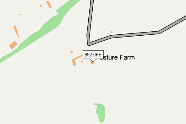
B92 0FE is located in the Bickenhill electoral ward, within the metropolitan district of Solihull and the English Parliamentary constituency of Meriden. The Sub Integrated Care Board (ICB) Location is NHS Birmingham and Solihull ICB - 15E and the police force is West Midlands. This postcode has been in use since June 2017.


GetTheData
Source: OS OpenMap – Local (Ordnance Survey)
Source: OS VectorMap District (Ordnance Survey)
Licence: Open Government Licence (requires attribution)
| Easting | 420829 |
| Northing | 282765 |
| Latitude | 52.442474 |
| Longitude | -1.694992 |
GetTheData
Source: Open Postcode Geo
Licence: Open Government Licence
| Country | England |
| Postcode District | B92 |
| ➜ B92 open data dashboard ➜ See where B92 is on a map | |
GetTheData
Source: Land Registry Price Paid Data
Licence: Open Government Licence
| Ward | Bickenhill |
| Constituency | Meriden |
GetTheData
Source: ONS Postcode Database
Licence: Open Government Licence
| May 2022 | Vehicle crime | On or near Park/Open Space | 415m |
| May 2022 | Other theft | On or near Park/Open Space | 415m |
| May 2022 | Other theft | On or near Park/Open Space | 415m |
| ➜ Get more crime data in our Crime section | |||
GetTheData
Source: data.police.uk
Licence: Open Government Licence
| East Way (Coventry Rd) | Stonebridge | 365m |
| Middle Bickenhill Lane (East Way) | Stonebridge | 438m |
| Stonebridge Island (Coventry Rd) | Stonebridge | 501m |
| Stonebridge Island (Coventry Rd) | Stonebridge | 517m |
| Bickenhill Lane (Coventry Rd) | Stonebridge | 713m |
| Hampton-in-Arden Station | 1.5km |
| Birmingham International Station | 2.3km |
| Marston Green Station | 5km |
GetTheData
Source: NaPTAN
Licence: Open Government Licence
| Percentage of properties with Next Generation Access | 0.0% |
| Percentage of properties with Superfast Broadband | 0.0% |
| Percentage of properties with Ultrafast Broadband | 0.0% |
| Percentage of properties with Full Fibre Broadband | 0.0% |
Superfast Broadband is between 30Mbps and 300Mbps
Ultrafast Broadband is > 300Mbps
| Percentage of properties unable to receive 2Mbps | 0.0% |
| Percentage of properties unable to receive 5Mbps | 0.0% |
| Percentage of properties unable to receive 10Mbps | 0.0% |
| Percentage of properties unable to receive 30Mbps | 100.0% |
GetTheData
Source: Ofcom
Licence: Ofcom Terms of Use (requires attribution)
GetTheData
Source: ONS Postcode Database
Licence: Open Government Licence


➜ Get more ratings from the Food Standards Agency
GetTheData
Source: Food Standards Agency
Licence: FSA terms & conditions
| Last Collection | |||
|---|---|---|---|
| Location | Mon-Fri | Sat | Distance |
| 4 Police House Diddington Lane | 17:00 | 08:30 | 1,241m |
| Hampton In Arden Post Office | 17:30 | 12:00 | 2,038m |
| Bham Intl Station | 17:00 | 12:00 | 2,255m |
GetTheData
Source: Dracos
Licence: Creative Commons Attribution-ShareAlike
| Facility | Distance |
|---|---|
| The Hampton Health And Fitness Club Old Station Road, Hampton-in-arden, Solihull Health and Fitness Gym, Studio | 1.3km |
| Hampton In Arden Sports Club Ltd Shadow Brook Lane, Hampton-in-arden, Solihull Artificial Grass Pitch, Squash Courts, Grass Pitches, Outdoor Tennis Courts | 1.5km |
| Livingwell Health Club (Birmingham Metropole) National Exhibition Centre, Birmingham Swimming Pool, Health and Fitness Gym | 1.7km |
GetTheData
Source: Active Places
Licence: Open Government Licence
| School | Phase of Education | Distance |
|---|---|---|
| The Island Project School Diddington Hall, Diddington Lane, Meriden, CV7 7HQ | Not applicable | 697m |
| George Fentham Endowed School Fentham Road, Hampton-in-Arden, Solihull, B92 0AY | Primary | 1.9km |
| Mill House School Old Hall Farm, Whitestitch Lane, Meridan, CV7 7JE | Not applicable | 3.2km |
GetTheData
Source: Edubase
Licence: Open Government Licence
The below table lists the International Territorial Level (ITL) codes (formerly Nomenclature of Territorial Units for Statistics (NUTS) codes) and Local Administrative Units (LAU) codes for B92 0FE:
| ITL 1 Code | Name |
|---|---|
| TLG | West Midlands (England) |
| ITL 2 Code | Name |
| TLG3 | West Midlands |
| ITL 3 Code | Name |
| TLG32 | Solihull |
| LAU 1 Code | Name |
| E08000029 | Solihull |
GetTheData
Source: ONS Postcode Directory
Licence: Open Government Licence
The below table lists the Census Output Area (OA), Lower Layer Super Output Area (LSOA), and Middle Layer Super Output Area (MSOA) for B92 0FE:
| Code | Name | |
|---|---|---|
| OA | E00051147 | |
| LSOA | E01010108 | Solihull 017A |
| MSOA | E02002097 | Solihull 017 |
GetTheData
Source: ONS Postcode Directory
Licence: Open Government Licence
| B92 0HJ | Middle Bickenhill Lane | 787m |
| B92 0HF | Old Station Road | 873m |
| B92 0HQ | Old Station Road | 892m |
| B92 0HE | Old Station Road | 938m |
| B92 0HD | The Grove | 1078m |
| B92 0BZ | Diddington Lane | 1103m |
| B92 0BY | Diddington Lane | 1123m |
| B92 0HA | Old Station Road | 1166m |
| B92 0EY | Old Station Road | 1197m |
| B92 0BS | Meriden Road | 1298m |
GetTheData
Source: Open Postcode Geo; Land Registry Price Paid Data
Licence: Open Government Licence