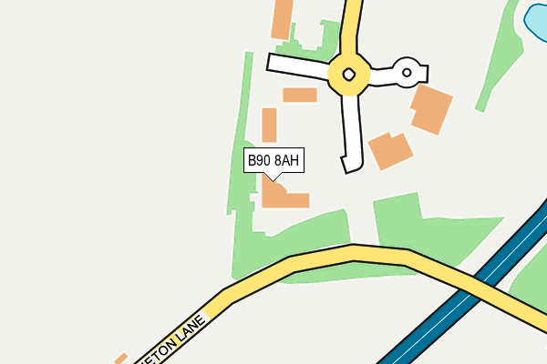
B90 8AH is located in the Blythe electoral ward, within the metropolitan district of Solihull and the English Parliamentary constituency of Meriden. The Sub Integrated Care Board (ICB) Location is NHS Birmingham and Solihull ICB - 15E and the police force is West Midlands. This postcode has been in use since May 2017.


GetTheData
Source: OS OpenMap – Local (Ordnance Survey)
Source: OS VectorMap District (Ordnance Survey)
Licence: Open Government Licence (requires attribution)
| Easting | 414063 |
| Northing | 275468 |
| Latitude | 52.377089 |
| Longitude | -1.794833 |
GetTheData
Source: Open Postcode Geo
Licence: Open Government Licence
| Country | England |
| Postcode District | B90 |
| ➜ B90 open data dashboard ➜ See where B90 is on a map ➜ Where is Solihull? | |
GetTheData
Source: Land Registry Price Paid Data
Licence: Open Government Licence
| Ward | Blythe |
| Constituency | Meriden |
GetTheData
Source: ONS Postcode Database
Licence: Open Government Licence
| June 2022 | Violence and sexual offences | On or near Blythe Gate | 197m |
| June 2022 | Criminal damage and arson | On or near Blythe Gate | 197m |
| May 2022 | Bicycle theft | On or near Blythe Gate | 197m |
| ➜ Get more crime data in our Crime section | |||
GetTheData
Source: data.police.uk
Licence: Open Government Licence
| Bus Terminal (Blythe Gate) | Illshaw Heath | 184m |
| Notcutts Garden Centre (Stratford Rd) | Monkspath | 637m |
| Notcutts Garden Centre (Stratford Rd) | Monkspath | 645m |
| Gate Lane (Stratford Rd) | Illshaw Heath | 677m |
| Gate Lane (Stratford Rd) | Illshaw Heath | 690m |
| Widney Manor Station | 2.5km |
| Dorridge Station | 2.9km |
| The Lakes Station | 3.9km |
GetTheData
Source: NaPTAN
Licence: Open Government Licence
GetTheData
Source: ONS Postcode Database
Licence: Open Government Licence


➜ Get more ratings from the Food Standards Agency
GetTheData
Source: Food Standards Agency
Licence: FSA terms & conditions
| Last Collection | |||
|---|---|---|---|
| Location | Mon-Fri | Sat | Distance |
| Stapenhall Road Monkspath Esta | 17:30 | 11:30 | 1,132m |
| Near Junction Of Thornton Road / | 17:30 | 11:30 | 1,230m |
| Cheswick Green Post Office | 18:30 | 11:30 | 1,403m |
GetTheData
Source: Dracos
Licence: Creative Commons Attribution-ShareAlike
| Facility | Distance |
|---|---|
| Shirley Golf Club Stratford Road, Shirley, Solihull Golf | 487m |
| Virgin Active (Solihull) Blythe Gate, Blythe Valley Park, Shirley, Solihull Swimming Pool, Health and Fitness Gym, Studio | 618m |
| Cheswick Green Primary School Cheswick Way, Cheswick Way, Cheswick Green, Solihull Grass Pitches | 1.1km |
GetTheData
Source: Active Places
Licence: Open Government Licence
| School | Phase of Education | Distance |
|---|---|---|
| Cheswick Green Primary School Cheswick Way, Cheswick Green, Solihull, B90 4HG | Primary | 1.1km |
| Monkspath Junior and Infant School Farmhouse Way, Shirley, Solihull, B90 4EH | Primary | 1.6km |
| St Patricks Church of England Primary Academy Salter Street, Earlswood, Solihull, B94 6DE | Primary | 1.9km |
GetTheData
Source: Edubase
Licence: Open Government Licence
The below table lists the International Territorial Level (ITL) codes (formerly Nomenclature of Territorial Units for Statistics (NUTS) codes) and Local Administrative Units (LAU) codes for B90 8AH:
| ITL 1 Code | Name |
|---|---|
| TLG | West Midlands (England) |
| ITL 2 Code | Name |
| TLG3 | West Midlands |
| ITL 3 Code | Name |
| TLG32 | Solihull |
| LAU 1 Code | Name |
| E08000029 | Solihull |
GetTheData
Source: ONS Postcode Directory
Licence: Open Government Licence
The below table lists the Census Output Area (OA), Lower Layer Super Output Area (LSOA), and Middle Layer Super Output Area (MSOA) for B90 8AH:
| Code | Name | |
|---|---|---|
| OA | E00051497 | |
| LSOA | E01010183 | Solihull 029D |
| MSOA | E02002109 | Solihull 029 |
GetTheData
Source: ONS Postcode Directory
Licence: Open Government Licence
| B94 6DR | Stratford Road | 619m |
| B90 4US | Stanbrook Road | 814m |
| B90 4UB | Fullbrook Close | 842m |
| B90 4UY | Bowbrook Avenue | 875m |
| B90 4UX | Talton Close | 903m |
| B90 4PE | Kerswell Drive | 904m |
| B94 6DY | Stratford Road | 924m |
| B90 4PB | Elkington Croft | 932m |
| B90 4EF | Stratford Road | 953m |
| B90 4PF | Norcombe Grove | 957m |
GetTheData
Source: Open Postcode Geo; Land Registry Price Paid Data
Licence: Open Government Licence