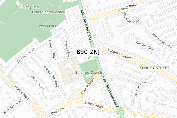
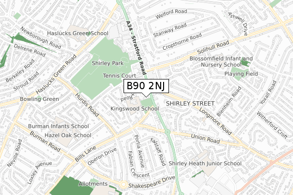
B90 2NJ is located in the Shirley West electoral ward, within the metropolitan district of Solihull and the English Parliamentary constituency of Solihull. The Sub Integrated Care Board (ICB) Location is NHS Birmingham and Solihull ICB - 15E and the police force is West Midlands. This postcode has been in use since November 2017.


GetTheData
Source: OS Open Zoomstack (Ordnance Survey)
Licence: Open Government Licence (requires attribution)
Attribution: Contains OS data © Crown copyright and database right 2024
Source: Open Postcode Geo
Licence: Open Government Licence (requires attribution)
Attribution: Contains OS data © Crown copyright and database right 2024; Contains Royal Mail data © Royal Mail copyright and database right 2024; Source: Office for National Statistics licensed under the Open Government Licence v.3.0
| Easting | 411952 |
| Northing | 278911 |
| Latitude | 52.408091 |
| Longitude | -1.825723 |
GetTheData
Source: Open Postcode Geo
Licence: Open Government Licence
| Country | England |
| Postcode District | B90 |
| ➜ B90 open data dashboard ➜ See where B90 is on a map ➜ Where is Solihull? | |
GetTheData
Source: Land Registry Price Paid Data
Licence: Open Government Licence
| Ward | Shirley West |
| Constituency | Solihull |
GetTheData
Source: ONS Postcode Database
Licence: Open Government Licence
| January 2024 | Vehicle crime | On or near Parking Area | 192m |
| January 2024 | Criminal damage and arson | On or near Parking Area | 192m |
| January 2024 | Vehicle crime | On or near Danbury Road | 208m |
| ➜ Get more crime data in our Crime section | |||
GetTheData
Source: data.police.uk
Licence: Open Government Licence
| St James Church (Stratford Rd) | Shirley | 38m |
| Shirley Church (Church Rd) | Shirley | 121m |
| St James Church (Stratford Rd) | Shirley | 126m |
| Longmore Rd (Stratford Rd) | Shirley | 176m |
| Sutherland Ave (Solihull Rd) | Shirley | 236m |
| Shirley Station | 1.4km |
| Yardley Wood Station | 2.5km |
| Whitlocks End Station | 2.5km |
GetTheData
Source: NaPTAN
Licence: Open Government Licence
GetTheData
Source: ONS Postcode Database
Licence: Open Government Licence


➜ Get more ratings from the Food Standards Agency
GetTheData
Source: Food Standards Agency
Licence: FSA terms & conditions
| Last Collection | |||
|---|---|---|---|
| Location | Mon-Fri | Sat | Distance |
| Shirley Post Office | 18:30 | 11:30 | 24m |
| Union Road | 17:30 | 11:30 | 310m |
| Longmore Road / Moreton Road | 17:45 | 11:30 | 372m |
GetTheData
Source: Dracos
Licence: Creative Commons Attribution-ShareAlike
| Facility | Distance |
|---|---|
| Tudor Grange Primary Academy, St James Halifax Road, Shirley, Solihull Grass Pitches | 112m |
| Shirley Park Grenville Road, Shirley, Solihull Grass Pitches, Outdoor Tennis Courts | 297m |
| Shirley Heath Junior School Coombe Road, Shirley, Solihull Grass Pitches | 704m |
GetTheData
Source: Active Places
Licence: Open Government Licence
| School | Phase of Education | Distance |
|---|---|---|
| Kingswood School St James Place, Shirley, Solihull, B90 2BA | Not applicable | 130m |
| Tudor Grange Primary Academy, St James Halifax Road, Shirley, Solihull, B90 2BT | Primary | 147m |
| Blossomfield Infant and Nursery School Eastcote Close, Shirley, Solihull, B90 3QX | Primary | 699m |
GetTheData
Source: Edubase
Licence: Open Government Licence
The below table lists the International Territorial Level (ITL) codes (formerly Nomenclature of Territorial Units for Statistics (NUTS) codes) and Local Administrative Units (LAU) codes for B90 2NJ:
| ITL 1 Code | Name |
|---|---|
| TLG | West Midlands (England) |
| ITL 2 Code | Name |
| TLG3 | West Midlands |
| ITL 3 Code | Name |
| TLG32 | Solihull |
| LAU 1 Code | Name |
| E08000029 | Solihull |
GetTheData
Source: ONS Postcode Directory
Licence: Open Government Licence
The below table lists the Census Output Area (OA), Lower Layer Super Output Area (LSOA), and Middle Layer Super Output Area (MSOA) for B90 2NJ:
| Code | Name | |
|---|---|---|
| OA | E00051647 | |
| LSOA | E01010223 | Solihull 030B |
| MSOA | E02006808 | Solihull 030 |
GetTheData
Source: ONS Postcode Directory
Licence: Open Government Licence
| B90 3DN | Stratford Road | 0m |
| B90 3AR | Stratford Road | 112m |
| B90 2BA | St James Place | 133m |
| B90 2BT | Halifax Road | 147m |
| B90 2BS | Halifax Road | 179m |
| B90 2AX | Church Road | 185m |
| B90 2BU | Danbury Road | 191m |
| B90 3HA | Sutherland Avenue | 201m |
| B90 2BX | Halifax Road | 225m |
| B90 3DY | Longmore Road | 226m |
GetTheData
Source: Open Postcode Geo; Land Registry Price Paid Data
Licence: Open Government Licence