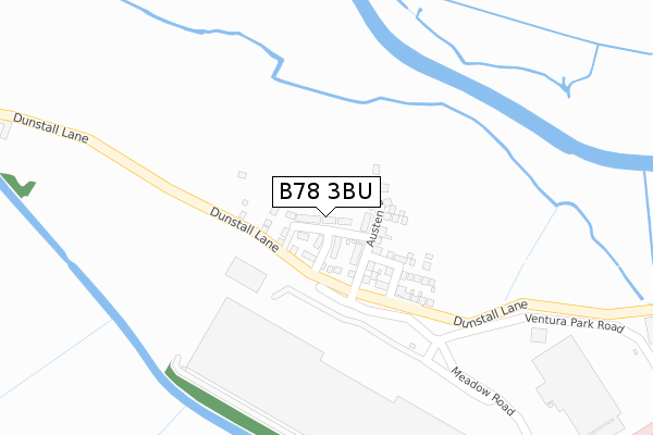
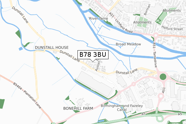
B78 3BU is located in the Castle electoral ward, within the local authority district of Tamworth and the English Parliamentary constituency of Tamworth. The Sub Integrated Care Board (ICB) Location is NHS Staffordshire and Stoke-on-Trent ICB - 05Q and the police force is Staffordshire. This postcode has been in use since November 2019.


GetTheData
Source: OS Open Zoomstack (Ordnance Survey)
Licence: Open Government Licence (requires attribution)
Attribution: Contains OS data © Crown copyright and database right 2025
Source: Open Postcode Geo
Licence: Open Government Licence (requires attribution)
Attribution: Contains OS data © Crown copyright and database right 2025; Contains Royal Mail data © Royal Mail copyright and database right 2025; Source: Office for National Statistics licensed under the Open Government Licence v.3.0
| Easting | 419166 |
| Northing | 303719 |
| Latitude | 52.630908 |
| Longitude | -1.718256 |
GetTheData
Source: Open Postcode Geo
Licence: Open Government Licence
| Country | England |
| Postcode District | B78 |
➜ See where B78 is on a map ➜ Where is Tamworth? | |
GetTheData
Source: Land Registry Price Paid Data
Licence: Open Government Licence
| Ward | Castle |
| Constituency | Tamworth |
GetTheData
Source: ONS Postcode Database
Licence: Open Government Licence
46, BINGLEY AVENUE, TAMWORTH, B78 3BU 2020 16 MAR £272,995 |
1, BINGLEY AVENUE, TAMWORTH, B78 3BU 2019 5 DEC £269,995 |
GetTheData
Source: HM Land Registry Price Paid Data
Licence: Contains HM Land Registry data © Crown copyright and database right 2025. This data is licensed under the Open Government Licence v3.0.
| Gagarin (Lichfield Road) | The Leys | 665m |
| Bradford Street (Lichfield Rd) | The Leys | 675m |
| Etchell Road (Ventura Park Road) | Ventura Park | 694m |
| Chambers Of Tamworth (Lichfield Road) | The Leys | 702m |
| Etchell Road (Ventura Park Road) | Ventura Park | 722m |
| Tamworth Station | 2.3km |
| Tamworth High Level Station | 2.3km |
| Wilnecote (Staffs) Station | 3.4km |
GetTheData
Source: NaPTAN
Licence: Open Government Licence
GetTheData
Source: ONS Postcode Database
Licence: Open Government Licence


➜ Get more ratings from the Food Standards Agency
GetTheData
Source: Food Standards Agency
Licence: FSA terms & conditions
| Last Collection | |||
|---|---|---|---|
| Location | Mon-Fri | Sat | Distance |
| Lincoln Avenue / Lichfield Roa | 17:15 | 11:30 | 835m |
| Sainsburys | 17:00 | 11:00 | 889m |
| Mariner | 18:30 | 11:30 | 993m |
GetTheData
Source: Dracos
Licence: Creative Commons Attribution-ShareAlike
| Risk of B78 3BU flooding from rivers and sea | Low |
| ➜ B78 3BU flood map | |
GetTheData
Source: Open Flood Risk by Postcode
Licence: Open Government Licence
The below table lists the International Territorial Level (ITL) codes (formerly Nomenclature of Territorial Units for Statistics (NUTS) codes) and Local Administrative Units (LAU) codes for B78 3BU:
| ITL 1 Code | Name |
|---|---|
| TLG | West Midlands (England) |
| ITL 2 Code | Name |
| TLG2 | Shropshire and Staffordshire |
| ITL 3 Code | Name |
| TLG24 | Staffordshire CC |
| LAU 1 Code | Name |
| E07000199 | Tamworth |
GetTheData
Source: ONS Postcode Directory
Licence: Open Government Licence
The below table lists the Census Output Area (OA), Lower Layer Super Output Area (LSOA), and Middle Layer Super Output Area (MSOA) for B78 3BU:
| Code | Name | |
|---|---|---|
| OA | E00152036 | |
| LSOA | E01029836 | Tamworth 002B |
| MSOA | E02006218 | Tamworth 002 |
GetTheData
Source: ONS Postcode Directory
Licence: Open Government Licence
| B78 3HJ | Bonehill Road | 489m |
| B79 7YJ | Blackfriars Close | 664m |
| B79 7SA | Lichfield Road | 675m |
| B79 7QW | Lichfield Road | 702m |
| B79 7YQ | Exeter Drive | 739m |
| B79 7RG | Swanmote | 779m |
| B79 7RU | Cygnet Drive | 792m |
| B79 7YL | Oxbridge Way | 821m |
| B79 7YG | Greyfriars Drive | 823m |
| B79 7QR | Bradford Street | 826m |
GetTheData
Source: Open Postcode Geo; Land Registry Price Paid Data
Licence: Open Government Licence