Property/Postcode Data Search:
B46 1DX maps, stats, and open data
B46 1DX is located in the Coleshill North electoral ward, within the local authority district of North Warwickshire and the English Parliamentary constituency of North Warwickshire. The Sub Integrated Care Board (ICB) Location is NHS Coventry and Warwickshire ICB - B2M3M and the police force is Warwickshire. This postcode has been in use since May 2019.
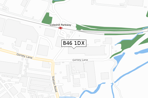
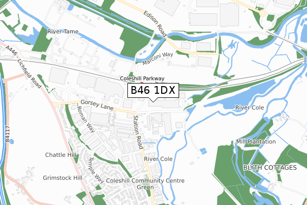
B46 1DX maps


Source: OS Open Zoomstack (Ordnance Survey)
Licence: Open Government Licence (requires attribution)
Attribution: Contains OS data © Crown copyright and database right 2025
Source: Open Postcode Geo
Licence: Open Government Licence (requires attribution)
Attribution: Contains OS data © Crown copyright and database right 2025; Contains Royal Mail data © Royal Mail copyright and database right 2025; Source: Office for National Statistics licensed under the Open Government Licence v.3.0
Licence: Open Government Licence (requires attribution)
Attribution: Contains OS data © Crown copyright and database right 2025
Source: Open Postcode Geo
Licence: Open Government Licence (requires attribution)
Attribution: Contains OS data © Crown copyright and database right 2025; Contains Royal Mail data © Royal Mail copyright and database right 2025; Source: Office for National Statistics licensed under the Open Government Licence v.3.0
B46 1DX geodata
| Easting | 419977 |
| Northing | 290864 |
| Latitude | 52.515315 |
| Longitude | -1.707043 |
Where is B46 1DX?
| Country | England |
| Postcode District | B46 |
Politics
| Ward | Coleshill North |
|---|---|
| Constituency | North Warwickshire |
Transport
Nearest bus stops to B46 1DX
| Coleshill Parkway (Private Road) | Coleshill | 86m |
| Coleshill Parkway (Private Road) | Coleshill | 121m |
| Coleshill Parkway (Private Road) | Coleshill | 121m |
| Coleshill Parkway (Private Road) | Coleshill | 135m |
| Headlam Factory (Gorsey Lane) | Coleshill | 206m |
Nearest railway stations to B46 1DX
| Coleshill Parkway Station | 0.2km |
| Water Orton Station | 2.5km |
Deprivation
24.2% of English postcodes are less deprived than B46 1DX:Food Standards Agency
Three nearest food hygiene ratings to B46 1DX (metres)
Performance Nutrition Chefs Ltd

Unit 1 Trillennium Gorsey Lane
196m
Inspire CBD
Unit 22 Coleshill Industrial Estate Station Road
316m
Greggs PLC

Unit 39 Coleshill Industrial Estate Station Road
403m
➜ Get more ratings from the Food Standards Agency
Nearest post box to B46 1DX
| Last Collection | |||
|---|---|---|---|
| Location | Mon-Fri | Sat | Distance |
| Gorsey Lane / Station Road | 17:30 | 07:00 | 184m |
| Chattle Hill | 18:30 | 538m | |
| Chattle Hill | 18:30 | 11:00 | 603m |
Environment
| Risk of B46 1DX flooding from rivers and sea | High |
B46 1DX ITL and B46 1DX LAU
The below table lists the International Territorial Level (ITL) codes (formerly Nomenclature of Territorial Units for Statistics (NUTS) codes) and Local Administrative Units (LAU) codes for B46 1DX:
| ITL 1 Code | Name |
|---|---|
| TLG | West Midlands (England) |
| ITL 2 Code | Name |
| TLG1 | Herefordshire, Worcestershire and Warwickshire |
| ITL 3 Code | Name |
| TLG13 | Warwickshire CC |
| LAU 1 Code | Name |
| E07000218 | North Warwickshire |
B46 1DX census areas
The below table lists the Census Output Area (OA), Lower Layer Super Output Area (LSOA), and Middle Layer Super Output Area (MSOA) for B46 1DX:
| Code | Name | |
|---|---|---|
| OA | E00158128 | |
| LSOA | E01031020 | North Warwickshire 006B |
| MSOA | E02006473 | North Warwickshire 006 |
Nearest postcodes to B46 1DX
| B46 1HQ | Roman Way | 515m |
| B46 1HH | Temple Way | 619m |
| B46 1HJ | Augustus Close | 637m |
| B46 1UD | Caesar Way | 656m |
| B46 1UB | Centurion Close | 671m |
| B46 1EZ | Stanhope Way | 676m |
| B46 1TX | Constantine Lane | 690m |
| B46 1HL | Julius Drive | 709m |
| B46 1UE | Temple Way | 719m |
| B46 1UG | Imperial Rise | 723m |