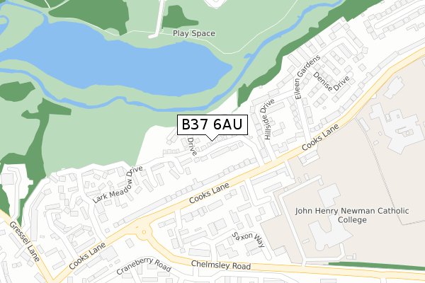
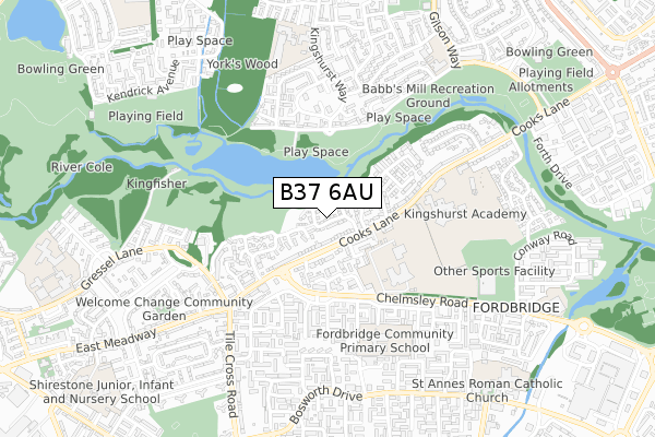
B37 6AU is located in the Kingshurst and Fordbridge electoral ward, within the metropolitan district of Solihull and the English Parliamentary constituency of Meriden. The Sub Integrated Care Board (ICB) Location is NHS Birmingham and Solihull ICB - 15E and the police force is West Midlands. This postcode has been in use since July 2018.


GetTheData
Source: OS Open Zoomstack (Ordnance Survey)
Licence: Open Government Licence (requires attribution)
Attribution: Contains OS data © Crown copyright and database right 2024
Source: Open Postcode Geo
Licence: Open Government Licence (requires attribution)
Attribution: Contains OS data © Crown copyright and database right 2024; Contains Royal Mail data © Royal Mail copyright and database right 2024; Source: Office for National Statistics licensed under the Open Government Licence v.3.0
| Easting | 416721 |
| Northing | 287540 |
| Latitude | 52.485541 |
| Longitude | -1.755188 |
GetTheData
Source: Open Postcode Geo
Licence: Open Government Licence
| Country | England |
| Postcode District | B37 |
| ➜ B37 open data dashboard ➜ See where B37 is on a map ➜ Where is Birmingham? | |
GetTheData
Source: Land Registry Price Paid Data
Licence: Open Government Licence
| Ward | Kingshurst And Fordbridge |
| Constituency | Meriden |
GetTheData
Source: ONS Postcode Database
Licence: Open Government Licence
2022 26 OCT £410,000 |
2022 11 FEB £322,500 |
2021 31 MAR £325,000 |
2020 22 DEC £248,500 |
44, SWAN DRIVE, KINGSHURST, BIRMINGHAM, B37 6AU 2019 4 SEP £318,500 |
57, SWAN DRIVE, KINGSHURST, BIRMINGHAM, B37 6AU 2019 30 AUG £279,999 |
42, SWAN DRIVE, KINGSHURST, BIRMINGHAM, B37 6AU 2019 9 AUG £299,995 |
38, SWAN DRIVE, KINGSHURST, BIRMINGHAM, B37 6AU 2019 26 JUL £359,995 |
59, SWAN DRIVE, KINGSHURST, BIRMINGHAM, B37 6AU 2019 26 JUL £299,995 |
24, SWAN DRIVE, KINGSHURST, BIRMINGHAM, B37 6AU 2019 26 JUL £299,995 |
GetTheData
Source: HM Land Registry Price Paid Data
Licence: Contains HM Land Registry data © Crown copyright and database right 2024. This data is licensed under the Open Government Licence v3.0.
| August 2023 | Public order | On or near Lark Meadow Drive | 236m |
| August 2023 | Possession of weapons | On or near Foxglove Crescent | 326m |
| August 2023 | Criminal damage and arson | On or near Foxglove Crescent | 326m |
| ➜ Get more crime data in our Crime section | |||
GetTheData
Source: data.police.uk
Licence: Open Government Licence
| Hillside Drive (Cooks Lane) | Fordbridge | 115m |
| Chelmsley Rd (Cooks Lane) | Fordbridge | 137m |
| Chelmsley Rd (Cooks Lane) | Fordbridge | 210m |
| City Technology College (Cooks Lane) | Fordbridge | 251m |
| City Technology College (Cooks Lane) | Fordbridge | 271m |
| Marston Green Station | 2km |
| Lea Hall Station | 2.2km |
| Water Orton Station | 3.8km |
GetTheData
Source: NaPTAN
Licence: Open Government Licence
| Percentage of properties with Next Generation Access | 100.0% |
| Percentage of properties with Superfast Broadband | 100.0% |
| Percentage of properties with Ultrafast Broadband | 98.1% |
| Percentage of properties with Full Fibre Broadband | 98.1% |
Superfast Broadband is between 30Mbps and 300Mbps
Ultrafast Broadband is > 300Mbps
| Percentage of properties unable to receive 2Mbps | 0.0% |
| Percentage of properties unable to receive 5Mbps | 0.0% |
| Percentage of properties unable to receive 10Mbps | 0.0% |
| Percentage of properties unable to receive 30Mbps | 0.0% |
GetTheData
Source: Ofcom
Licence: Ofcom Terms of Use (requires attribution)
GetTheData
Source: ONS Postcode Database
Licence: Open Government Licence


➜ Get more ratings from the Food Standards Agency
GetTheData
Source: Food Standards Agency
Licence: FSA terms & conditions
| Last Collection | |||
|---|---|---|---|
| Location | Mon-Fri | Sat | Distance |
| Tile Cross Post Office | 17:30 | 11:30 | 565m |
| Bosworth Drive / Yorklea Croft | 17:00 | 12:30 | 688m |
| Leycroftavenue | 18:30 | 11:30 | 821m |
GetTheData
Source: Dracos
Licence: Creative Commons Attribution-ShareAlike
| Facility | Distance |
|---|---|
| Babbs Mill Park Fordbridge Road, Kingshurst, Solihull Grass Pitches | 289m |
| John Henry Newman Catholic College Chelmsley Road, Birmingham Sports Hall, Swimming Pool, Grass Pitches, Artificial Grass Pitch | 374m |
| Tudor Grange Academy Kingshurst Cooks Lane, Birmingham Artificial Grass Pitch, Grass Pitches, Sports Hall, Studio, Outdoor Tennis Courts | 449m |
GetTheData
Source: Active Places
Licence: Open Government Licence
| School | Phase of Education | Distance |
|---|---|---|
| John Henry Newman Catholic College Chelmsley Road, Chelmsley Wood, Birmingham, B37 5GA | Secondary | 241m |
| Tudor Grange Academy Kingshurst Cooks Lane, Solihull, Birmingham, B37 6NU | Secondary | 449m |
| Fordbridge Community Primary School Crabtree Drive, Chelmsley Wood, Birmingham, B37 5BU | Primary | 504m |
GetTheData
Source: Edubase
Licence: Open Government Licence
The below table lists the International Territorial Level (ITL) codes (formerly Nomenclature of Territorial Units for Statistics (NUTS) codes) and Local Administrative Units (LAU) codes for B37 6AU:
| ITL 1 Code | Name |
|---|---|
| TLG | West Midlands (England) |
| ITL 2 Code | Name |
| TLG3 | West Midlands |
| ITL 3 Code | Name |
| TLG32 | Solihull |
| LAU 1 Code | Name |
| E08000029 | Solihull |
GetTheData
Source: ONS Postcode Directory
Licence: Open Government Licence
The below table lists the Census Output Area (OA), Lower Layer Super Output Area (LSOA), and Middle Layer Super Output Area (MSOA) for B37 6AU:
| Code | Name | |
|---|---|---|
| OA | E00051295 | |
| LSOA | E01010149 | Solihull 005D |
| MSOA | E02002085 | Solihull 005 |
GetTheData
Source: ONS Postcode Directory
Licence: Open Government Licence
| B37 6NE | Cooks Lane | 96m |
| B37 6NG | Hillside Drive | 148m |
| B37 6ND | Hipsmoor Close | 154m |
| B37 6PA | Cooks Lane | 170m |
| B37 6NH | Cooks Lane | 180m |
| B37 6NX | Cooks Lane | 184m |
| B37 6NY | Kew Close | 197m |
| B37 5AY | Saxon Way | 207m |
| B37 6NA | Lark Meadow Drive | 235m |
| B37 6NJ | Eileen Gardens | 297m |
GetTheData
Source: Open Postcode Geo; Land Registry Price Paid Data
Licence: Open Government Licence