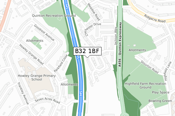
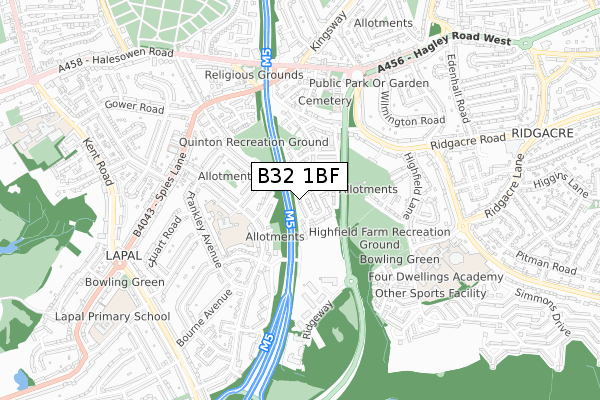
B32 1BF is located in the Quinton electoral ward, within the metropolitan district of Birmingham and the English Parliamentary constituency of Birmingham, Edgbaston. The Sub Integrated Care Board (ICB) Location is NHS Birmingham and Solihull ICB - 15E and the police force is West Midlands. This postcode has been in use since May 2019.


GetTheData
Source: OS Open Zoomstack (Ordnance Survey)
Licence: Open Government Licence (requires attribution)
Attribution: Contains OS data © Crown copyright and database right 2024
Source: Open Postcode Geo
Licence: Open Government Licence (requires attribution)
Attribution: Contains OS data © Crown copyright and database right 2024; Contains Royal Mail data © Royal Mail copyright and database right 2024; Source: Office for National Statistics licensed under the Open Government Licence v.3.0
| Easting | 399365 |
| Northing | 284645 |
| Latitude | 52.459767 |
| Longitude | -2.010767 |
GetTheData
Source: Open Postcode Geo
Licence: Open Government Licence
| Country | England |
| Postcode District | B32 |
| ➜ B32 open data dashboard ➜ See where B32 is on a map ➜ Where is Birmingham? | |
GetTheData
Source: Land Registry Price Paid Data
Licence: Open Government Licence
| Ward | Quinton |
| Constituency | Birmingham, Edgbaston |
GetTheData
Source: ONS Postcode Database
Licence: Open Government Licence
2020 8 OCT £324,000 |
10, THE GREEN, QUINTON, BIRMINGHAM, B32 1BF 2020 10 JUL £322,000 |
12, THE GREEN, QUINTON, BIRMINGHAM, B32 1BF 2019 24 JUN £327,500 |
16, THE GREEN, QUINTON, BIRMINGHAM, B32 1BF 2019 24 MAY £285,000 |
GetTheData
Source: HM Land Registry Price Paid Data
Licence: Contains HM Land Registry data © Crown copyright and database right 2024. This data is licensed under the Open Government Licence v3.0.
| December 2023 | Burglary | On or near Hickmans Close | 336m |
| September 2023 | Drugs | On or near Hickmans Close | 336m |
| April 2023 | Public order | On or near Hickmans Close | 336m |
| ➜ Get more crime data in our Crime section | |||
GetTheData
Source: data.police.uk
Licence: Open Government Licence
| Quinton Island (Stoney Lane) | Quinton | 209m |
| Quinton Island (Stoney Lane) | Quinton | 213m |
| Quinton Church (Hagley Road West) | Quinton | 259m |
| Quinton Church (Hagley Road West) | Quinton | 262m |
| Ridgeway Ave (Spies Lane) | Hurst Green | 271m |
| Rowley Regis Station | 2.4km |
| Old Hill Station | 3.3km |
| Langley Green Station | 3.8km |
GetTheData
Source: NaPTAN
Licence: Open Government Licence
| Percentage of properties with Next Generation Access | 0.0% |
| Percentage of properties with Superfast Broadband | 0.0% |
| Percentage of properties with Ultrafast Broadband | 0.0% |
| Percentage of properties with Full Fibre Broadband | 0.0% |
Superfast Broadband is between 30Mbps and 300Mbps
Ultrafast Broadband is > 300Mbps
| Percentage of properties unable to receive 2Mbps | 0.0% |
| Percentage of properties unable to receive 5Mbps | 0.0% |
| Percentage of properties unable to receive 10Mbps | 0.0% |
| Percentage of properties unable to receive 30Mbps | 100.0% |
GetTheData
Source: Ofcom
Licence: Ofcom Terms of Use (requires attribution)
GetTheData
Source: ONS Postcode Database
Licence: Open Government Licence


➜ Get more ratings from the Food Standards Agency
GetTheData
Source: Food Standards Agency
Licence: FSA terms & conditions
| Last Collection | |||
|---|---|---|---|
| Location | Mon-Fri | Sat | Distance |
| Chichester Drive | 16:00 | 12:00 | 133m |
| Quinton Post Office | 17:30 | 12:00 | 241m |
| Highfield Lane / Ridgacre Road | 17:30 | 12:00 | 408m |
GetTheData
Source: Dracos
Licence: Creative Commons Attribution-ShareAlike
| Facility | Distance |
|---|---|
| The Gym Group (Birmingham Hagley) Hagley Road West, Halesowen Health and Fitness Gym | 425m |
| Highfield Farm Recreation Ground Stourton Road, Quinton, Birmingham Grass Pitches | 525m |
| Four Dwellings Academy Dwellings Lane, Quinton, Birmingham Sports Hall, Artificial Grass Pitch | 713m |
GetTheData
Source: Active Places
Licence: Open Government Licence
| School | Phase of Education | Distance |
|---|---|---|
| Quinton Church Primary School Hagley Road West, Quinton, Birmingham, B32 1AJ | Primary | 151m |
| Howley Grange Primary School Howley Grange Road, Halesowen, B62 0HS | Primary | 520m |
| Perryfields Primary School Apsley Road, Oldbury, B68 0QY | Primary | 637m |
GetTheData
Source: Edubase
Licence: Open Government Licence
The below table lists the International Territorial Level (ITL) codes (formerly Nomenclature of Territorial Units for Statistics (NUTS) codes) and Local Administrative Units (LAU) codes for B32 1BF:
| ITL 1 Code | Name |
|---|---|
| TLG | West Midlands (England) |
| ITL 2 Code | Name |
| TLG3 | West Midlands |
| ITL 3 Code | Name |
| TLG31 | Birmingham |
| LAU 1 Code | Name |
| E08000025 | Birmingham |
GetTheData
Source: ONS Postcode Directory
Licence: Open Government Licence
The below table lists the Census Output Area (OA), Lower Layer Super Output Area (LSOA), and Middle Layer Super Output Area (MSOA) for B32 1BF:
| Code | Name | |
|---|---|---|
| OA | E00046935 | |
| LSOA | E01009250 | Birmingham 080B |
| MSOA | E02001906 | Birmingham 080 |
GetTheData
Source: ONS Postcode Directory
Licence: Open Government Licence
| B32 1AS | Ridgacre Road West | 32m |
| B32 1AY | Meadow Road | 43m |
| B32 1BA | Meadow Road | 48m |
| B32 1AR | Ridgacre Road West | 59m |
| B32 1AE | Village Mews | 97m |
| B32 1BS | Jackson Way | 102m |
| B32 1AX | Ridgacre Road West | 128m |
| B32 1AT | Ridgacre Road West | 131m |
| B32 1BP | Chichester Drive | 133m |
| B32 1BQ | Powell Avenue | 140m |
GetTheData
Source: Open Postcode Geo; Land Registry Price Paid Data
Licence: Open Government Licence