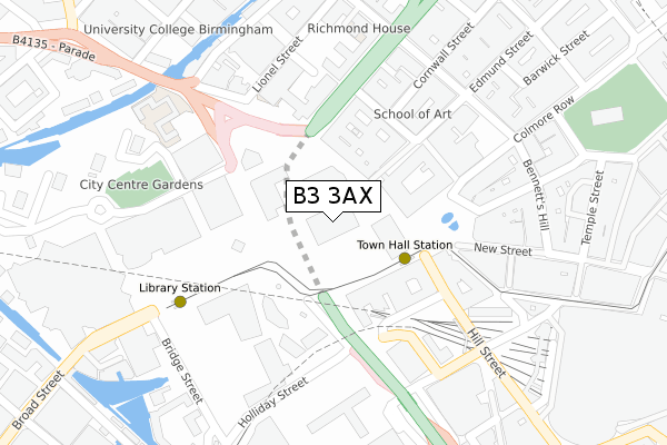
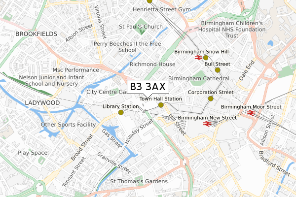
B3 3AX is located in the Ladywood electoral ward, within the metropolitan district of Birmingham and the English Parliamentary constituency of Birmingham, Ladywood. The Sub Integrated Care Board (ICB) Location is NHS Birmingham and Solihull ICB - 15E and the police force is West Midlands. This postcode has been in use since November 2017.


GetTheData
Source: OS Open Zoomstack (Ordnance Survey)
Licence: Open Government Licence (requires attribution)
Attribution: Contains OS data © Crown copyright and database right 2024
Source: Open Postcode Geo
Licence: Open Government Licence (requires attribution)
Attribution: Contains OS data © Crown copyright and database right 2024; Contains Royal Mail data © Royal Mail copyright and database right 2024; Source: Office for National Statistics licensed under the Open Government Licence v.3.0
| Easting | 406539 |
| Northing | 286889 |
| Latitude | 52.479903 |
| Longitude | -1.905143 |
GetTheData
Source: Open Postcode Geo
Licence: Open Government Licence
| Country | England |
| Postcode District | B3 |
| ➜ B3 open data dashboard ➜ See where B3 is on a map ➜ Where is Birmingham? | |
GetTheData
Source: Land Registry Price Paid Data
Licence: Open Government Licence
| Ward | Ladywood |
| Constituency | Birmingham, Ladywood |
GetTheData
Source: ONS Postcode Database
Licence: Open Government Licence
| January 2024 | Anti-social behaviour | On or near Conference/Exhibition Centre | 203m |
| January 2024 | Other theft | On or near Conference/Exhibition Centre | 203m |
| January 2024 | Theft from the person | On or near Conference/Exhibition Centre | 203m |
| ➜ Get more crime data in our Crime section | |||
GetTheData
Source: data.police.uk
Licence: Open Government Licence
| Town Hall (Paradise St) | International Convention Centre | 99m |
| Municipal Offices (Great Charles St Queensway) | International Convention Centre | 134m |
| Beneficial Building (Suffolk St Queensway) | International Convention Centre | 152m |
| Art Gallery (Edmund St) | Birmingham | 190m |
| Municipal Offices (Great Charles St Queensway) | International Convention Centre | 212m |
| Grand Central New Street (Midland Metro Stop) (Stephenson Street) | Birmingham | 421m |
| Corporation Street (Midland Metro Stop) (Corporation Street) | Birmingham | 541m |
| Snow Hill (Midland Metro Stop) (Colmore Row) | Birmingham | 578m |
| Bull Street (Midland Metro Stop) (Bull Street) | Birmingham | 639m |
| St Paul's (Midland Metro Stop) (Livery Street) | Jewellery Quarter | 757m |
| Birmingham New Street Station | 0.4km |
| Birmingham Snow Hill Station | 0.6km |
| Birmingham Moor Street Station | 0.9km |
GetTheData
Source: NaPTAN
Licence: Open Government Licence
GetTheData
Source: ONS Postcode Database
Licence: Open Government Licence

➜ Get more ratings from the Food Standards Agency
GetTheData
Source: Food Standards Agency
Licence: FSA terms & conditions
| Last Collection | |||
|---|---|---|---|
| Location | Mon-Fri | Sat | Distance |
| Margaret St | 19:00 | 12:30 | 190m |
| Birmingham Bo | 19:00 | 13:00 | 208m |
| Birmingham Bo (A) | 19:00 | 13:00 | 208m |
GetTheData
Source: Dracos
Licence: Creative Commons Attribution-ShareAlike
| Facility | Distance |
|---|---|
| The Copthorne Hotel Paradise Place, Birmingham Health and Fitness Gym, Swimming Pool | 94m |
| Crowne Plaza Hotel Holliday Street, Birmingham Health and Fitness Gym, Swimming Pool | 234m |
| University College Birmingham (Richmond House) Newhall Street, Birmingham Health and Fitness Gym | 288m |
GetTheData
Source: Active Places
Licence: Open Government Licence
| School | Phase of Education | Distance |
|---|---|---|
| University College Birmingham Summer Row, Birmingham, B3 1JB | Not applicable | 224m |
| City United Academy (CUA) 10 Edward Street, Birmingham, Birmingham, Birmingham, B1 2RX | Not applicable | 601m |
| Nelson Junior and Infant School King Edward's Road, Ladywood, Birmingham, B1 2PJ | Primary | 745m |
GetTheData
Source: Edubase
Licence: Open Government Licence
The below table lists the International Territorial Level (ITL) codes (formerly Nomenclature of Territorial Units for Statistics (NUTS) codes) and Local Administrative Units (LAU) codes for B3 3AX:
| ITL 1 Code | Name |
|---|---|
| TLG | West Midlands (England) |
| ITL 2 Code | Name |
| TLG3 | West Midlands |
| ITL 3 Code | Name |
| TLG31 | Birmingham |
| LAU 1 Code | Name |
| E08000025 | Birmingham |
GetTheData
Source: ONS Postcode Directory
Licence: Open Government Licence
The below table lists the Census Output Area (OA), Lower Layer Super Output Area (LSOA), and Middle Layer Super Output Area (MSOA) for B3 3AX:
| Code | Name | |
|---|---|---|
| OA | E00175670 | |
| LSOA | E01033625 | Birmingham 138D |
| MSOA | E02006899 | Birmingham 138 |
GetTheData
Source: ONS Postcode Directory
Licence: Open Government Licence
| B1 2AJ | Paradise Street | 149m |
| B1 2AF | Paradise Street | 162m |
| B1 2AH | Paradise Street | 162m |
| B3 3AP | Colmore Row | 217m |
| B3 3JY | Great Charles Street Queensway | 241m |
| B2 4AY | Pinfold Street | 242m |
| B3 3PL | Newhall Street | 247m |
| B3 3LG | Great Charles Street Queensway | 269m |
| B3 1JP | Fleet Street | 287m |
| B1 1HH | Holliday Street | 288m |
GetTheData
Source: Open Postcode Geo; Land Registry Price Paid Data
Licence: Open Government Licence