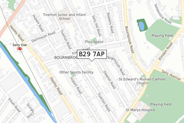
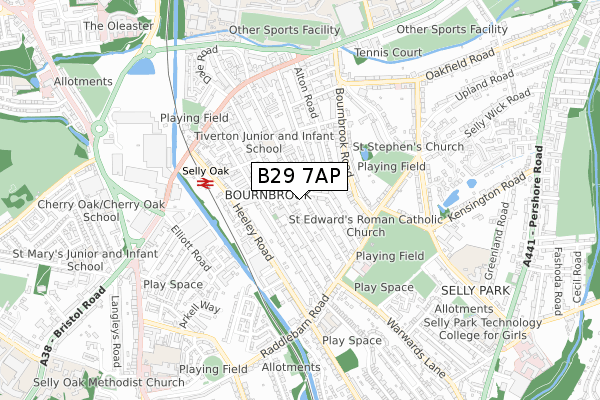
B29 7AP is located in the Bournbrook & Selly Park electoral ward, within the metropolitan district of Birmingham and the English Parliamentary constituency of Birmingham, Selly Oak. The Sub Integrated Care Board (ICB) Location is NHS Birmingham and Solihull ICB - 15E and the police force is West Midlands. This postcode has been in use since October 2017.


GetTheData
Source: OS Open Zoomstack (Ordnance Survey)
Licence: Open Government Licence (requires attribution)
Attribution: Contains OS data © Crown copyright and database right 2024
Source: Open Postcode Geo
Licence: Open Government Licence (requires attribution)
Attribution: Contains OS data © Crown copyright and database right 2024; Contains Royal Mail data © Royal Mail copyright and database right 2024; Source: Office for National Statistics licensed under the Open Government Licence v.3.0
| Easting | 404862 |
| Northing | 282600 |
| Latitude | 52.441362 |
| Longitude | -1.929895 |
GetTheData
Source: Open Postcode Geo
Licence: Open Government Licence
| Country | England |
| Postcode District | B29 |
| ➜ B29 open data dashboard ➜ See where B29 is on a map ➜ Where is Birmingham? | |
GetTheData
Source: Land Registry Price Paid Data
Licence: Open Government Licence
| Ward | Bournbrook & Selly Park |
| Constituency | Birmingham, Selly Oak |
GetTheData
Source: ONS Postcode Database
Licence: Open Government Licence
| January 2024 | Criminal damage and arson | On or near Parking Area | 368m |
| December 2023 | Other crime | On or near Parking Area | 368m |
| November 2023 | Anti-social behaviour | On or near Parking Area | 368m |
| ➜ Get more crime data in our Crime section | |||
GetTheData
Source: data.police.uk
Licence: Open Government Licence
| Coronation Rd (Dawlish Rd) | Bournbrook | 53m |
| Coronation Rd (Dawlish Rd) | Bournbrook | 104m |
| Rookery Rd (Coronation Rd) | Bournbrook | 202m |
| Elmdon Rd (Bournbrook Rd) | Bournbrook | 274m |
| St Mary's Hospice (Raddlebarn Rd) | Selly Park | 335m |
| Selly Oak Station | 0.4km |
| University Station | 1.2km |
| Bournville Station | 1.6km |
GetTheData
Source: NaPTAN
Licence: Open Government Licence
➜ Broadband speed and availability dashboard for B29 7AP
| Percentage of properties with Next Generation Access | 100.0% |
| Percentage of properties with Superfast Broadband | 100.0% |
| Percentage of properties with Ultrafast Broadband | 100.0% |
| Percentage of properties with Full Fibre Broadband | 0.0% |
Superfast Broadband is between 30Mbps and 300Mbps
Ultrafast Broadband is > 300Mbps
| Median download speed | 100.0Mbps |
| Average download speed | 100.0Mbps |
| Maximum download speed | 100.00Mbps |
Ofcom does not currently provide upload speed data for B29 7AP. This is because there are less than four broadband connections in this postcode.
| Percentage of properties unable to receive 2Mbps | 0.0% |
| Percentage of properties unable to receive 5Mbps | 0.0% |
| Percentage of properties unable to receive 10Mbps | 0.0% |
| Percentage of properties unable to receive 30Mbps | 0.0% |
➜ Broadband speed and availability dashboard for B29 7AP
GetTheData
Source: Ofcom
Licence: Ofcom Terms of Use (requires attribution)
GetTheData
Source: ONS Postcode Database
Licence: Open Government Licence


➜ Get more ratings from the Food Standards Agency
GetTheData
Source: Food Standards Agency
Licence: FSA terms & conditions
| Last Collection | |||
|---|---|---|---|
| Location | Mon-Fri | Sat | Distance |
| Exeter Road / Hubert Road | 17:45 | 12:30 | 178m |
| Raddlebarn Road Post Office | 17:30 | 12:30 | 471m |
| Tiverton Road / Bristol Road | 17:45 | 12:30 | 510m |
GetTheData
Source: Dracos
Licence: Creative Commons Attribution-ShareAlike
| Facility | Distance |
|---|---|
| Tiverton Pool & Fitness Centre (Closed) Tiverton Road, Birmingham Swimming Pool, Health and Fitness Gym | 116m |
| Elmdon Playing Field Elmdon Road, Selly Park, Birmingham Grass Pitches | 416m |
| Selly Park Recreation Ground Raddlebarn Road, Birmingham Grass Pitches | 448m |
GetTheData
Source: Active Places
Licence: Open Government Licence
| School | Phase of Education | Distance |
|---|---|---|
| Tiverton Academy Tiverton Road, Selly Oak, Birmingham, B29 6BW | Primary | 310m |
| Selly Oak Nursery School 26 Tiverton Road, Birmingham, B29 6BP | Nursery | 429m |
| Raddlebarn Primary School Gristhorpe Road, Selly Oak, Birmingham, B29 7TD | Primary | 528m |
GetTheData
Source: Edubase
Licence: Open Government Licence
The below table lists the International Territorial Level (ITL) codes (formerly Nomenclature of Territorial Units for Statistics (NUTS) codes) and Local Administrative Units (LAU) codes for B29 7AP:
| ITL 1 Code | Name |
|---|---|
| TLG | West Midlands (England) |
| ITL 2 Code | Name |
| TLG3 | West Midlands |
| ITL 3 Code | Name |
| TLG31 | Birmingham |
| LAU 1 Code | Name |
| E08000025 | Birmingham |
GetTheData
Source: ONS Postcode Directory
Licence: Open Government Licence
The below table lists the Census Output Area (OA), Lower Layer Super Output Area (LSOA), and Middle Layer Super Output Area (MSOA) for B29 7AP:
| Code | Name | |
|---|---|---|
| OA | E00047067 | |
| LSOA | E01009286 | Birmingham 096C |
| MSOA | E02001922 | Birmingham 096 |
GetTheData
Source: ONS Postcode Directory
Licence: Open Government Licence
| B29 7AW | Dawlish Road | 60m |
| B29 7AR | Dawlish Road | 66m |
| B29 6DB | Tiverton Road | 72m |
| B29 7AS | Dawlish Road | 89m |
| B29 6BU | Tiverton Road | 101m |
| B29 6EU | Exeter Road | 114m |
| B29 7BA | Teignmouth Road | 115m |
| B29 7AZ | Teignmouth Road | 118m |
| B29 7DE | Coronation Road | 136m |
| B29 6ET | Hubert Road | 144m |
GetTheData
Source: Open Postcode Geo; Land Registry Price Paid Data
Licence: Open Government Licence