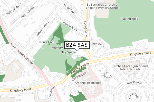
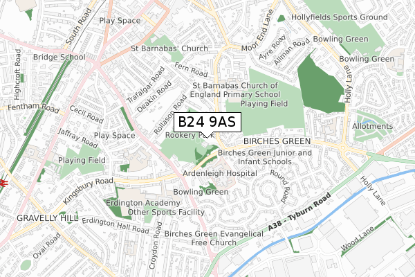
B24 9AS is located in the Erdington electoral ward, within the metropolitan district of Birmingham and the English Parliamentary constituency of Birmingham, Erdington. The Sub Integrated Care Board (ICB) Location is NHS Birmingham and Solihull ICB - 15E and the police force is West Midlands. This postcode has been in use since September 2019.


GetTheData
Source: OS Open Zoomstack (Ordnance Survey)
Licence: Open Government Licence (requires attribution)
Attribution: Contains OS data © Crown copyright and database right 2024
Source: Open Postcode Geo
Licence: Open Government Licence (requires attribution)
Attribution: Contains OS data © Crown copyright and database right 2024; Contains Royal Mail data © Royal Mail copyright and database right 2024; Source: Office for National Statistics licensed under the Open Government Licence v.3.0
| Easting | 411322 |
| Northing | 291160 |
| Latitude | 52.518222 |
| Longitude | -1.834573 |
GetTheData
Source: Open Postcode Geo
Licence: Open Government Licence
| Country | England |
| Postcode District | B24 |
| ➜ B24 open data dashboard ➜ See where B24 is on a map ➜ Where is Birmingham? | |
GetTheData
Source: Land Registry Price Paid Data
Licence: Open Government Licence
| Ward | Erdington |
| Constituency | Birmingham, Erdington |
GetTheData
Source: ONS Postcode Database
Licence: Open Government Licence
23, WILBERFORCE WAY, BIRMINGHAM, B24 9AS 2021 31 MAR £327,500 |
27, WILBERFORCE WAY, BIRMINGHAM, B24 9AS 2021 31 MAR £320,000 |
20, WILBERFORCE WAY, BIRMINGHAM, B24 9AS 2021 26 MAR £269,950 |
29, WILBERFORCE WAY, BIRMINGHAM, B24 9AS 2021 12 MAR £255,000 |
22, WILBERFORCE WAY, BIRMINGHAM, B24 9AS 2021 8 MAR £320,000 |
31, WILBERFORCE WAY, BIRMINGHAM, B24 9AS 2021 5 MAR £257,500 |
33, WILBERFORCE WAY, BIRMINGHAM, B24 9AS 2021 5 MAR £255,000 |
28, WILBERFORCE WAY, BIRMINGHAM, B24 9AS 2021 26 FEB £271,950 |
26, WILBERFORCE WAY, BIRMINGHAM, B24 9AS 2021 26 FEB £320,000 |
18, WILBERFORCE WAY, BIRMINGHAM, B24 9AS 2021 19 FEB £272,000 |
GetTheData
Source: HM Land Registry Price Paid Data
Licence: Contains HM Land Registry data © Crown copyright and database right 2024. This data is licensed under the Open Government Licence v3.0.
| January 2024 | Violence and sexual offences | On or near Wood End Road | 447m |
| January 2024 | Burglary | On or near Wood End Road | 447m |
| December 2023 | Vehicle crime | On or near Wood End Road | 447m |
| ➜ Get more crime data in our Crime section | |||
GetTheData
Source: data.police.uk
Licence: Open Government Licence
| Spring Lane (Kingsbury Rd) | Erdington | 180m |
| Spring Lane (Kingsbury Rd) | Erdington | 225m |
| Bromford Lane (Kingsbury Rd) | Erdington | 249m |
| Bromford Lane (Kingsbury Rd) | Erdington | 282m |
| Rookery Park (Wood End Rd) | Erdington | 290m |
| Erdington Station | 1.2km |
| Gravelly Hill Station | 1.3km |
| Chester Road Station | 1.9km |
GetTheData
Source: NaPTAN
Licence: Open Government Licence
| Percentage of properties with Next Generation Access | 0.0% |
| Percentage of properties with Superfast Broadband | 0.0% |
| Percentage of properties with Ultrafast Broadband | 0.0% |
| Percentage of properties with Full Fibre Broadband | 0.0% |
Superfast Broadband is between 30Mbps and 300Mbps
Ultrafast Broadband is > 300Mbps
| Percentage of properties unable to receive 2Mbps | 0.0% |
| Percentage of properties unable to receive 5Mbps | 0.0% |
| Percentage of properties unable to receive 10Mbps | 0.0% |
| Percentage of properties unable to receive 30Mbps | 0.0% |
GetTheData
Source: Ofcom
Licence: Ofcom Terms of Use (requires attribution)
GetTheData
Source: ONS Postcode Database
Licence: Open Government Licence


➜ Get more ratings from the Food Standards Agency
GetTheData
Source: Food Standards Agency
Licence: FSA terms & conditions
| Last Collection | |||
|---|---|---|---|
| Location | Mon-Fri | Sat | Distance |
| Berkswell Road / Moor End Lane | 17:45 | 12:30 | 551m |
| Wood End Lane / Jaffray Cresce | 17:30 | 12:15 | 615m |
| Inland Road / Tyburn Road | 17:30 | 12:30 | 675m |
GetTheData
Source: Dracos
Licence: Creative Commons Attribution-ShareAlike
| Facility | Distance |
|---|---|
| Spring Lane Playing Fields Spring Lane, Birmingham Grass Pitches | 202m |
| Rookery Park Rollason Road, Birmingham Grass Pitches, Outdoor Tennis Courts | 215m |
| Saint Barnabas Ce Primary School Spring Lane, Birmingham Grass Pitches | 326m |
GetTheData
Source: Active Places
Licence: Open Government Licence
| School | Phase of Education | Distance |
|---|---|---|
| Saint Barnabas Church of England Primary School Spring Lane, Erdington, Birmingham, B24 9BY | Primary | 326m |
| Queensbury School Wood End Road, Birmingham, B24 8BL | Not applicable | 418m |
| Erdington Academy Kingsbury Road, Erdington, Birmingham, B24 8RE | Secondary | 481m |
GetTheData
Source: Edubase
Licence: Open Government Licence
The below table lists the International Territorial Level (ITL) codes (formerly Nomenclature of Territorial Units for Statistics (NUTS) codes) and Local Administrative Units (LAU) codes for B24 9AS:
| ITL 1 Code | Name |
|---|---|
| TLG | West Midlands (England) |
| ITL 2 Code | Name |
| TLG3 | West Midlands |
| ITL 3 Code | Name |
| TLG31 | Birmingham |
| LAU 1 Code | Name |
| E08000025 | Birmingham |
GetTheData
Source: ONS Postcode Directory
Licence: Open Government Licence
The below table lists the Census Output Area (OA), Lower Layer Super Output Area (LSOA), and Middle Layer Super Output Area (MSOA) for B24 9AS:
| Code | Name | |
|---|---|---|
| OA | E00045694 | |
| LSOA | E01009012 | Birmingham 028C |
| MSOA | E02001854 | Birmingham 028 |
GetTheData
Source: ONS Postcode Directory
Licence: Open Government Licence
| B24 9BU | Spring Lane | 60m |
| B24 9BP | Spring Lane | 101m |
| B24 9BL | Western Road | 139m |
| B24 9BW | Shipley Fields | 143m |
| B24 9BQ | Brueton Drive | 169m |
| B24 9BG | Church Road | 180m |
| B24 9SD | Kingsbury Road | 196m |
| B24 9SE | Kingsbury Road | 221m |
| B24 9BT | Spring Lane | 222m |
| B24 9BH | Rollason Road | 257m |
GetTheData
Source: Open Postcode Geo; Land Registry Price Paid Data
Licence: Open Government Licence