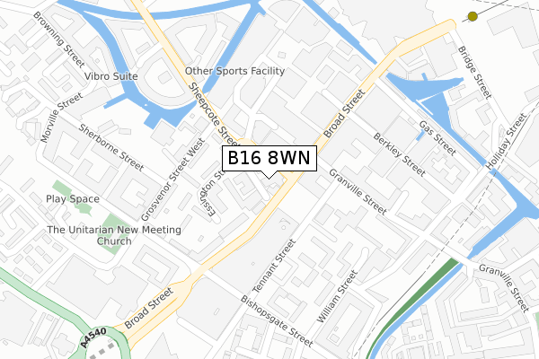
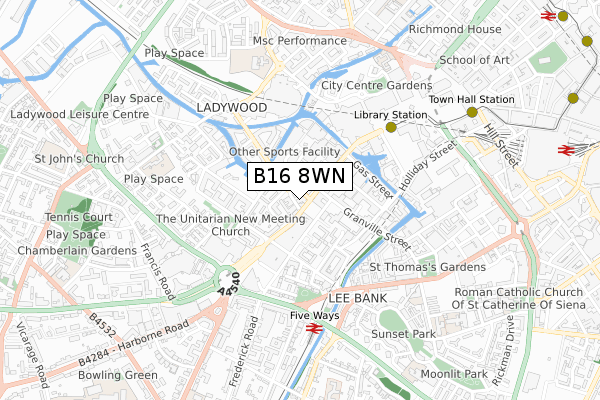
B16 8WN is located in the Ladywood electoral ward, within the metropolitan district of Birmingham and the English Parliamentary constituency of Birmingham, Ladywood. The Sub Integrated Care Board (ICB) Location is NHS Birmingham and Solihull ICB - 15E and the police force is West Midlands. This postcode has been in use since December 2019.


GetTheData
Source: OS Open Zoomstack (Ordnance Survey)
Licence: Open Government Licence (requires attribution)
Attribution: Contains OS data © Crown copyright and database right 2024
Source: Open Postcode Geo
Licence: Open Government Licence (requires attribution)
Attribution: Contains OS data © Crown copyright and database right 2024; Contains Royal Mail data © Royal Mail copyright and database right 2024; Source: Office for National Statistics licensed under the Open Government Licence v.3.0
| Easting | 405943 |
| Northing | 286450 |
| Latitude | 52.475963 |
| Longitude | -1.913926 |
GetTheData
Source: Open Postcode Geo
Licence: Open Government Licence
| Country | England |
| Postcode District | B16 |
| ➜ B16 open data dashboard ➜ See where B16 is on a map ➜ Where is Birmingham? | |
GetTheData
Source: Land Registry Price Paid Data
Licence: Open Government Licence
| Ward | Ladywood |
| Constituency | Birmingham, Ladywood |
GetTheData
Source: ONS Postcode Database
Licence: Open Government Licence
| January 2024 | Anti-social behaviour | On or near Parking Area | 133m |
| January 2024 | Anti-social behaviour | On or near Parking Area | 133m |
| January 2024 | Burglary | On or near Parking Area | 133m |
| ➜ Get more crime data in our Crime section | |||
GetTheData
Source: data.police.uk
Licence: Open Government Licence
| Sheepcote St (Broad St) | Five Ways | 58m |
| Sheepcote St (Broad St) | Five Ways | 61m |
| Sheepcote St (Broad St) | Five Ways | 69m |
| Grosvenor St West (Sheepcote St) | National Indoor Arena | 137m |
| Brindley Place (Broad St) | International Convention Centre | 149m |
| Grand Central New Street (Midland Metro Stop) (Stephenson Street) | Birmingham | 1,037m |
| Corporation Street (Midland Metro Stop) (Corporation Street) | Birmingham | 1,217m |
| Snow Hill (Midland Metro Stop) (Colmore Row) | Birmingham | 1,314m |
| Bull Street (Midland Metro Stop) (Bull Street) | Birmingham | 1,366m |
| St Paul's (Midland Metro Stop) (Livery Street) | Jewellery Quarter | 1,371m |
| Five Ways Station | 0.5km |
| Birmingham New Street Station | 1km |
| Birmingham Snow Hill Station | 1.3km |
GetTheData
Source: NaPTAN
Licence: Open Government Licence
GetTheData
Source: ONS Postcode Database
Licence: Open Government Licence


➜ Get more ratings from the Food Standards Agency
GetTheData
Source: Food Standards Agency
Licence: FSA terms & conditions
| Last Collection | |||
|---|---|---|---|
| Location | Mon-Fri | Sat | Distance |
| Sheepcotestreet | 17:30 | 12:30 | 178m |
| Brindley Place | 18:30 | 12:30 | 210m |
| Granville Square | 16:45 | 12:30 | 235m |
GetTheData
Source: Dracos
Licence: Creative Commons Attribution-ShareAlike
| Facility | Distance |
|---|---|
| Puregym (Birmingham City Centre) Broad Street, Birmingham Health and Fitness Gym, Studio | 235m |
| Bannatyne Health Club (Birmingham Brindley Place) Brunswick Street, Birmingham Swimming Pool, Health and Fitness Gym, Studio | 285m |
| The Gym Group (Birmingham Broad Street) Broadway, Ladywood Middleway, Birmingham Health and Fitness Gym | 315m |
GetTheData
Source: Active Places
Licence: Open Government Licence
| School | Phase of Education | Distance |
|---|---|---|
| City United Academy (CUA) 10 Edward Street, Birmingham, Birmingham, Birmingham, B1 2RX | Not applicable | 572m |
| Nelson Junior and Infant School King Edward's Road, Ladywood, Birmingham, B1 2PJ | Primary | 590m |
| St John's & St Peter's CofE Academy St Vincent Street West, Ladywood, Birmingham, B16 8RN | Primary | 605m |
GetTheData
Source: Edubase
Licence: Open Government Licence
The below table lists the International Territorial Level (ITL) codes (formerly Nomenclature of Territorial Units for Statistics (NUTS) codes) and Local Administrative Units (LAU) codes for B16 8WN:
| ITL 1 Code | Name |
|---|---|
| TLG | West Midlands (England) |
| ITL 2 Code | Name |
| TLG3 | West Midlands |
| ITL 3 Code | Name |
| TLG31 | Birmingham |
| LAU 1 Code | Name |
| E08000025 | Birmingham |
GetTheData
Source: ONS Postcode Directory
Licence: Open Government Licence
The below table lists the Census Output Area (OA), Lower Layer Super Output Area (LSOA), and Middle Layer Super Output Area (MSOA) for B16 8WN:
| Code | Name | |
|---|---|---|
| OA | E00046394 | |
| LSOA | E01033639 | Birmingham 136D |
| MSOA | E02006897 | Birmingham 136 |
GetTheData
Source: ONS Postcode Directory
Licence: Open Government Licence
| B15 1AY | Broad Street | 80m |
| B16 8AJ | Sheepcote Street | 96m |
| B16 8AL | Essington Street | 110m |
| B1 2HG | Broad Street | 132m |
| B15 1AU | Broad Street | 136m |
| B16 8HN | Grosvenor Street West | 160m |
| B15 1UE | Granville Square | 163m |
| B15 1UG | Granville Square | 163m |
| B15 1UH | Granville Square | 163m |
| B15 1UQ | Granville Square | 163m |
GetTheData
Source: Open Postcode Geo; Land Registry Price Paid Data
Licence: Open Government Licence