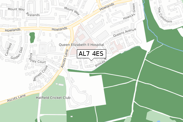
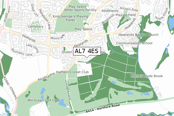
AL7 4ES is located in the Howlands electoral ward, within the local authority district of Welwyn Hatfield and the English Parliamentary constituency of Welwyn Hatfield. The Sub Integrated Care Board (ICB) Location is NHS Hertfordshire and West Essex ICB - 06K and the police force is Hertfordshire. This postcode has been in use since December 2017.


GetTheData
Source: OS Open Zoomstack (Ordnance Survey)
Licence: Open Government Licence (requires attribution)
Attribution: Contains OS data © Crown copyright and database right 2024
Source: Open Postcode Geo
Licence: Open Government Licence (requires attribution)
Attribution: Contains OS data © Crown copyright and database right 2024; Contains Royal Mail data © Royal Mail copyright and database right 2024; Source: Office for National Statistics licensed under the Open Government Licence v.3.0
| Easting | 525105 |
| Northing | 210810 |
| Latitude | 51.781983 |
| Longitude | -0.187812 |
GetTheData
Source: Open Postcode Geo
Licence: Open Government Licence
| Country | England |
| Postcode District | AL7 |
| ➜ AL7 open data dashboard ➜ See where AL7 is on a map ➜ Where is Welwyn Garden City? | |
GetTheData
Source: Land Registry Price Paid Data
Licence: Open Government Licence
| Ward | Howlands |
| Constituency | Welwyn Hatfield |
GetTheData
Source: ONS Postcode Database
Licence: Open Government Licence
| June 2022 | Anti-social behaviour | On or near Howicks Green | 296m |
| June 2022 | Violence and sexual offences | On or near Howicks Green | 296m |
| June 2022 | Violence and sexual offences | On or near Howicks Green | 296m |
| ➜ Get more crime data in our Crime section | |||
GetTheData
Source: data.police.uk
Licence: Open Government Licence
| New Qeii Hospital (Howlands) | Welwyn Garden City | 232m |
| Ryelands (Howlands) | Welwyn Garden City | 295m |
| New Qeii Hospital (Howlands) | Welwyn Garden City | 304m |
| Ryelands (Howlands) | Welwyn Garden City | 315m |
| Howlands House (Howlands) | Welwyn Garden City | 433m |
| Welwyn Garden City Station | 2.4km |
| Hatfield (Herts) Station | 2.8km |
| Welwyn North Station | 4.6km |
GetTheData
Source: NaPTAN
Licence: Open Government Licence
➜ Broadband speed and availability dashboard for AL7 4ES
| Percentage of properties with Next Generation Access | 100.0% |
| Percentage of properties with Superfast Broadband | 100.0% |
| Percentage of properties with Ultrafast Broadband | 100.0% |
| Percentage of properties with Full Fibre Broadband | 100.0% |
Superfast Broadband is between 30Mbps and 300Mbps
Ultrafast Broadband is > 300Mbps
Ofcom does not currently provide download speed data for AL7 4ES. This is because there are less than four broadband connections in this postcode.
Ofcom does not currently provide upload speed data for AL7 4ES. This is because there are less than four broadband connections in this postcode.
| Percentage of properties unable to receive 2Mbps | 0.0% |
| Percentage of properties unable to receive 5Mbps | 0.0% |
| Percentage of properties unable to receive 10Mbps | 0.0% |
| Percentage of properties unable to receive 30Mbps | 0.0% |
➜ Broadband speed and availability dashboard for AL7 4ES
GetTheData
Source: Ofcom
Licence: Ofcom Terms of Use (requires attribution)
GetTheData
Source: ONS Postcode Database
Licence: Open Government Licence


➜ Get more ratings from the Food Standards Agency
GetTheData
Source: Food Standards Agency
Licence: FSA terms & conditions
| Last Collection | |||
|---|---|---|---|
| Location | Mon-Fri | Sat | Distance |
| Howlands | 17:30 | 12:00 | 258m |
| Beehive Lane | 17:30 | 12:00 | 494m |
| The Commons | 17:30 | 12:00 | 628m |
GetTheData
Source: Dracos
Licence: Creative Commons Attribution-ShareAlike
| Facility | Distance |
|---|---|
| Hatfield And Crusaders Cricket Club Ascots Lane, Welwyn Garden City Grass Pitches | 212m |
| King George V Playing Fields (Welwyn Garden City) Beehive Lane, Welwyn Garden City Grass Pitches, Outdoor Tennis Courts, Artificial Grass Pitch | 595m |
| Mill Green Golf Club Gypsy Lane, Welwyn Garden City Golf | 755m |
GetTheData
Source: Active Places
Licence: Open Government Licence
| School | Phase of Education | Distance |
|---|---|---|
| Commonswood Primary & Nursery School The Commons, WELWYN GARDEN CITY, AL7 4RU | Primary | 766m |
| Creswick Primary & Nursery School Sir John Newsom Way, Welwyn Garden City, AL7 4FL | Primary | 1.1km |
| Creswick Primary & Nursery School Sir John Newsom Way, Welwyn Garden City, AL7 4FL | Primary | 1.1km |
GetTheData
Source: Edubase
Licence: Open Government Licence
The below table lists the International Territorial Level (ITL) codes (formerly Nomenclature of Territorial Units for Statistics (NUTS) codes) and Local Administrative Units (LAU) codes for AL7 4ES:
| ITL 1 Code | Name |
|---|---|
| TLH | East |
| ITL 2 Code | Name |
| TLH2 | Bedfordshire and Hertfordshire |
| ITL 3 Code | Name |
| TLH23 | Hertfordshire CC |
| LAU 1 Code | Name |
| E07000241 | Welwyn Hatfield |
GetTheData
Source: ONS Postcode Directory
Licence: Open Government Licence
The below table lists the Census Output Area (OA), Lower Layer Super Output Area (LSOA), and Middle Layer Super Output Area (MSOA) for AL7 4ES:
| Code | Name | |
|---|---|---|
| OA | E00173215 | |
| LSOA | E01023946 | Welwyn Hatfield 008D |
| MSOA | E02004987 | Welwyn Hatfield 008 |
GetTheData
Source: ONS Postcode Directory
Licence: Open Government Licence
| AL7 4HQ | Howlands | 164m |
| AL7 4JB | Wyndhams End | 249m |
| AL7 4HD | Howlands | 255m |
| AL7 4HE | Howlands | 257m |
| AL7 4HN | Howlands | 265m |
| AL7 4HL | Ascots Lane | 276m |
| AL7 4HZ | Kingsley Court | 284m |
| AL7 4RJ | Howicks Green | 285m |
| AL7 4LE | Little Wade | 295m |
| AL7 4LD | Mount Way | 306m |
GetTheData
Source: Open Postcode Geo; Land Registry Price Paid Data
Licence: Open Government Licence