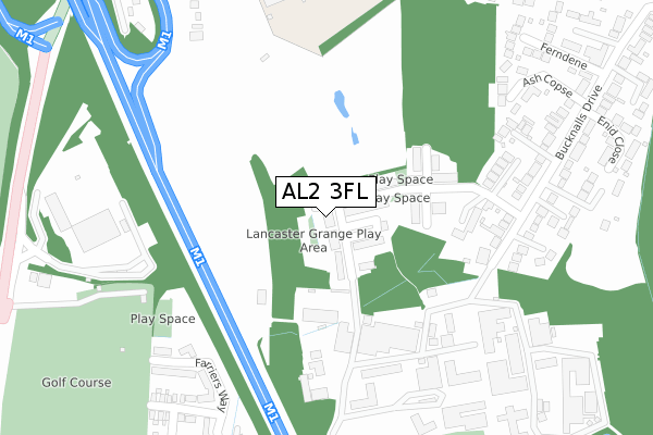
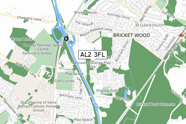
AL2 3FL is located in the St Stephen electoral ward, within the local authority district of St Albans and the English Parliamentary constituency of St Albans. The Sub Integrated Care Board (ICB) Location is NHS Hertfordshire and West Essex ICB - 06N and the police force is Hertfordshire. This postcode has been in use since December 2018.


GetTheData
Source: OS Open Zoomstack (Ordnance Survey)
Licence: Open Government Licence (requires attribution)
Attribution: Contains OS data © Crown copyright and database right 2024
Source: Open Postcode Geo
Licence: Open Government Licence (requires attribution)
Attribution: Contains OS data © Crown copyright and database right 2024; Contains Royal Mail data © Royal Mail copyright and database right 2024; Source: Office for National Statistics licensed under the Open Government Licence v.3.0
| Easting | 512295 |
| Northing | 201674 |
| Latitude | 51.702587 |
| Longitude | -0.376372 |
GetTheData
Source: Open Postcode Geo
Licence: Open Government Licence
| Country | England |
| Postcode District | AL2 |
| ➜ AL2 open data dashboard ➜ See where AL2 is on a map ➜ Where is Bricket Wood? | |
GetTheData
Source: Land Registry Price Paid Data
Licence: Open Government Licence
| Ward | St Stephen |
| Constituency | St Albans |
GetTheData
Source: ONS Postcode Database
Licence: Open Government Licence
| June 2022 | Anti-social behaviour | On or near Sports/Recreation Area | 304m |
| June 2022 | Public order | On or near Park/Open Space | 387m |
| June 2022 | Violence and sexual offences | On or near Sports/Recreation Area | 419m |
| ➜ Get more crime data in our Crime section | |||
GetTheData
Source: data.police.uk
Licence: Open Government Licence
| Building Research Establishment (Bucknalls Lane) | Garston | 323m |
| Mount Pleasant Lane School (Mount Pleasant Lane) | Bricket Wood | 386m |
| Mount Pleasant Lane School (Mount Pleasant Lane) | Bricket Wood | 449m |
| West Riding (Mount Pleasant Lane) | Bricket Wood | 583m |
| West Riding (Mount Pleasant Lane) | Bricket Wood | 603m |
| Bricket Wood Station | 1.2km |
| Garston (Herts) Station | 1.8km |
| How Wood (Herts) Station | 2.8km |
GetTheData
Source: NaPTAN
Licence: Open Government Licence
| Percentage of properties with Next Generation Access | 100.0% |
| Percentage of properties with Superfast Broadband | 100.0% |
| Percentage of properties with Ultrafast Broadband | 100.0% |
| Percentage of properties with Full Fibre Broadband | 100.0% |
Superfast Broadband is between 30Mbps and 300Mbps
Ultrafast Broadband is > 300Mbps
| Percentage of properties unable to receive 2Mbps | 0.0% |
| Percentage of properties unable to receive 5Mbps | 0.0% |
| Percentage of properties unable to receive 10Mbps | 0.0% |
| Percentage of properties unable to receive 30Mbps | 0.0% |
GetTheData
Source: Ofcom
Licence: Ofcom Terms of Use (requires attribution)
GetTheData
Source: ONS Postcode Database
Licence: Open Government Licence


➜ Get more ratings from the Food Standards Agency
GetTheData
Source: Food Standards Agency
Licence: FSA terms & conditions
| Last Collection | |||
|---|---|---|---|
| Location | Mon-Fri | Sat | Distance |
| Ferndene | 17:30 | 12:00 | 464m |
| Oakwood Road Post Office | 18:30 | 12:00 | 901m |
| Katherine Place | 17:00 | 12:00 | 1,938m |
GetTheData
Source: Dracos
Licence: Creative Commons Attribution-ShareAlike
| Facility | Distance |
|---|---|
| Penfold Park Golf Course (Closed) St. Albans Road, Watford Golf | 318m |
| Mount Pleasant Lane School Mount Pleasant Lane, Bricket Wood, St. Albans Grass Pitches | 373m |
| Saint Michaels Catholic High School High Elms Lane, Watford Artificial Grass Pitch, Sports Hall, Grass Pitches | 740m |
GetTheData
Source: Active Places
Licence: Open Government Licence
| School | Phase of Education | Distance |
|---|---|---|
| Mount Pleasant Lane Primary School Mount Pleasant Lane, Bricket Wood, St Albans, AL2 3XA | Primary | 387m |
| Saint Michael's Catholic High School High Elms Lane, Garston, Watford, WD25 0SS | Secondary | 739m |
| Coates Way JMI and Nursery School Coates Way, Garston, Watford, WD25 9NW | Primary | 901m |
GetTheData
Source: Edubase
Licence: Open Government Licence
The below table lists the International Territorial Level (ITL) codes (formerly Nomenclature of Territorial Units for Statistics (NUTS) codes) and Local Administrative Units (LAU) codes for AL2 3FL:
| ITL 1 Code | Name |
|---|---|
| TLH | East |
| ITL 2 Code | Name |
| TLH2 | Bedfordshire and Hertfordshire |
| ITL 3 Code | Name |
| TLH23 | Hertfordshire CC |
| LAU 1 Code | Name |
| E07000240 | St Albans |
GetTheData
Source: ONS Postcode Directory
Licence: Open Government Licence
The below table lists the Census Output Area (OA), Lower Layer Super Output Area (LSOA), and Middle Layer Super Output Area (MSOA) for AL2 3FL:
| Code | Name | |
|---|---|---|
| OA | E00120502 | |
| LSOA | E01023733 | St Albans 020E |
| MSOA | E02004943 | St Albans 020 |
GetTheData
Source: ONS Postcode Directory
Licence: Open Government Licence
| AL2 3YB | The Kestrels | 254m |
| AL2 3YA | Ash Copse | 335m |
| AL2 3YT | Moran Close | 344m |
| AL2 3US | Hampstead Close | 348m |
| AL2 3XL | Bucknalls Drive | 364m |
| WD25 9NF | Bucknalls Close | 377m |
| AL2 3DX | Ferndene | 399m |
| AL2 3UL | Aspen Close | 413m |
| AL2 3UX | Mount Pleasant Lane | 414m |
| AL2 3UH | Bluebird Way | 422m |
GetTheData
Source: Open Postcode Geo; Land Registry Price Paid Data
Licence: Open Government Licence