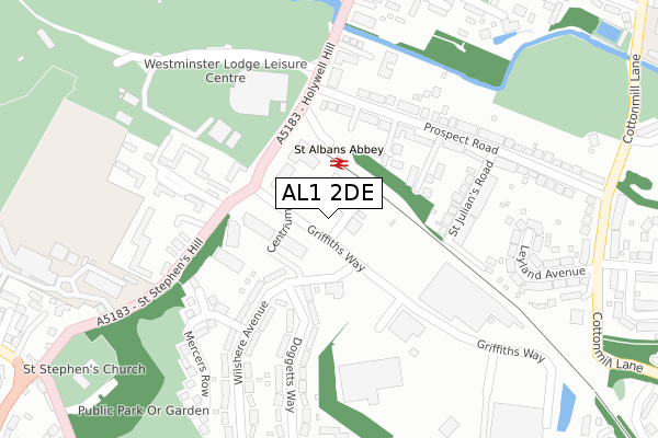
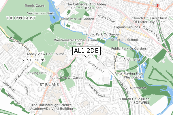
AL1 2DE is located in the Sopwell electoral ward, within the local authority district of St Albans and the English Parliamentary constituency of St Albans. The Sub Integrated Care Board (ICB) Location is NHS Hertfordshire and West Essex ICB - 06N and the police force is Hertfordshire. This postcode has been in use since September 2019.


GetTheData
Source: OS Open Zoomstack (Ordnance Survey)
Licence: Open Government Licence (requires attribution)
Attribution: Contains OS data © Crown copyright and database right 2024
Source: Open Postcode Geo
Licence: Open Government Licence (requires attribution)
Attribution: Contains OS data © Crown copyright and database right 2024; Contains Royal Mail data © Royal Mail copyright and database right 2024; Source: Office for National Statistics licensed under the Open Government Licence v.3.0
| Easting | 514517 |
| Northing | 206322 |
| Latitude | 51.743912 |
| Longitude | -0.342706 |
GetTheData
Source: Open Postcode Geo
Licence: Open Government Licence
| Country | England |
| Postcode District | AL1 |
| ➜ AL1 open data dashboard ➜ See where AL1 is on a map ➜ Where is St Albans? | |
GetTheData
Source: Land Registry Price Paid Data
Licence: Open Government Licence
| Ward | Sopwell |
| Constituency | St Albans |
GetTheData
Source: ONS Postcode Database
Licence: Open Government Licence
| June 2022 | Criminal damage and arson | On or near Griffiths Way | 40m |
| June 2022 | Violence and sexual offences | On or near Griffiths Way | 40m |
| June 2022 | Criminal damage and arson | On or near Griffiths Way | 40m |
| ➜ Get more crime data in our Crime section | |||
GetTheData
Source: data.police.uk
Licence: Open Government Licence
| Griffiths Way | St Albans | 35m |
| Griffiths Way | St Albans | 42m |
| Wilshere Avenue (Doggetts Way) | St Julians | 148m |
| Wilshere Avenue (Doggetts Way) | St Julians | 157m |
| St Albans Abbey Railway Station (Holywell Hill) | St Albans | 172m |
| St Albans Abbey Station | 0.1km |
| St Albans City Station | 1.3km |
| Park Street Station | 2.1km |
GetTheData
Source: NaPTAN
Licence: Open Government Licence
GetTheData
Source: ONS Postcode Database
Licence: Open Government Licence


➜ Get more ratings from the Food Standards Agency
GetTheData
Source: Food Standards Agency
Licence: FSA terms & conditions
| Last Collection | |||
|---|---|---|---|
| Location | Mon-Fri | Sat | Distance |
| The Brambles | 17:30 | 12:00 | 266m |
| Dellfield | 17:30 | 12:00 | 599m |
| Church End | 16:40 | 11:00 | 617m |
GetTheData
Source: Dracos
Licence: Creative Commons Attribution-ShareAlike
| Facility | Distance |
|---|---|
| Abbey View Sports Complex Holywell Hill, St. Albans Golf, Athletics, Grass Pitches, Outdoor Tennis Courts | 210m |
| Westminster Lodge Leisure Centre Holywell Hill, St. Albans Health and Fitness Gym, Swimming Pool, Sports Hall, Studio | 233m |
| Puregym (St Albans) Abbey View Retail Park, Griffiths Way, St. Albans Health and Fitness Gym | 258m |
GetTheData
Source: Active Places
Licence: Open Government Licence
| School | Phase of Education | Distance |
|---|---|---|
| The Abbey Church of England Voluntary Aided Primary School, St Albans Grove Road, St Albans, AL1 1DQ | Primary | 415m |
| St Columba's College King Harry Lane, St Albans, AL3 4AW | Not applicable | 540m |
| St Peter's School Cottonmill Lane, St Albans, AL1 1HL | Primary | 595m |
GetTheData
Source: Edubase
Licence: Open Government Licence
The below table lists the International Territorial Level (ITL) codes (formerly Nomenclature of Territorial Units for Statistics (NUTS) codes) and Local Administrative Units (LAU) codes for AL1 2DE:
| ITL 1 Code | Name |
|---|---|
| TLH | East |
| ITL 2 Code | Name |
| TLH2 | Bedfordshire and Hertfordshire |
| ITL 3 Code | Name |
| TLH23 | Hertfordshire CC |
| LAU 1 Code | Name |
| E07000240 | St Albans |
GetTheData
Source: ONS Postcode Directory
Licence: Open Government Licence
The below table lists the Census Output Area (OA), Lower Layer Super Output Area (LSOA), and Middle Layer Super Output Area (MSOA) for AL1 2DE:
| Code | Name | |
|---|---|---|
| OA | E00120545 | |
| LSOA | E01023740 | St Albans 017D |
| MSOA | E02004940 | St Albans 017 |
GetTheData
Source: ONS Postcode Directory
Licence: Open Government Licence
| AL1 2AY | Ashwood Mews | 127m |
| AL1 2DP | The Brambles | 159m |
| AL1 2BX | Prospect Road | 162m |
| AL1 2DN | Holywell Hill | 164m |
| AL1 2AR | Ashwood Mews | 170m |
| AL1 2DS | St Stephens Hill | 171m |
| AL1 2AX | Prospect Road | 182m |
| AL1 2AW | The Shrubberies | 198m |
| AL1 2AT | Prospect Road | 217m |
| AL1 2QT | Mercers Row | 223m |
GetTheData
Source: Open Postcode Geo; Land Registry Price Paid Data
Licence: Open Government Licence