West Holmes Field - Ilkley
West Holmes Field is located in Ilkley (LS29), and offers Grass Pitches.
| Address | Middleton Avenue, Ilkley, LS29 0AD |
| Management Type | Local Authority (in house) |
| Management Group | Local Authority |
| Owner Type | Local Authority |
| Owner Group | Local Authority |
| Education Phase | Not applicable |
Facilities
| Accessibility | Sports Club / Community Association |
| Management Type | Local Authority (in house) |
| Year Refurbished | 2013 |
| Changing Rooms | Yes |
| Year Changing Rooms Refurbished | 2013 |
| Date Record Checked | 12th Jul 2022 |
| Opening Times | Dawn To Dusk |
Facility specifics
Disabled access
| Disabled Access | Yes |
| Finding/Reaching Entrance | Yes |
| Doorways | Yes |
| Disabled Changing Facilities | Yes |
| Disabled Toilets | Yes |
| Spectator Areas | Yes |
| Emergency Exits | Yes |
| Accessibility | Sports Club / Community Association |
| Management Type | Local Authority (in house) |
| Changing Rooms | Yes |
| Year Changing Rooms Refurbished | 2013 |
| Date Record Checked | 12th Jul 2022 |
| Opening Times | Dawn To Dusk |
Facility specifics
Disabled access
| Disabled Access | Yes |
| Finding/Reaching Entrance | Yes |
| Doorways | Yes |
| Disabled Changing Facilities | Yes |
| Disabled Toilets | Yes |
| Spectator Areas | Yes |
| Emergency Exits | Yes |
Contact
Disabled access
Disabled access for West Holmes Field
| Disabled Access | Yes |
| Finding/Reaching Entrance | Yes |
| Doorways | Yes |
| Disabled Changing Facilities | Yes |
| Disabled Toilets | Yes |
| Spectator Areas | Yes |
| Emergency Exits | Yes |
Where is West Holmes Field?
| Sub Building Name | |
| Building Name | |
| Building Number | 0 |
| Dependent Thoroughfare | |
| Thoroughfare Name | Middleton Avenue |
| Double Dependent Locality | |
| Dependent Locality | |
| PostTown | Ilkley |
| Postcode | LS29 0AD |
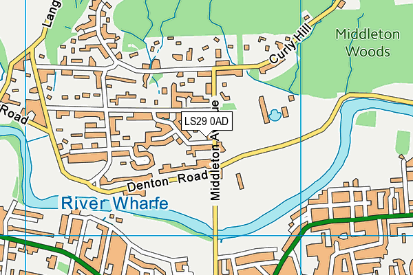
West Holmes Field on a map

West Holmes Field geodata
| Easting | 411578 |
| Northing | 448146 |
| Latitude | 53.929315 |
| Longitude | -1.825161 |
| Local Authority Name | Bradford |
| Local Authority Code | E08000032 |
| Parliamentary Constituency Name | Keighley |
| Parliamentary Constituency Code | E14000766 |
| Region Name | Yorkshire and the Humber |
| Region Code | E15000003 |
| Ward Name | Ilkley |
| Ward Code | E05001354 |
| Output Area Code | E00053958 |
About this data
This data is open data sourced from Active Places Power and licenced under the Active Places Open Data Licence.
| Created On | 26th Oct 2007 |
| Audited On | 12th Jul 2022 |
| Checked On | 12th Jul 2022 |
