The Tew Centre - Great Tew
The Tew Centre is located in Great Tew, Chipping Norton (OX7), and offers Grass Pitches.
| Address | THE TEW CENTRE, Ledwell Road, Great Tew, Chipping Norton, OX7 4AG |
| Car Park | Yes |
| Car Park Capacity | 20 |
| Management Type | Sport Club |
| Management Group | Others |
| Owner Type | Other |
| Owner Group | Others |
| Education Phase | Not applicable |
Aliases
The Tew Centre is also known as:
- Great And Little Tew Cricket Club
- Great Tew Athletic Fc
Facilities
| Accessibility | Sports Club / Community Association |
| Management Type | Sport Club |
| Changing Rooms | Yes |
| Date Record Created | 15th Aug 2017 |
| Date Record Checked | 18th Apr 2023 |
| Opening Times | Dawn To Dusk |
Facility specifics
Disabled access
| Disabled Access | Yes |
| Finding/Reaching Entrance | Yes |
| Reception Area | Yes |
| Doorways | Yes |
| Activity Areas | Yes |
| Disabled Toilets | Yes |
| Social Areas | Yes |
| Spectator Areas | Yes |
| Emergency Exits | Yes |
| Accessibility | Private Use |
| Management Type | Sport Club |
| Changing Rooms | Yes |
| Date Record Created | 12th Aug 2021 |
| Date Record Checked | 18th Apr 2023 |
| Opening Times | Dawn To Dusk |
Facility specifics
Disabled access
| Disabled Access | Yes |
| Finding/Reaching Entrance | Yes |
| Reception Area | Yes |
| Doorways | Yes |
| Activity Areas | Yes |
| Disabled Toilets | Yes |
| Social Areas | Yes |
| Spectator Areas | Yes |
| Emergency Exits | Yes |
Contact
Disabled access
Disabled access for The Tew Centre
| Disabled Access | Yes |
| Finding/Reaching Entrance | Yes |
| Reception Area | Yes |
| Doorways | Yes |
| Activity Areas | Yes |
| Disabled Toilets | Yes |
| Social Areas | Yes |
| Spectator Areas | Yes |
| Emergency Exits | Yes |
Where is The Tew Centre?
8192:htmlspecialchars(): Passing null to parameter #1 ($string) of type string is deprecated
| Sub Building Name | |
| Building Name | THE TEW CENTRE |
| Building Number | 0 |
8192:htmlspecialchars(): Passing null to parameter #1 ($string) of type string is deprecated
| Dependent Thoroughfare | |
| Thoroughfare Name | LEDWELL ROAD |
8192:htmlspecialchars(): Passing null to parameter #1 ($string) of type string is deprecated
| Double Dependent Locality | |
| Dependent Locality | GREAT TEW |
| PostTown | CHIPPING NORTON |
| Postcode | OX7 4AG |
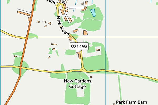
The Tew Centre on a map

The Tew Centre geodata
| Easting | 439514.41 |
| Northing | 228784.52 |
| Latitude | 51.95615 |
| Longitude | -1.426397 |
| Local Authority Name | West Oxfordshire |
| Local Authority Code | E07000181 |
| Parliamentary Constituency Name | Witney |
| Parliamentary Constituency Code | E14001046 |
| Region Name | South East |
| Region Code | E15000008 |
| Ward Name | Kingham, Rollright and Enstone |
| Ward Code | E05006642 |
| Output Area Code | E00146667 |
About this data
This data is open data sourced from Active Places Power and licenced under the Active Places Open Data Licence.
| toid | osgb1000002494386127 |
| Created On | 15th Aug 2017 |
| Audited On | 18th Apr 2023 |
| Checked On | 18th Apr 2023 |
