St Thomas More Rc Language College - London
St Thomas More Rc Language College is located in London (SW3), and offers Sports Hall.
| Address | Cadogan Street, London, SW3 2QS |
| Car Park | Yes |
| Car Park Capacity | 10 |
| Management Type | School/College/University (in house) |
| Management Group | Education |
| Owner Type | Voluntary Aided School |
| Owner Group | Education |
| Education Phase | Secondary |
Facilities
| Accessibility | Sports Club / Community Association |
| Management Type | School/College/University (in house) |
| Year Built | 1960 |
| Changing Rooms | Yes |
| Date Record Checked | 14th Apr 2023 |
Opening times
| Access description | Private Use |
|---|
| Opening time | 08:45 |
| Closing time | 17:00 |
| Period open for | Monday-Friday |
| |
| Access description | Sports Club / Community Association |
|---|
| Opening time | 17:00 |
| Closing time | 21:00 |
| Period open for | Monday-Friday |
| |
| Access description | Sports Club / Community Association |
|---|
| Opening time | 09:00 |
| Closing time | 17:00 |
| Period open for | Weekend |
Facility specifics
| Area | 306m² |
| Floor Matting | Don't Know |
| Gymnastics Trampoline Use | Don't Know |
| Length | 18m |
| Moveable Balance Apparatus | Don't Know |
| Moveable Large Apparatus | Don't Know |
| Moveable Rebound Apparatus | Don't Know |
| Moveable Trampolines | Don't Know |
| Width | 17m |
| Small Apparatus | Don't Know |
| Swinging and Hanging Apparatus | Don't Know |
Disabled access
| Disabled Access | Yes |
| Finding/Reaching Entrance | Yes |
| Doorways | Yes |
| Activity Areas | Yes |
| Emergency Exits | Yes |
Contact
Disabled access
Disabled access for St Thomas More Rc Language College
| Disabled Access | Yes |
| Finding/Reaching Entrance | Yes |
| Doorways | Yes |
| Activity Areas | Yes |
| Disabled Toilets | Yes |
| Emergency Exits | Yes |
Where is St Thomas More Rc Language College?
8192:htmlspecialchars(): Passing null to parameter #1 ($string) of type string is deprecated
| Sub Building Name | |
8192:htmlspecialchars(): Passing null to parameter #1 ($string) of type string is deprecated
| Building Name | |
| Building Number | 0 |
8192:htmlspecialchars(): Passing null to parameter #1 ($string) of type string is deprecated
| Dependent Thoroughfare | |
| Thoroughfare Name | CADOGAN STREET |
8192:htmlspecialchars(): Passing null to parameter #1 ($string) of type string is deprecated
| Double Dependent Locality | |
8192:htmlspecialchars(): Passing null to parameter #1 ($string) of type string is deprecated
| Dependent Locality | |
| PostTown | LONDON |
| Postcode | SW3 2QS |
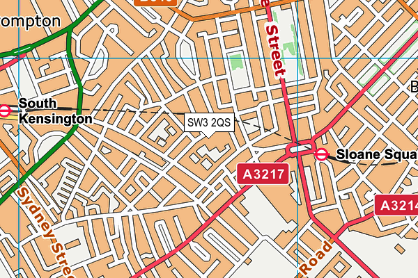
St Thomas More Rc Language College on a map

St Thomas More Rc Language College geodata
| Easting | 527684 |
| Northing | 178707 |
| Latitude | 51.492898 |
| Longitude | -0.162172 |
| Local Authority Name | Kensington and Chelsea |
| Local Authority Code | E09000020 |
| Parliamentary Constituency Name | Chelsea and Fulham |
| Parliamentary Constituency Code | E14000629 |
| Region Name | London |
| Region Code | E15000007 |
| Ward Name | Royal Hospital |
| Ward Code | E05009403 |
| Output Area Code | E00014337 |
About this data
This data is open data sourced from Active Places Power and licenced under the Active Places Open Data Licence.
| toid | osgb1000042191358 |
| Created On | 19th Jul 2004 |
| Audited On | 14th Apr 2023 |
| Checked On | 14th Apr 2023 |
