Newbiggin Colliery Welfare (Closed) - Newbiggin-by-the-sea
Newbiggin Colliery Welfare (Closed) is located in Newbiggin-by-the-sea (NE64).
| Address | Cleveland Avenue, Newbiggin-by-the-sea, NE64 6RQ |
| Car Park | Yes |
| Car Park Capacity | 10 |
| Management Type | Local Authority (in house) |
| Management Group | Local Authority |
| Owner Type | Local Authority |
| Owner Group | Local Authority |
| Education Phase | Not Known |
| Closure Date | 9th Nov 2015 |
| Closure Reason | Strategic Review - facility/site not being replaced |
Facilities
| Closure Date | 9th Nov 2015 |
| Closure Reason | Strategic Review - facility/site not being replaced |
| Accessibility | Pay and Play |
| Management Type | Local Authority (in house) |
| Changing Rooms | No |
| Date Record Checked | 9th Nov 2015 |
| Opening Times | Dawn To Dusk |
Facility specifics
| Closure Date | 9th Nov 2015 |
| Closure Reason | Strategic Review - facility/site not being replaced |
| Accessibility | Pay and Play |
| Management Type | Not Known |
| Changing Rooms | Yes |
| Date Record Checked | 9th Nov 2015 |
| Opening Times | Detailed Timings |
Facility specifics
Contact
Where is Newbiggin Colliery Welfare (Closed)?
| Sub Building Name | |
| Building Name | |
| Building Number | 0 |
| Dependent Thoroughfare | |
| Thoroughfare Name | Cleveland Avenue |
| Double Dependent Locality | |
| Dependent Locality | |
| PostTown | Newbiggin-by-the-Sea |
| Postcode | NE64 6RQ |
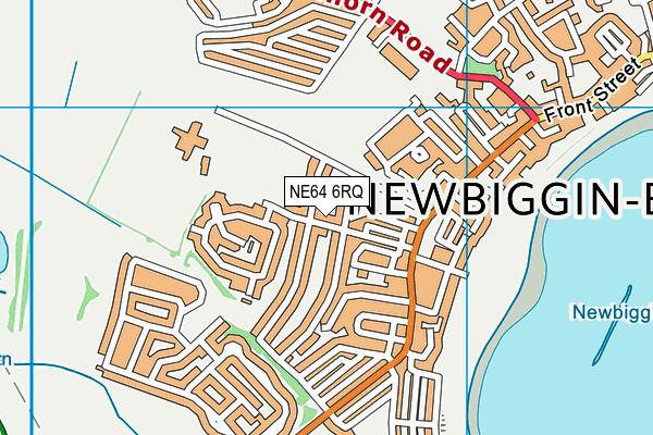
Newbiggin Colliery Welfare (Closed) on a map

Newbiggin Colliery Welfare (Closed) geodata
| Easting | 430483 |
| Northing | 587872 |
| Latitude | 55.184201 |
| Longitude | -1.522827 |
| Local Authority Name | Northumberland |
| Local Authority Code | E06000057 |
| Parliamentary Constituency Name | Wansbeck |
| Parliamentary Constituency Code | E14001014 |
| Region Name | North East |
| Region Code | E15000001 |
| Ward Name | Seaton with Newbiggin West |
| Ward Code | E05009149 |
| Output Area Code | E00140196 |
About this data
This data is open data sourced from Active Places Power and licenced under the Active Places Open Data Licence.
| Created On | 22nd Aug 2007 |
| Audited On | 26th Jan 2015 |
| Checked On | 12th Nov 2014 |
