Hmp Long Lartin - South Littleton
Hmp Long Lartin is located in South Littleton, Evesham (WR11), and offers Health and Fitness Gym, and Artificial Grass Pitch.
| Address | South Littleton, Evesham, WR11 8TZ |
| Management Type | Other |
| Management Group | Others |
| Owner Type | Government |
| Owner Group | Others |
| Education Phase | Not applicable |
Facilities
| Accessibility | Private Use |
| Management Type | Other |
| Year Built | 1995 |
| Changing Rooms | Yes |
| Date Record Checked | 25th Apr 2023 |
Opening times
| Access description | Private Use |
|---|
| Opening time | 09:00 |
| Closing time | 21:00 |
| Period open for | Every day |
Facility specifics
Disabled access
| Disabled Access | Yes |
| Finding/Reaching Entrance | Yes |
| Reception Area | Yes |
| Doorways | Yes |
| Disabled Changing Facilities | Yes |
| Activity Areas | Yes |
| Disabled Toilets | Yes |
| Emergency Exits | Yes |
| Accessibility | Private Use |
| Management Type | Other |
| Year Built | 2008 |
| Changing Rooms | Yes |
| Date Record Checked | 25th Apr 2023 |
| Opening Times | Dawn To Dusk |
Facility specifics
| Area | 600m² |
| Fill | Yes - Rubber |
| Floodlit | No |
| Indoor | No |
| Length | 30m |
| Pile Length | 30mm |
| Width | 20m |
| WR22 Compliant Pitch | No |
Disabled access
| Disabled Access | Yes |
| Finding/Reaching Entrance | Yes |
| Reception Area | Yes |
| Doorways | Yes |
| Disabled Changing Facilities | Yes |
| Activity Areas | Yes |
| Disabled Toilets | Yes |
| Emergency Exits | Yes |
Contact
Disabled access
Disabled access for Hmp Long Lartin
| Disabled Access | Yes |
| Finding/Reaching Entrance | Yes |
| Reception Area | Yes |
| Doorways | Yes |
| Disabled Changing Facilities | Yes |
| Activity Areas | Yes |
| Disabled Toilets | Yes |
| Emergency Exits | Yes |
Where is Hmp Long Lartin?
8192:htmlspecialchars(): Passing null to parameter #1 ($string) of type string is deprecated
| Sub Building Name | |
8192:htmlspecialchars(): Passing null to parameter #1 ($string) of type string is deprecated
| Building Name | |
| Building Number | 0 |
8192:htmlspecialchars(): Passing null to parameter #1 ($string) of type string is deprecated
| Dependent Thoroughfare | |
8192:htmlspecialchars(): Passing null to parameter #1 ($string) of type string is deprecated
| Thoroughfare Name | |
8192:htmlspecialchars(): Passing null to parameter #1 ($string) of type string is deprecated
| Double Dependent Locality | |
| Dependent Locality | SOUTH LITTLETON |
| PostTown | EVESHAM |
| Postcode | WR11 8TZ |
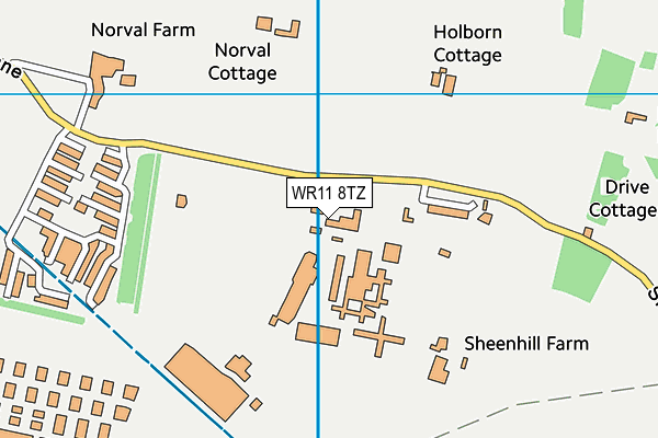
Hmp Long Lartin on a map

Hmp Long Lartin geodata
| Easting | 410028.1 |
| Northing | 245711.7 |
| Latitude | 52.109644 |
| Longitude | -1.854986 |
| Local Authority Name | Wychavon |
| Local Authority Code | E07000238 |
| Parliamentary Constituency Name | Mid Worcestershire |
| Parliamentary Constituency Code | E14000818 |
| Region Name | West Midlands |
| Region Code | E15000005 |
| Ward Name | The Littletons |
| Ward Code | E05007925 |
| Output Area Code | E00171600 |
About this data
This data is open data sourced from Active Places Power and licenced under the Active Places Open Data Licence.
| toid | osgb1000021132972 |
| Created On | 27th Jul 2007 |
| Audited On | 25th Apr 2023 |
| Checked On | 25th Apr 2023 |
