Easygym (London Park Royal) (Closed) - North Circular Road
Easygym (London Park Royal) (Closed) is located in North Circular Road, London (NW10).
| Address | HAMILTON HOUSE, North Circular Road, North Circular Road, London, NW10 7XP |
| Management Type | Commercial Management |
| Management Group | Commercial |
| Owner Type | Commercial |
| Owner Group | Commercial |
| Education Phase | Not applicable |
| Closure Date | 29th Oct 2020 |
| Closure Reason | Strategic Review - facility/site not being replaced |
Facilities
| Closure Date | 29th Oct 2020 |
| Closure Reason | Strategic Review - facility/site not being replaced |
| Accessibility | Registered Membership use |
| Management Type | Commercial Management |
| Year Built | 2019 |
| Changing Rooms | Yes |
| Date Record Created | 6th Mar 2020 |
| Date Record Checked | 14th Sep 2021 |
Opening times
| Access description | Registered Membership use |
|---|
| Opening time | 07:00 |
| Closing time | 23:00 |
| Period open for | Monday-Friday |
| |
| Access description | Registered Membership use |
|---|
| Opening time | 07:00 |
| Closing time | 23:00 |
| Period open for | Saturday |
| |
| Access description | Registered Membership use |
|---|
| Opening time | 08:00 |
| Closing time | 20:00 |
| Period open for | Sunday |
Facility specifics
Disabled access
| Disabled Access | Yes |
| Finding/Reaching Entrance | Yes |
| Reception Area | Yes |
| Doorways | Yes |
| Disabled Changing Facilities | Yes |
| Activity Areas | Yes |
| Disabled Toilets | Yes |
| Emergency Exits | Yes |
Contact
Disabled access
Disabled access for Easygym (London Park Royal) (Closed)
| Disabled Access | Yes |
| Finding/Reaching Entrance | Yes |
| Reception Area | Yes |
| Doorways | Yes |
| Disabled Changing Facilities | Yes |
| Activity Areas | Yes |
| Disabled Toilets | Yes |
| Emergency Exits | Yes |
Where is Easygym (London Park Royal) (Closed)?
8192:htmlspecialchars(): Passing null to parameter #1 ($string) of type string is deprecated
| Sub Building Name | |
| Building Name | HAMILTON HOUSE |
| Building Number | 0 |
8192:htmlspecialchars(): Passing null to parameter #1 ($string) of type string is deprecated
| Dependent Thoroughfare | |
| Thoroughfare Name | NORTH CIRCULAR ROAD |
| Double Dependent Locality | NORTH CIRCULAR ROAD |
8192:htmlspecialchars(): Passing null to parameter #1 ($string) of type string is deprecated
| Dependent Locality | |
| PostTown | LONDON |
| Postcode | NW10 7XP |
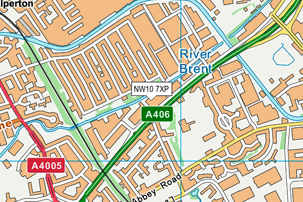
Easygym (London Park Royal) (Closed) on a map

Easygym (London Park Royal) (Closed) geodata
| Easting | 518897.5 |
| Northing | 183306.07 |
| Latitude | 51.536146 |
| Longitude | -0.287124 |
| Local Authority Name | Ealing |
| Local Authority Code | E09000009 |
| Parliamentary Constituency Name | Ealing Central and Acton |
| Parliamentary Constituency Code | E14000674 |
| Region Name | London |
| Region Code | E15000007 |
| Ward Name | Hanger Hill |
| Ward Code | E05013524 |
| Output Area Code | E00006375 |
About this data
This data is open data sourced from Active Places Power and licenced under the Active Places Open Data Licence.
| Created On | 6th Mar 2020 |
| Audited On | 28th Apr 2021 |
| Checked On | 28th Apr 2021 |
