Clockface Miners Welfare And Recreation Club - Clock Face
Clockface Miners Welfare And Recreation Club is located in Clock Face, St. Helens (WA9), and offers Grass Pitches.
| Address | Crawford Street, Clock Face, St. Helens, WA9 4XL |
| Car Park | Yes |
| Car Park Capacity | 30 |
| Management Type | Sport Club |
| Management Group | Others |
| Owner Type | Sports Club |
| Owner Group | Sports Club |
| Education Phase | Not applicable |
Facilities
| Accessibility | Sports Club / Community Association |
| Management Type | Sport Club |
| Year Refurbished | 2015 |
| Changing Rooms | Yes |
| Date Record Checked | 4th Apr 2023 |
| Opening Times | Dawn To Dusk |
Facility specifics
Disabled access
| Disabled Access | Yes |
| Disabled Parking | Yes |
| Finding/Reaching Entrance | Yes |
| Doorways | Yes |
| Activity Areas | Yes |
| Disabled Toilets | Yes |
| Social Areas | Yes |
| Emergency Exits | Yes |
Contact
| Contact Type | Enquiries |
| Telephone | 01744 812291 |
8192:str_replace(): Passing null to parameter #3 ($subject) of type array|string is deprecated
Disabled access
Disabled access for Clockface Miners Welfare And Recreation Club
| Disabled Access | Yes |
| Disabled Parking | Yes |
| Finding/Reaching Entrance | Yes |
| Doorways | Yes |
| Activity Areas | Yes |
| Disabled Toilets | Yes |
| Social Areas | Yes |
| Emergency Exits | Yes |
Where is Clockface Miners Welfare And Recreation Club?
8192:htmlspecialchars(): Passing null to parameter #1 ($string) of type string is deprecated
| Sub Building Name | |
8192:htmlspecialchars(): Passing null to parameter #1 ($string) of type string is deprecated
| Building Name | |
| Building Number | 0 |
8192:htmlspecialchars(): Passing null to parameter #1 ($string) of type string is deprecated
| Dependent Thoroughfare | |
| Thoroughfare Name | CRAWFORD STREET |
8192:htmlspecialchars(): Passing null to parameter #1 ($string) of type string is deprecated
| Double Dependent Locality | |
| Dependent Locality | CLOCK FACE |
| PostTown | ST. HELENS |
| Postcode | WA9 4XL |
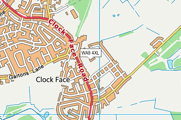
Clockface Miners Welfare And Recreation Club on a map

Clockface Miners Welfare And Recreation Club geodata
| Easting | 352926.5 |
| Northing | 391452.7 |
| Latitude | 53.417764 |
| Longitude | -2.70974 |
| Local Authority Name | St. Helens |
| Local Authority Code | E08000013 |
| Parliamentary Constituency Name | St Helens South and Whiston |
| Parliamentary Constituency Code | E14000963 |
| Region Name | North West |
| Region Code | E15000002 |
| Ward Name | Bold & Lea Green |
| Ward Code | E05014122 |
| Output Area Code | E00034980 |
About this data
This data is open data sourced from Active Places Power and licenced under the Active Places Open Data Licence.
| toid | osgb1000035708518 |
| Created On | 16th Nov 2006 |
| Audited On | 4th Apr 2023 |
| Checked On | 4th Apr 2023 |
