Cheadle Town End (Closed) - Dilhorne
Cheadle Town End (Closed) is located in Dilhorne, Stoke-on-trent (ST10).
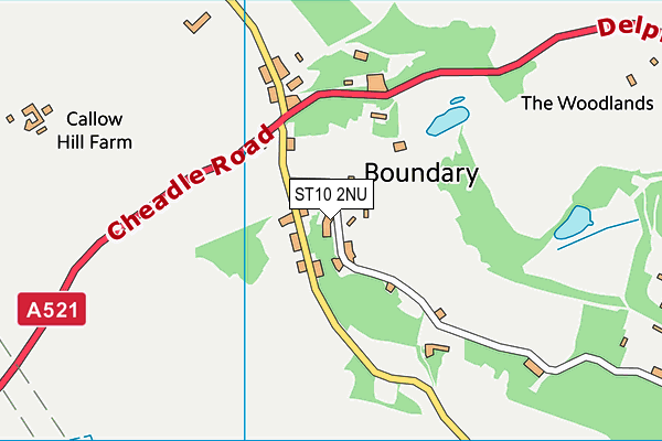
| Address | The Common, Dilhorne, Stoke-on-trent, ST10 2NU |
| Management Type | Sport Club |
| Management Group | Others |
| Owner Type | Sports Club |
| Owner Group | Sports Club |
| Education Phase | Not applicable |
| Closure Date | 1st Aug 2016 |
| Closure Reason | Strategic Review - facility/site not being replaced |
Facilities
| Closure Date | 1st Aug 2016 |
| Closure Reason | Strategic Review - facility/site not being replaced |
| Accessibility | Sports Club / Community Association |
| Management Type | Sport Club |
| Changing Rooms | Yes |
| Date Record Created | 8th Mar 2017 |
| Date Record Checked | 1st Aug 2018 |
| Opening Times | Dawn To Dusk |
Facility specifics
Contact
| Contact Type | Enquiries |
| Telephone | 07971 641168 |
8192:str_replace(): Passing null to parameter #3 ($subject) of type array|string is deprecated
Where is Cheadle Town End (Closed)?
8192:htmlspecialchars(): Passing null to parameter #1 ($string) of type string is deprecated
| Sub Building Name | |
8192:htmlspecialchars(): Passing null to parameter #1 ($string) of type string is deprecated
| Building Name | |
| Building Number | 0 |
8192:htmlspecialchars(): Passing null to parameter #1 ($string) of type string is deprecated
| Dependent Thoroughfare | |
| Thoroughfare Name | THE COMMON |
8192:htmlspecialchars(): Passing null to parameter #1 ($string) of type string is deprecated
| Double Dependent Locality | |
| Dependent Locality | DILHORNE |
| PostTown | STOKE-ON-TRENT |
| Postcode | ST10 2NU |
Cheadle Town End (Closed) on a map

Cheadle Town End (Closed) geodata
| Easting | 397834.48 |
| Northing | 343235.3 |
| Latitude | 52.986451 |
| Longitude | -2.033705 |
| Local Authority Name | Staffordshire Moorlands |
| Local Authority Code | E07000198 |
| Parliamentary Constituency Name | Staffordshire Moorlands |
| Parliamentary Constituency Code | E14000966 |
| Region Name | West Midlands |
| Region Code | E15000005 |
| Ward Name | Caverswall |
| Ward Code | E05007047 |
| Output Area Code | E00151736 |
About this data
This data is open data sourced from Active Places Power and licenced under the Active Places Open Data Licence.
| toid | osgb1000025016555 |
| Created On | 8th Mar 2017 |
| Audited On | 8th Mar 2017 |
| Checked On | 7th Mar 2018 |
