Bunbury Jubilee Playing Field
Bunbury Jubilee Playing Field is located in Bunbury (CW6), and offers Grass Pitches, and Outdoor Tennis Courts.
| Address | BUNBURY PLAYING FIELDS, Hurst Close, Bunbury, CW6 9PZ |
| Car Park | Yes |
| Car Park Capacity | 30 |
| Management Type | School/College/University (in house) |
| Management Group | Education |
| Owner Type | Local Authority |
| Owner Group | Local Authority |
| Education Phase | Not applicable |
Facilities
| Accessibility | Sports Club / Community Association |
| Management Type | School/College/University (in house) |
| Changing Rooms | Yes |
| Date Record Created | 5th May 2016 |
| Date Record Checked | 7th Sep 2023 |
| Opening Times | Dawn To Dusk |
Facility specifics
| Accessibility | Sports Club / Community Association |
| Management Type | Local Authority (in house) |
| Changing Rooms | Yes |
| Date Record Created | 5th May 2016 |
| Date Record Checked | 7th Sep 2023 |
| Opening Times | Dawn To Dusk |
Facility specifics
| Accessibility | Sports Club / Community Association |
| Management Type | Local Authority (in house) |
| Changing Rooms | Yes |
| Date Record Created | 5th May 2016 |
| Date Record Checked | 7th Sep 2023 |
| Opening Times | Dawn To Dusk |
Facility specifics
| Accessibility | Sports Club / Community Association |
| Management Type | Local Authority (in house) |
| Year Built | 1990 |
| Year Refurbished | 2022 |
| Changing Rooms | Yes |
| Date Record Created | 5th May 2016 |
| Date Record Checked | 7th Sep 2023 |
| Opening Times | Dawn To Dusk |
Facility specifics
| Floodlit | Yes |
| Overmarked | No |
| Surface Type | Macadam |
Contact
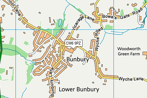
Where is Bunbury Jubilee Playing Field?
8192:htmlspecialchars(): Passing null to parameter #1 ($string) of type string is deprecated
| Sub Building Name | |
| Building Name | BUNBURY PLAYING FIELDS |
| Building Number | 0 |
8192:htmlspecialchars(): Passing null to parameter #1 ($string) of type string is deprecated
| Dependent Thoroughfare | |
| Thoroughfare Name | HURST CLOSE |
8192:htmlspecialchars(): Passing null to parameter #1 ($string) of type string is deprecated
| Double Dependent Locality | |
8192:htmlspecialchars(): Passing null to parameter #1 ($string) of type string is deprecated
| Dependent Locality | |
| PostTown | BUNBURY |
| Postcode | CW6 9PZ |
Bunbury Jubilee Playing Field on a map

Bunbury Jubilee Playing Field geodata
| Easting | 356609.25 |
| Northing | 357715.96 |
| Latitude | 53.114849 |
| Longitude | -2.649718 |
| Local Authority Name | Cheshire East |
| Local Authority Code | E06000049 |
| Parliamentary Constituency Name | Eddisbury |
| Parliamentary Constituency Code | E14000686 |
| Region Name | North West |
| Region Code | E15000002 |
| Ward Name | Bunbury |
| Ward Code | E05008616 |
| Output Area Code | E00093141 |
About this data
This data is open data sourced from Active Places Power and licenced under the Active Places Open Data Licence.
| toid | osgb1000000255099694 |
| Created On | 5th May 2016 |
| Audited On | 7th Sep 2023 |
| Checked On | 7th Sep 2023 |
