Brunel Way Pump Track
Brunel Way Pump Track is located in Brunel Way, Bristol (BS3), and offers Cycling.
| Address | Brunel Way, Brunel Way, Bristol, BS3 2LE |
| Management Type | Local Authority (in house) |
| Management Group | Local Authority |
| Owner Type | Local Authority |
| Owner Group | Local Authority |
| Education Phase | Not applicable |
Facilities
| Accessibility | Free Public Access |
| Management Type | Local Authority (in house) |
| Year Built | 2010 |
| Year Refurbished | 2016 |
| Changing Rooms | No |
| Date Record Created | 10th Aug 2021 |
| Date Record Checked | 11th Oct 2022 |
| Opening Times | Dawn To Dusk |
Facility specifics
| Automatic Start Gate | No |
| Floodlit | No |
| Overall Width | 2m |
| Start Gate | No |
| Surface | Macadam |
| Total Length | 100m |
Contact
| Contact Type | Enquiries |
| Telephone | 00000 000000 |
8192:str_replace(): Passing null to parameter #3 ($subject) of type array|string is deprecated
Where is Brunel Way Pump Track?
8192:htmlspecialchars(): Passing null to parameter #1 ($string) of type string is deprecated
| Sub Building Name | |
8192:htmlspecialchars(): Passing null to parameter #1 ($string) of type string is deprecated
| Building Name | |
| Building Number | 0 |
8192:htmlspecialchars(): Passing null to parameter #1 ($string) of type string is deprecated
| Dependent Thoroughfare | |
| Thoroughfare Name | BRUNEL WAY |
| Double Dependent Locality | BRUNEL WAY |
8192:htmlspecialchars(): Passing null to parameter #1 ($string) of type string is deprecated
| Dependent Locality | |
| PostTown | BRISTOL |
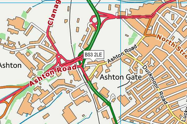
| Postcode | BS3 2LE |
Brunel Way Pump Track on a map

Brunel Way Pump Track geodata
| Easting | 356701.21 |
| Northing | 172068.09 |
| Latitude | 51.445936 |
| Longitude | -2.624425 |
| Local Authority Name | Bristol, City of |
| Local Authority Code | E06000023 |
| Parliamentary Constituency Name | Bristol South |
| Parliamentary Constituency Code | E14000601 |
| Region Name | South West |
| Region Code | E15000009 |
| Ward Name | Bedminster |
| Ward Code | E05010887 |
| Output Area Code | E00074249 |
About this data
This data is open data sourced from Active Places Power and licenced under the Active Places Open Data Licence.
| Created On | 10th Aug 2021 |
| Audited On | 11th Oct 2022 |
| Checked On | 11th Oct 2022 |
