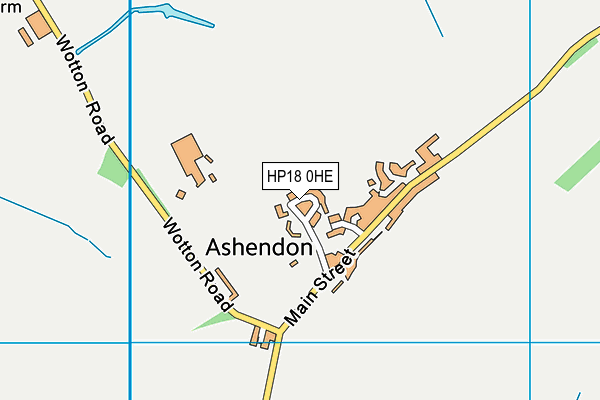
Ashendon Playing Fields
Ashendon Playing Fields is located in Ashendon, Aylesbury (HP18), and offers Grass Pitches.
| Address | Lower End, Ashendon, Aylesbury, HP18 0HE |
| Car Park | Yes |
| Car Park Capacity | 20 |
| Management Type | Community Organisation |
| Management Group | Others |
| Owner Type | Community Organisation |
| Owner Group | Community Organisation |
| Education Phase | Not applicable |
| Start Date | 19th May 2016 |
Facilities
| Status Notes | Facilities are available but there are no formal classes/sessions at present. Various locals run groups throughout the year on a voluntary basis i.e school holiday sessions |
| Accessibility | Free Public Access |
| Management Type | Community Organisation |
| Year Built | 1959 |
| Year Refurbished | 2008 |
| Changing Rooms | Yes |
| Year Changing Rooms Refurbished | 2008 |
| Date Record Checked | 7th Oct 2022 |
| Opening Times | Dawn To Dusk |
Facility specifics
Disabled access
| Disabled Access | Yes |
| Disabled Parking | Yes |
| Finding/Reaching Entrance | Yes |
| Reception Area | Yes |
| Doorways | Yes |
| Disabled Changing Facilities | Yes |
| Activity Areas | Yes |
| Disabled Toilets | Yes |
| Social Areas | Yes |
| Spectator Areas | Yes |
| Emergency Exits | Yes |
| Notes | Equipped on a minimal basis currently |
Contact
Disabled access
Disabled access for Ashendon Playing Fields
| Disabled Access | Yes |
| Disabled Parking | Yes |
| Finding/Reaching Entrance | Yes |
| Reception Area | Yes |
| Doorways | Yes |
| Disabled Changing Facilities | Yes |
| Activity Areas | Yes |
| Disabled Toilets | Yes |
| Social Areas | Yes |
| Spectator Areas | Yes |
| Emergency Exits | Yes |
| Notes | Easy access from the car park to the pavilion via the play equipment & to the Multi Use Games Area |
Where is Ashendon Playing Fields?
| Sub Building Name | |
| Building Name | |
| Building Number | 0 |
| Dependent Thoroughfare | |
| Thoroughfare Name | Lower End |
| Double Dependent Locality | |
| Dependent Locality | Ashendon |
| PostTown | Aylesbury |
| Postcode | HP18 0HE |
Ashendon Playing Fields on a map

Ashendon Playing Fields geodata
| Easting | 470396.59 |
| Northing | 214162.33 |
| Latitude | 51.82166 |
| Longitude | -0.980041 |
| Local Authority Name | Buckinghamshire |
| Local Authority Code | E06000060 |
| Parliamentary Constituency Name | Buckingham |
| Parliamentary Constituency Code | E14000608 |
| Region Name | South East |
| Region Code | E15000008 |
| Ward Name | Stone and Waddesdon |
| Ward Code | E05013159 |
| Output Area Code | E00089411 |
About this data
This data is open data sourced from Active Places Power and licenced under the Active Places Open Data Licence.
| Created On | 16th Nov 2006 |
| Audited On | 7th Oct 2022 |
| Checked On | 2nd Oct 2023 |
