YO8 9TS maps, stats, and open data
YO8 9TS is located in the Thorpe Willoughby & Hambleton electoral ward, within the unitary authority of North Yorkshire and the English Parliamentary constituency of Selby and Ainsty. The Sub Integrated Care Board (ICB) Location is NHS Humber and North Yorkshire ICB - 03Q and the police force is North Yorkshire. This postcode has been in use since October 2017.
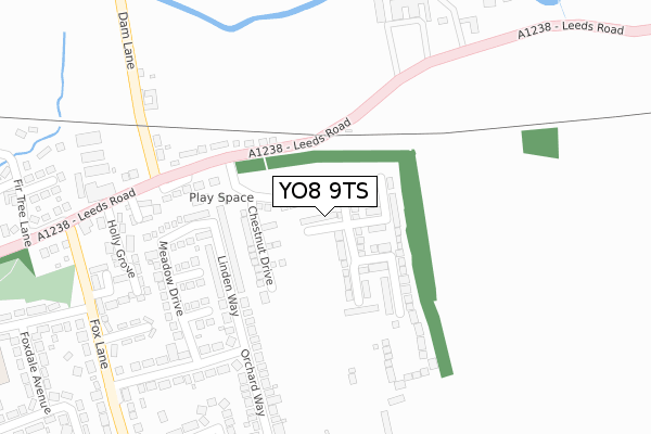
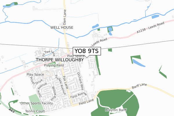
YO8 9TS maps


Licence: Open Government Licence (requires attribution)
Attribution: Contains OS data © Crown copyright and database right 2025
Source: Open Postcode Geo
Licence: Open Government Licence (requires attribution)
Attribution: Contains OS data © Crown copyright and database right 2025; Contains Royal Mail data © Royal Mail copyright and database right 2025; Source: Office for National Statistics licensed under the Open Government Licence v.3.0
YO8 9TS geodata
| Easting | 458070 |
| Northing | 431115 |
| Latitude | 53.773164 |
| Longitude | -1.120389 |
Where is YO8 9TS?
| Country | England |
| Postcode District | YO8 |
Politics
| Ward | Thorpe Willoughby & Hambleton |
|---|---|
| Constituency | Selby And Ainsty |
House Prices
Sales of detached houses in YO8 9TS
2023 14 SEP £320,000 |
26, BAY STREET, THORPE WILLOUGHBY, SELBY, YO8 9TS 2022 30 JUN £284,995 |
24, BAY STREET, THORPE WILLOUGHBY, SELBY, YO8 9TS 2022 23 MAY £219,995 |
28, BAY STREET, THORPE WILLOUGHBY, SELBY, YO8 9TS 2022 12 MAY £284,995 |
22, BAY STREET, THORPE WILLOUGHBY, SELBY, YO8 9TS 2022 25 MAR £284,995 |
17, BAY STREET, THORPE WILLOUGHBY, SELBY, YO8 9TS 2022 25 FEB £239,995 |
19, BAY STREET, THORPE WILLOUGHBY, SELBY, YO8 9TS 2022 25 FEB £339,995 |
21, BAY STREET, THORPE WILLOUGHBY, SELBY, YO8 9TS 2021 22 DEC £399,995 |
23, BAY STREET, THORPE WILLOUGHBY, SELBY, YO8 9TS 2021 22 DEC £399,995 |
25, BAY STREET, THORPE WILLOUGHBY, SELBY, YO8 9TS 2021 17 DEC £284,995 |
➜ Thorpe Willoughby house prices
Licence: Contains HM Land Registry data © Crown copyright and database right 2025. This data is licensed under the Open Government Licence v3.0.
Transport
Nearest bus stops to YO8 9TS
| Holly Grove (Leeds Road) | Thorpe Willoughby | 364m |
| Francis Court (Fox Lane) | Thorpe Willoughby | 381m |
| Londesborough Grove (Fox Lane) | Thorpe Willoughby | 389m |
| Southlands Farm (Leeds Road) | Thorpe Willoughby | 409m |
| The Fox (Leeds Road) | Thorpe Willoughby | 413m |
Nearest railway stations to YO8 9TS
| Selby Station | 3.9km |
Broadband
Broadband access in YO8 9TS (2020 data)
| Percentage of properties with Next Generation Access | 100.0% |
| Percentage of properties with Superfast Broadband | 100.0% |
| Percentage of properties with Ultrafast Broadband | 90.0% |
| Percentage of properties with Full Fibre Broadband | 90.0% |
Superfast Broadband is between 30Mbps and 300Mbps
Ultrafast Broadband is > 300Mbps
Broadband limitations in YO8 9TS (2020 data)
| Percentage of properties unable to receive 2Mbps | 0.0% |
| Percentage of properties unable to receive 5Mbps | 0.0% |
| Percentage of properties unable to receive 10Mbps | 0.0% |
| Percentage of properties unable to receive 30Mbps | 0.0% |
Deprivation
13.6% of English postcodes are less deprived than YO8 9TS:Food Standards Agency
Three nearest food hygiene ratings to YO8 9TS (metres)


➜ Get more ratings from the Food Standards Agency
Nearest post box to YO8 9TS
| Last Collection | |||
|---|---|---|---|
| Location | Mon-Fri | Sat | Distance |
| Thorpe Willoughby Post Office | 17:00 | 10:50 | 357m |
| Main Road Thorpe Willoughby | 17:00 | 11:45 | 416m |
| Field Lane Thorpe Willoughby | 16:00 | 11:30 | 707m |
YO8 9TS ITL and YO8 9TS LAU
The below table lists the International Territorial Level (ITL) codes (formerly Nomenclature of Territorial Units for Statistics (NUTS) codes) and Local Administrative Units (LAU) codes for YO8 9TS:
| ITL 1 Code | Name |
|---|---|
| TLE | Yorkshire and The Humber |
| ITL 2 Code | Name |
| TLE2 | North Yorkshire |
| ITL 3 Code | Name |
| TLE22 | North Yorkshire CC |
| LAU 1 Code | Name |
| E07000169 | Selby |
YO8 9TS census areas
The below table lists the Census Output Area (OA), Lower Layer Super Output Area (LSOA), and Middle Layer Super Output Area (MSOA) for YO8 9TS:
| Code | Name | |
|---|---|---|
| OA | E00142121 | |
| LSOA | E01027894 | Selby 007D |
| MSOA | E02005815 | Selby 007 |
Nearest postcodes to YO8 9TS
| YO8 9ND | Linden Way | 150m |
| YO8 9PW | Meadow Close | 208m |
| YO8 9PL | Meadow Garth | 210m |
| YO8 9NE | Orchard Way | 221m |
| YO8 9PN | Meadow Drive | 241m |
| YO8 9NB | Orchard Way | 252m |
| YO8 9PQ | North View | 287m |
| YO8 9LT | Leeds Road | 288m |
| YO8 9LS | Leeds Road | 295m |
| YO8 9NF | Sandway Drive | 295m |