YO8 5NG maps, stats, and open data
YO8 5NG is located in the Barlby & Riccall electoral ward, within the unitary authority of North Yorkshire and the English Parliamentary constituency of Selby and Ainsty. The Sub Integrated Care Board (ICB) Location is NHS Humber and North Yorkshire ICB - 03Q and the police force is North Yorkshire. This postcode has been in use since October 2018.
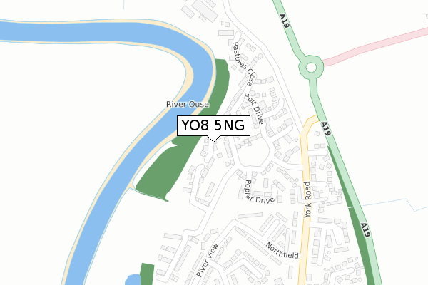
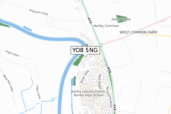
YO8 5NG maps


Licence: Open Government Licence (requires attribution)
Attribution: Contains OS data © Crown copyright and database right 2025
Source: Open Postcode Geo
Licence: Open Government Licence (requires attribution)
Attribution: Contains OS data © Crown copyright and database right 2025; Contains Royal Mail data © Royal Mail copyright and database right 2025; Source: Office for National Statistics licensed under the Open Government Licence v.3.0
YO8 5NG geodata
| Easting | 463165 |
| Northing | 435127 |
| Latitude | 53.808627 |
| Longitude | -1.042274 |
Where is YO8 5NG?
| Country | England |
| Postcode District | YO8 |
Politics
| Ward | Barlby & Riccall |
|---|---|
| Constituency | Selby And Ainsty |
House Prices
Sales of detached houses in YO8 5NG
2025 20 FEB £340,000 |
2023 28 JUN £415,000 |
2021 4 JUN £305,000 |
11, ORCHARD DRIVE, BARLBY, SELBY, YO8 5NG 2019 27 JUN £235,000 |
14, ORCHARD DRIVE, BARLBY, SELBY, YO8 5NG 2019 14 JUN £150,000 |
22, ORCHARD DRIVE, BARLBY, SELBY, YO8 5NG 2019 31 MAY £245,000 |
7, ORCHARD DRIVE, BARLBY, SELBY, YO8 5NG 2019 10 MAY £278,000 |
9, ORCHARD DRIVE, BARLBY, SELBY, YO8 5NG 2019 10 MAY £299,995 |
3, ORCHARD DRIVE, BARLBY, SELBY, YO8 5NG 2019 26 APR £272,995 |
1, ORCHARD DRIVE, BARLBY, SELBY, YO8 5NG 2019 26 APR £253,000 |
Licence: Contains HM Land Registry data © Crown copyright and database right 2025. This data is licensed under the Open Government Licence v3.0.
Transport
Nearest bus stops to YO8 5NG
| Northfield (York Road) | Barlby | 310m |
| Northfield (York Road) | Barlby | 342m |
| Police Station (York Road) | Barlby | 515m |
| Bramley Avenue (York Road) | Barlby | 646m |
| Grove Park (York Road) | Barlby | 734m |
Nearest railway stations to YO8 5NG
| Selby Station | 3.2km |
Broadband
Broadband access in YO8 5NG (2020 data)
| Percentage of properties with Next Generation Access | 100.0% |
| Percentage of properties with Superfast Broadband | 100.0% |
| Percentage of properties with Ultrafast Broadband | 100.0% |
| Percentage of properties with Full Fibre Broadband | 100.0% |
Superfast Broadband is between 30Mbps and 300Mbps
Ultrafast Broadband is > 300Mbps
Broadband limitations in YO8 5NG (2020 data)
| Percentage of properties unable to receive 2Mbps | 0.0% |
| Percentage of properties unable to receive 5Mbps | 0.0% |
| Percentage of properties unable to receive 10Mbps | 0.0% |
| Percentage of properties unable to receive 30Mbps | 0.0% |
Deprivation
37.8% of English postcodes are less deprived than YO8 5NG:Food Standards Agency
Three nearest food hygiene ratings to YO8 5NG (metres)

➜ Get more ratings from the Food Standards Agency
Nearest post box to YO8 5NG
| Last Collection | |||
|---|---|---|---|
| Location | Mon-Fri | Sat | Distance |
| Barlby Village | 18:00 | 11:15 | 344m |
| Barlby Post Office | 17:30 | 11:45 | 926m |
| Highfield Crescent | 18:00 | 11:30 | 1,273m |
YO8 5NG ITL and YO8 5NG LAU
The below table lists the International Territorial Level (ITL) codes (formerly Nomenclature of Territorial Units for Statistics (NUTS) codes) and Local Administrative Units (LAU) codes for YO8 5NG:
| ITL 1 Code | Name |
|---|---|
| TLE | Yorkshire and The Humber |
| ITL 2 Code | Name |
| TLE2 | North Yorkshire |
| ITL 3 Code | Name |
| TLE22 | North Yorkshire CC |
| LAU 1 Code | Name |
| E07000169 | Selby |
YO8 5NG census areas
The below table lists the Census Output Area (OA), Lower Layer Super Output Area (LSOA), and Middle Layer Super Output Area (MSOA) for YO8 5NG:
| Code | Name | |
|---|---|---|
| OA | E00142024 | |
| LSOA | E01027877 | Selby 003B |
| MSOA | E02005811 | Selby 003 |
Nearest postcodes to YO8 5NG
| YO8 5UY | Beech Croft | 252m |
| YO8 5JY | York Road | 256m |
| YO8 5JS | Northfield | 264m |
| YO8 5UX | Turnhead Court | 283m |
| YO8 5LH | Derwent Drive | 298m |
| YO8 5JT | River View | 319m |
| YO8 5JX | Turnhead Crescent | 352m |
| YO8 5JU | River Close | 361m |
| YO8 5JR | West View Mount | 388m |
| YO8 5XG | Kings Close | 404m |