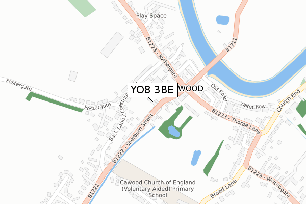
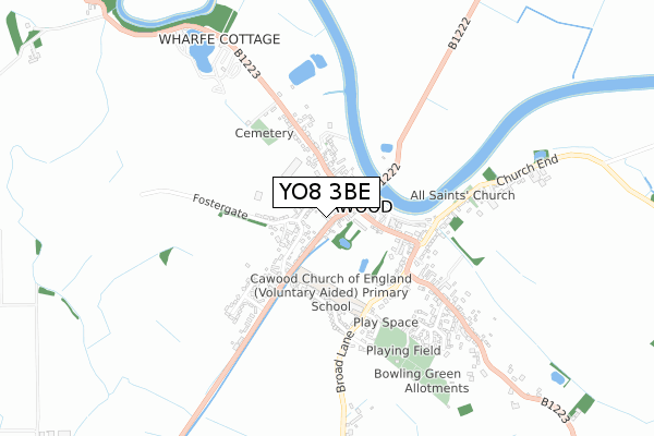
YO8 3BE is located in the Cawood & Escrick electoral ward, within the unitary authority of North Yorkshire and the English Parliamentary constituency of Selby and Ainsty. The Sub Integrated Care Board (ICB) Location is NHS Humber and North Yorkshire ICB - 03Q and the police force is North Yorkshire. This postcode has been in use since February 2019.


GetTheData
Source: OS Open Zoomstack (Ordnance Survey)
Licence: Open Government Licence (requires attribution)
Attribution: Contains OS data © Crown copyright and database right 2025
Source: Open Postcode Geo
Licence: Open Government Licence (requires attribution)
Attribution: Contains OS data © Crown copyright and database right 2025; Contains Royal Mail data © Royal Mail copyright and database right 2025; Source: Office for National Statistics licensed under the Open Government Licence v.3.0
| Easting | 457272 |
| Northing | 437719 |
| Latitude | 53.832601 |
| Longitude | -1.131271 |
GetTheData
Source: Open Postcode Geo
Licence: Open Government Licence
| Country | England |
| Postcode District | YO8 |
➜ See where YO8 is on a map ➜ Where is Cawood? | |
GetTheData
Source: Land Registry Price Paid Data
Licence: Open Government Licence
| Ward | Cawood & Escrick |
| Constituency | Selby And Ainsty |
GetTheData
Source: ONS Postcode Database
Licence: Open Government Licence
| Castle Gatehouse (Thorpe Lane) | Cawood | 154m |
| Chapel (Thorpe Lane) | Cawood | 159m |
| Cornmill Close (Thorpe Lane) | Cawood | 355m |
| The Castle Inn (Wistowgate) | Cawood | 475m |
| The Castle Inn (Wistowgate) | Cawood | 475m |
GetTheData
Source: NaPTAN
Licence: Open Government Licence
| Percentage of properties with Next Generation Access | 100.0% |
| Percentage of properties with Superfast Broadband | 100.0% |
| Percentage of properties with Ultrafast Broadband | 0.0% |
| Percentage of properties with Full Fibre Broadband | 0.0% |
Superfast Broadband is between 30Mbps and 300Mbps
Ultrafast Broadband is > 300Mbps
| Percentage of properties unable to receive 2Mbps | 0.0% |
| Percentage of properties unable to receive 5Mbps | 0.0% |
| Percentage of properties unable to receive 10Mbps | 0.0% |
| Percentage of properties unable to receive 30Mbps | 0.0% |
GetTheData
Source: Ofcom
Licence: Ofcom Terms of Use (requires attribution)
GetTheData
Source: ONS Postcode Database
Licence: Open Government Licence


➜ Get more ratings from the Food Standards Agency
GetTheData
Source: Food Standards Agency
Licence: FSA terms & conditions
| Last Collection | |||
|---|---|---|---|
| Location | Mon-Fri | Sat | Distance |
| Cawood Post Office | 18:50 | 10:30 | 121m |
| 6 Bishops Close Cawood | 16:10 | 10:30 | 384m |
| 22 Wistowgate Cawood | 16:00 | 10:30 | 634m |
GetTheData
Source: Dracos
Licence: Creative Commons Attribution-ShareAlike
The below table lists the International Territorial Level (ITL) codes (formerly Nomenclature of Territorial Units for Statistics (NUTS) codes) and Local Administrative Units (LAU) codes for YO8 3BE:
| ITL 1 Code | Name |
|---|---|
| TLE | Yorkshire and The Humber |
| ITL 2 Code | Name |
| TLE2 | North Yorkshire |
| ITL 3 Code | Name |
| TLE22 | North Yorkshire CC |
| LAU 1 Code | Name |
| E07000169 | Selby |
GetTheData
Source: ONS Postcode Directory
Licence: Open Government Licence
The below table lists the Census Output Area (OA), Lower Layer Super Output Area (LSOA), and Middle Layer Super Output Area (MSOA) for YO8 3BE:
| Code | Name | |
|---|---|---|
| OA | E00142065 | |
| LSOA | E01027886 | Selby 002B |
| MSOA | E02005810 | Selby 002 |
GetTheData
Source: ONS Postcode Directory
Licence: Open Government Licence
| YO8 3TB | Chestnut Road | 72m |
| YO8 3SA | Chestnut Mews | 78m |
| YO8 3SR | Market Place | 83m |
| YO8 3SS | Sherburn Street | 92m |
| YO8 3TQ | Rythergate Court | 134m |
| YO8 3TH | High Street | 142m |
| YO8 3TN | Threadgold Lane | 154m |
| YO8 3TP | Rythergate | 162m |
| YO8 3TF | Abbotts Gardens | 173m |
| YO8 3TL | King Street | 174m |
GetTheData
Source: Open Postcode Geo; Land Registry Price Paid Data
Licence: Open Government Licence